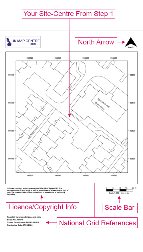
OS MasterMap 1:500 scale block plan for planning applications
Ordnance Survey MasterMap Topography Layer® @ 1:500 - Overview
A detailed Ordnance Survey plan at a scale of 1:500 is often required to accompany other scaled plans (eg: a 1:1250 or 1:2500) when applying for planning permission.:
- This is an enlarged (zoomed in) version of a standard OS Extract
- Sometimes referred to as a Block Plan or a Site Plan
- Suitable for decrofting applications with the Crofting Commission and Registers of Scotland
Alternative Products: