


Ordnance Survey 1:10 000 scale GeoTiff Raster Mapping for GIS systems
GIS Raster Data - GeoTiff
Ordnance Survey Premium Licenced Partner • Fully Licenced official OS mapping • Raster Data
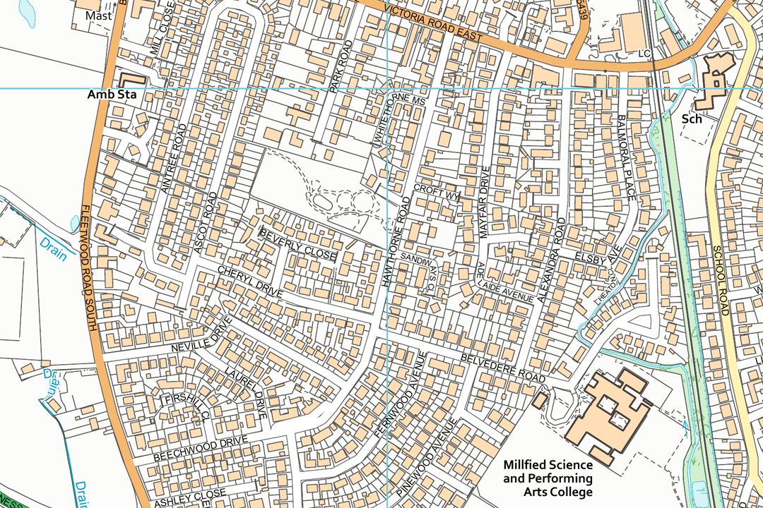
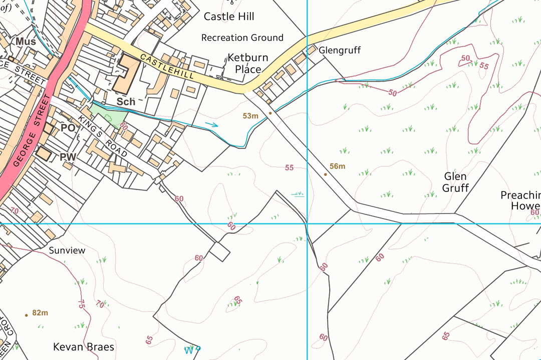
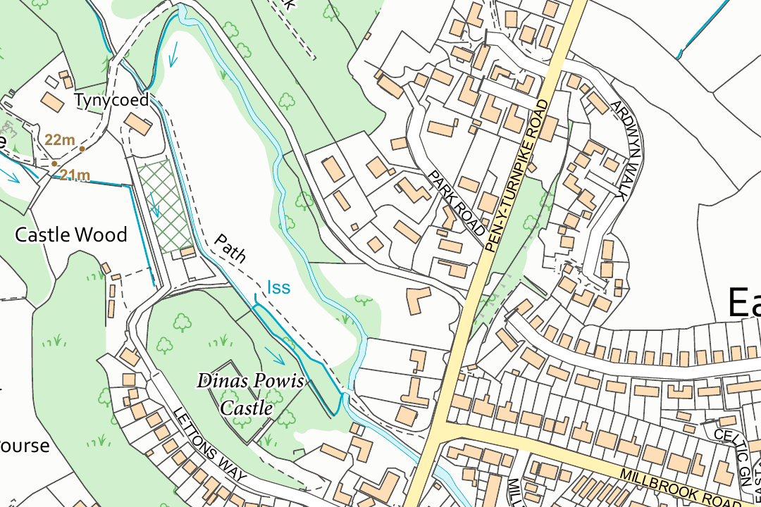
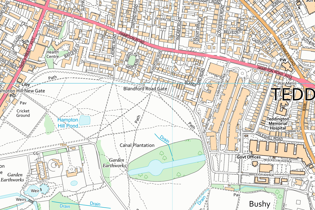
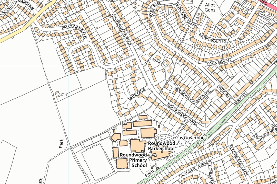
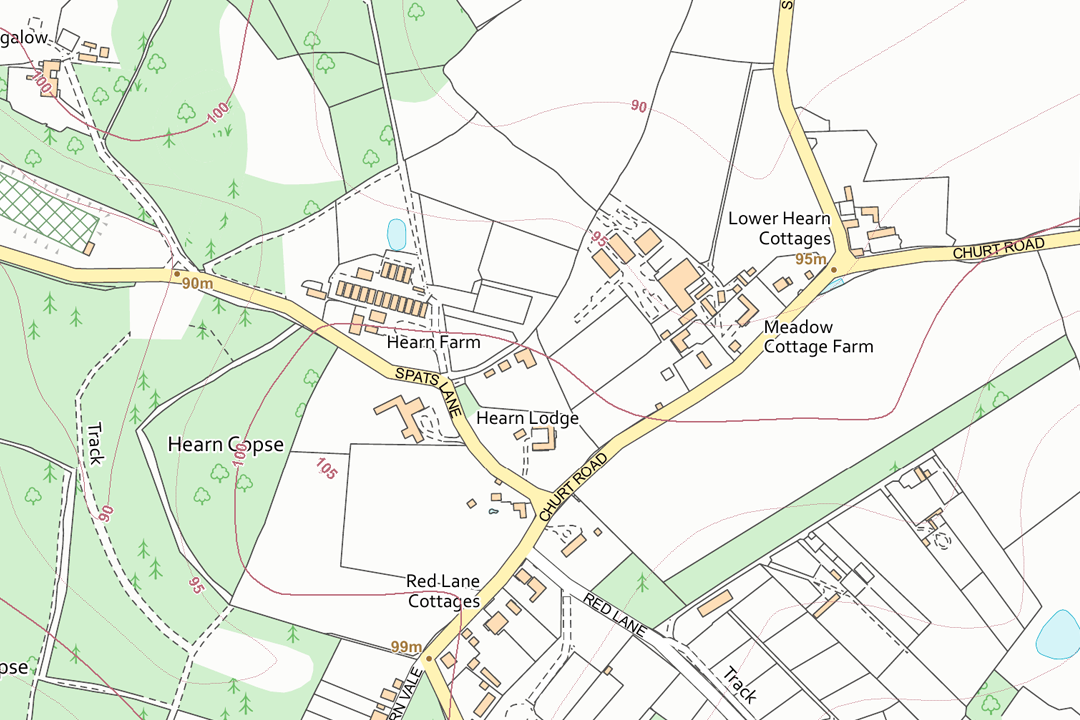
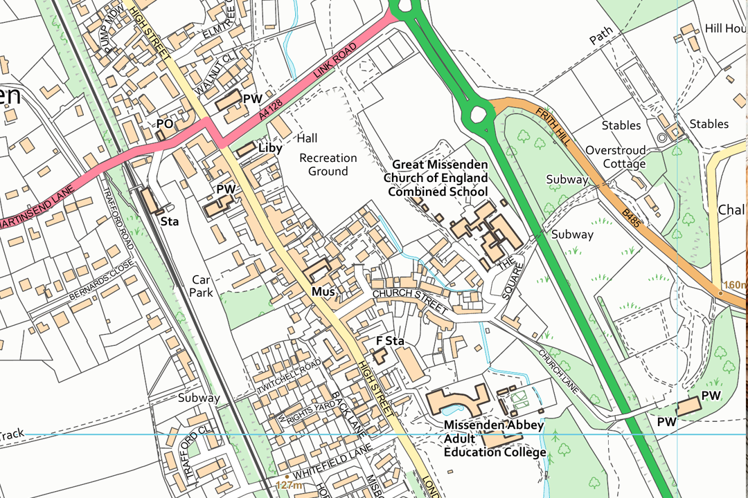
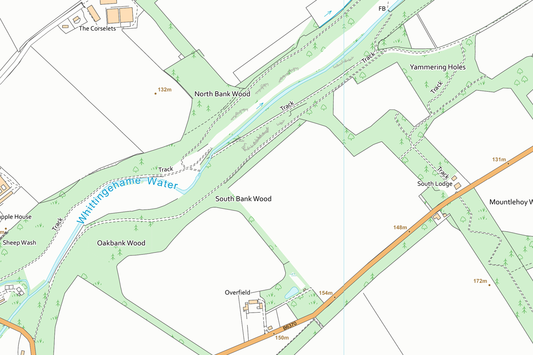
Suburban residential area at 1:10 000 - orange buildings, connected road network and individual property outlines in a single GeoTIFF. Welsh village with Castle Hill and surrounding farmland - field boundaries, contour values and scattered rural properties clearly visible. Town edge meeting parkland and woodland - Powis Castle grounds, residential streets and green vegetation shading at VectorMap Local detail. Teddington and Bushy Park area - pink trunk roads, green A-roads, canal and parkland in the standard VectorMap Local colour palette. Suburban area with schools and park - blue OS grid lines at 1 km intervals provide coordinate reference for GIS workflows. Rural hamlet with scattered farms and cottages - field boundaries and woodland shading give context for estate management and land assessment. Small town with recreation ground, school and dual carriageway bypass - the level of detail that makes VectorMap Local ideal for site evaluation. River valley with woodland blocks and rural properties - one GeoTIFF file covering your area of interest, no tile boundaries to manage.
© Crown copyright and database rights 2026 OS AC0000848283
OS 10k Raster Data Sections
- Custom rectangle - your area of interest
- GeoTIFF with TFW world file
- Colour or B&W
- Optional 5 m contours
- No bounding information
- Replaces OS Landplan
- Viewing range 1:3000 to 1:20 000
- Updated quarterly
OS 1:10 000 Raster Data Sections - VectorMap Local GeoTIFF Mapping Sized to Your Site
An OS 1:10 000 raster data section is a single georeferenced GeoTIFF file cut to a custom rectangle that you frame around your project area. Unlike the fixed 5 km x 5 km raster tiles which follow the OS National Grid, a section is sized to fit your site and delivered as one file with no tile boundaries to manage. It is often the most cost-effective way to get OS 1:10 000 mapping into a GIS project when you are working on a single area of interest.
The mapping is derived from OS VectorMap Local - the same trusted Ordnance Survey dataset that produces our 1:10 000 print extracts. It is generated automatically from the OS Large Scale Topographic Database, the same source behind OS MasterMap, ensuring accurate building geometries, a connected road network and consistent feature generalisation. Sections are available in colour or black and white, with an optional 5 m contour overlay. The data is updated quarterly in January, April, July and October.
Frame your project area on the interactive map, choose a colour style, pay online and the GeoTIFF section is emailed to you in around 30 minutes, seven days a week.
What Is a 1:10 000 Raster Data Section?
It is a single GeoTIFF raster image covering the rectangular extent you choose - no grid lines, no title block, no fixed tile boundaries. The file is georeferenced to British National Grid (EPSG:27700) and loads straight into your GIS project. Where the 5 km raster tiles are ideal for building data libraries and covering larger regions systematically, sections are designed for single-site project work where you want one clean file that covers exactly the ground you need - and nothing more.
Pay Only for What You Need
A section covers just the area you frame on the map. If your project site sits in the corner of a 5 km tile, you would be paying for 25 km² when you only need a fraction of that coverage. A section lets you buy precisely the extent your project requires - often at a lower cost than a full tile.
Colour or Black & White Plus Contours
Choose the backdrop that suits your project. Full colour uses the standard VectorMap Local palette with orange buildings, green roads and blue water features. Black and white strips everything to clean line work for overlaying thematic data. Add optional 5 m contours at checkout for terrain context.
Derived from the OS Large-Scale Database
VectorMap Local is generated automatically from the same source data behind OS MasterMap. That automated derivation means improved building geometries, a connected road network, consistent feature generalisation and currency that keeps pace with the parent dataset.
Unlimited GIS Outputs Under Licence
Your OS licence permits unlimited PDF or image outputs from your GIS software at any scale. Print as many map sheets as your project requires from the section data - there is no per-print charge on top of the licence fee.
Not a GIS User?
If you do not use GIS software and just need a printed 1:10 000 map of a specific area, our ready-to-use extracts are the easier option. They arrive as a PDF, TIFF or JPG at the paper size you choose - no specialist software required:
1:10 000 Regional Location Plan - print-ready OS map accepted by Land Registry, Registers of Scotland, the Crofting Commission and forestry bodies. Available in colour or black and white with optional 5 m contours.
When Do I Need a 1:10 000 Raster Data Section?
Sections are for GIS professionals working on a defined project site who want VectorMap Local mapping covering their area of interest in a single file. If you need layered vector data for CAD, a more suitable alternative is our VectorMap Local CAD product. Common users and uses include:
Estate & Land Management GIS
Land agents, estate managers and rural surveyors load a section beneath ownership boundaries, sporting rights, tenancy parcels and management zones. A section sized to the holding avoids paying for surrounding tiles the project does not need.
Forestry & Woodland Planning
Foresters and woodland managers use sections with the contour overlay for compartment mapping, felling coupe design, access route planning and planting assessments on sloped terrain. The black and white style lets compartment shading stand out clearly.
Environmental & Ecological Assessment
Ecologists and environmental consultants load sections as a spatial framework for Phase 1 habitat surveys, ecological constraint analysis, environmental impact assessment and land-use appraisals within a defined study boundary.
Energy & Infrastructure Projects
Windfarm developers, pipeline operators and utility companies use sections to plan corridor routes, assess access options, model cable and pipe alignments and present project extents to stakeholders and planning authorities.
Local Authority & Public Sector GIS
Council GIS teams, highways departments and emergency planners use sections as a licensed base layer for project-specific asset mapping, route planning, flood modelling and community safety assessments covering a defined area.
Site Evaluation & Feasibility Studies
Developers and project managers use sections to evaluate candidate sites for new amenities, housing, commercial premises or infrastructure. The building-level detail and connected road network support desk-based feasibility assessment without a site visit.
Archaeological & Heritage Assessment
Heritage consultants use sections for desk-based assessments, historic landscape characterisation and settings analysis. The contour overlay and building detail help interpret archaeological features and assess visual impact within the study area.
Agricultural & Rural Development
Agronomists, rural development officers and agricultural consultants load sections beneath field parcel data, drainage schemes, agri-environment agreements and rural payment claim boundaries for analysis and reporting across a defined farm or holding.
Further Reading
New to working with GeoTIFF data in GIS? These guides cover the essentials:
- How to Open TIF and TFW Files in QGIS - Step by Step
- OS Raster Maps: What They Are and When to Use Them
- OS Vector and Raster Mapping Fully Explained
About UK Map Centre LLP

