


OS 1:50 000 Scale Raster Data - GeoTIFF format for GIS systems
GIS Raster Data - GeoTiff
OS Premium Licenced Partner • Official OS mapping • 1:50 000 Scale Raster Data • Sections Dispatched Fast by Email
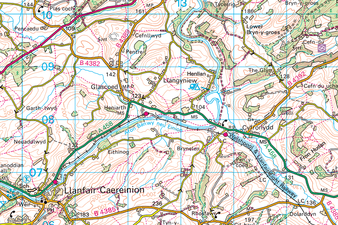
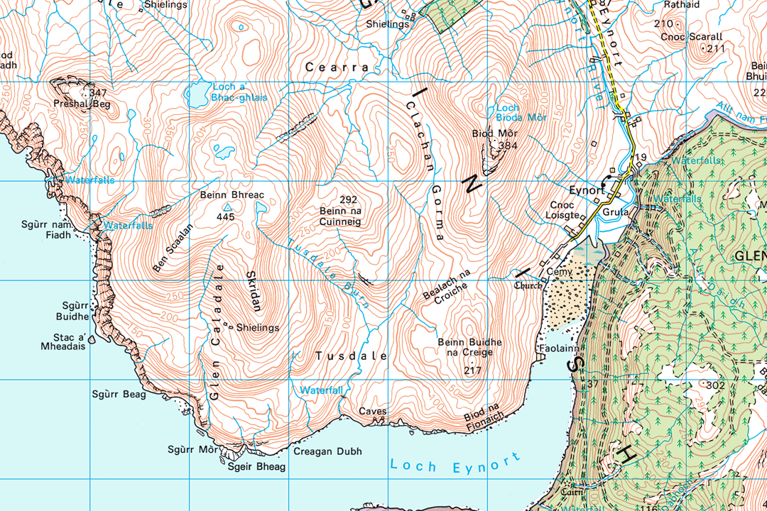
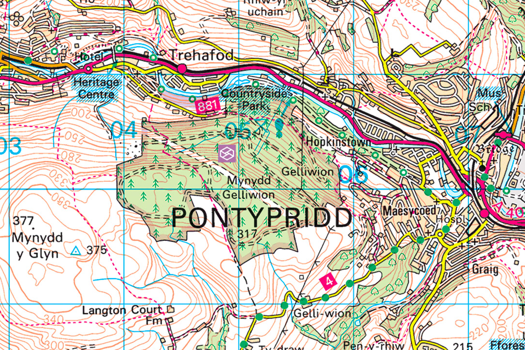
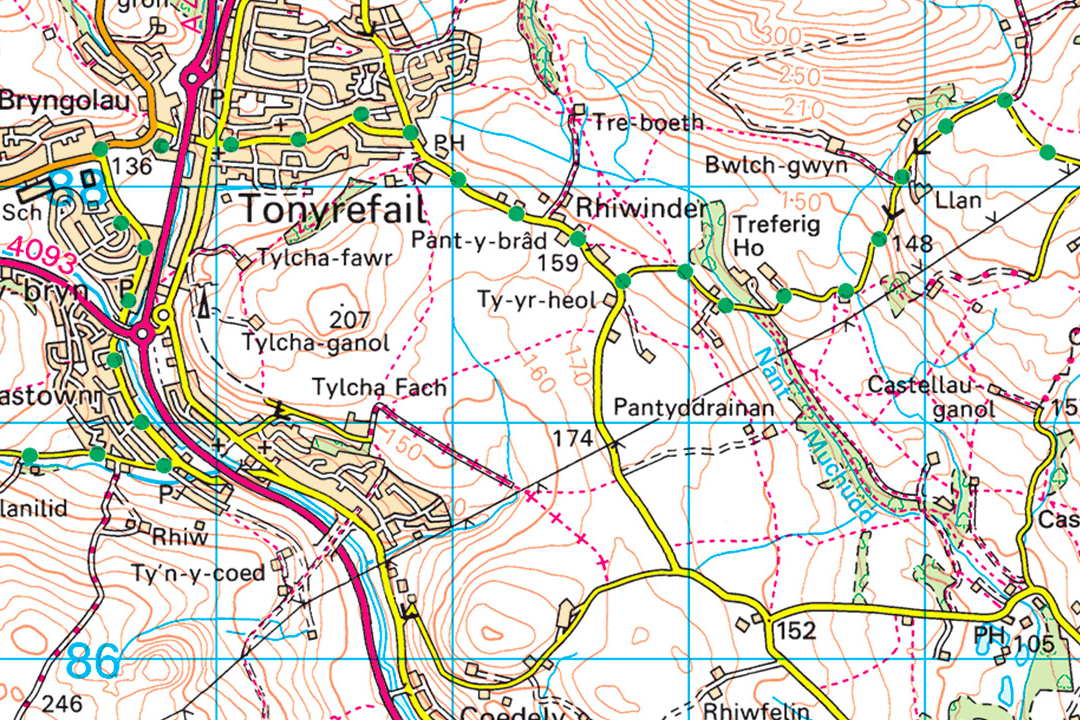
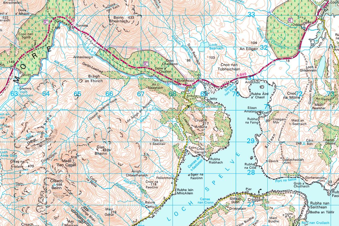
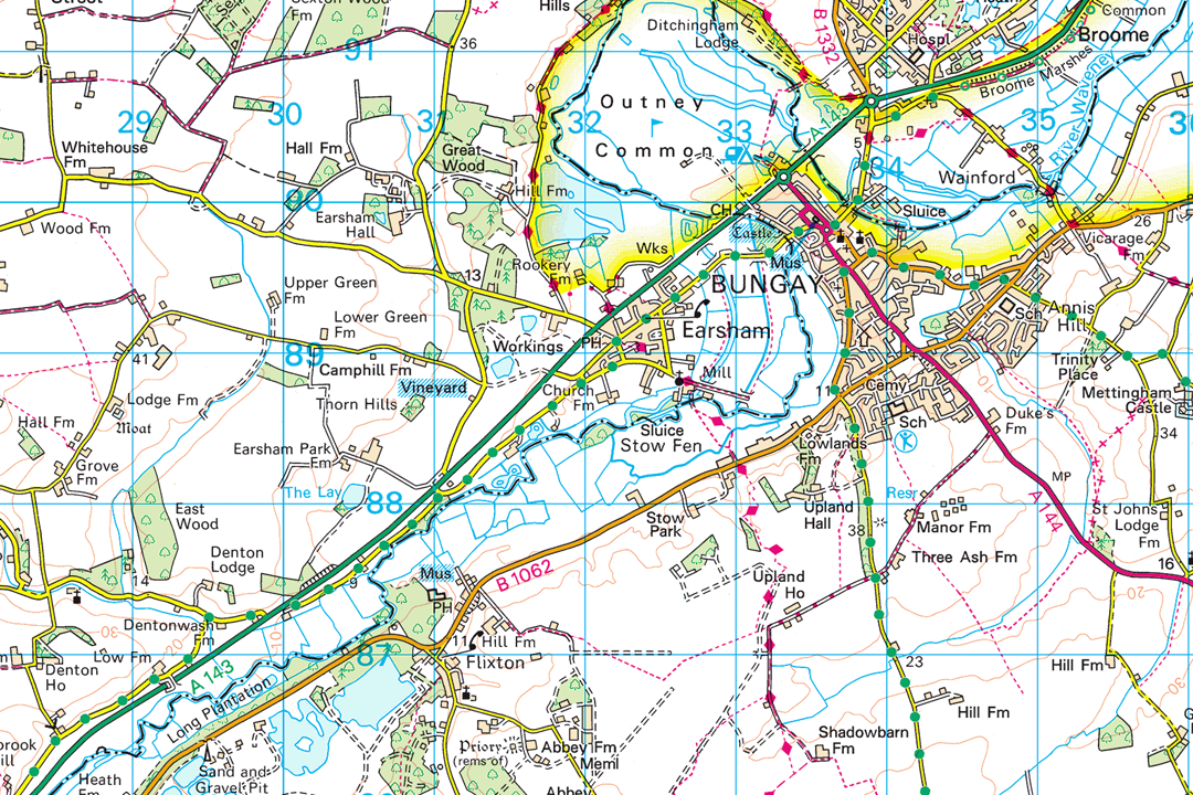

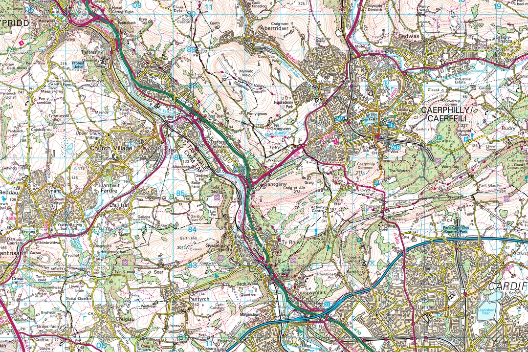
Mid-Wales valleys with the River Banwy and A458 - frame your section around the area you need Highland coast with mountain contours and rocky shoreline - one GeoTIFF sized to your project Urban and valley context around Pontypridd - pay only for the coverage your project requires South Wales valleys with villages and contour lines - ideal for corridor studies and regional planning West coast sea loch and peninsula - remote landscape detail for environmental and energy projects Bungay with the River Waveney and Outney Common - regional context for planning and environmental work Coastal islands and shoreline detail - the Landranger specification covers land and sea features Valleys near Caerphilly - settlements, roads and woodland in a single georeferenced section file
© Crown copyright and database rights 2026 OS AC0000848283
OS 50k Raster Data Sections
- Custom rectangle - your area of interest
- GeoTIFF with TFW world file
- Full colour (Landranger palette)
- Contours included
- No bounding information
- Viewing range 1:15 000 to 1:60 000
- One file per section
- Updated quarterly
OS 1:50 000 Raster Data Sections - Landranger-Level GeoTIFF Mapping Sized to Your Region
An OS 1:50 000 raster data section is a single georeferenced GeoTIFF file cut to a custom rectangle that you frame around your project region. Unlike the fixed 20 km x 20 km raster tiles which follow the OS National Grid, a section is sized to fit your area of interest and delivered as one file with no tile boundaries to manage. It is often the most cost-effective way to get OS Landranger-level mapping into a GIS or CAD project when you are working on a single region or corridor.
The mapping is derived from the OS 1:50 000 Scale Colour Raster dataset - the same source data used to produce the printed OS Landranger map series. At this scale the mapping provides a clear regional overview showing roads, railways, settlements, contour lines, woodland, water features, airports and other landmarks across a wide area. The data is updated quarterly in March, June, September and December.
Frame your project area on the interactive map, pay online and the GeoTIFF section is emailed to you in around 30 minutes, seven days a week.
What Is a 1:50 000 Raster Data Section?
It is a single GeoTIFF raster image covering the rectangular extent you choose - no grid lines, no title block, no fixed tile boundaries. The file is georeferenced to British National Grid (EPSG:27700) and loads straight into your GIS or CAD project. Where the 20 km raster tiles are ideal for building data libraries and covering large regions systematically, sections are designed for single-region project work where you want one clean file covering exactly the area you need.
Pay Only for What You Need
A section covers just the area you frame on the map. If your project region sits in the corner of a 20 km tile, you would be paying for 400 km² when you only need a fraction of that coverage. A section lets you buy precisely the extent your project requires - often at a lower cost than a full tile.
Regional Overview in GIS-Ready Format
The same road network, contour lines, settlement detail and landscape features found on a printed OS Landranger map - delivered as a georeferenced GeoTIFF that loads straight into your GIS or CAD project. Best viewed between 1:20 000 and 1:50 000 scale.
Overlay Your Own Data
Load the section as a backdrop and overlay vehicle routes, delivery zones, asset registers, pipeline corridors, marketing catchments or any other project-specific vector layer. The Landranger detail provides clear geographic context without overwhelming your own data.
Unlimited GIS Outputs Under Licence
Your OS licence permits unlimited PDF or image outputs from your GIS software at any scale. Print as many map sheets as your project requires from the section data - there is no per-print charge on top of the licence fee.
Not a GIS User?
If you do not use GIS or CAD software and just need a printed 1:50 000 Landranger map of a specific area, our ready-to-use extracts are the easier option. They arrive as a PDF, TIFF or JPG at the paper size you choose - no specialist software required:
1:50 000 Landranger Map Extract - the same mapping as the pink fold-out OS Landranger maps, site-centred and delivered digitally. Ideal for cycling, touring, emergency services and general reference.
When Do I Need a 1:50 000 Raster Data Section?
Sections are for GIS and CAD professionals who need a licensed OS backdrop at regional scale covering a defined project area. At 1:50 000 the mapping shows the road network, settlement pattern, terrain and landscape character across a wide region. Common users and uses include:
Development & Land-Use Planning
Planners, developers and consultants load a section as a regional context layer for strategic land-use assessments, local plan evidence bases and development framework drawings that need to show how a site relates to surrounding settlements, transport links and landscape designations.
Environmental Impact Analysis
Environmental consultants use sections as a base for zone of theoretical visibility studies, landscape and visual impact assessments, strategic habitat mapping and cumulative impact analysis where the study area extends well beyond the immediate development site.
Vehicle Routing & Logistics
Fleet managers, logistics companies and delivery planners use sections as a GIS backdrop for route optimisation, depot catchment analysis, delivery zone mapping and driver briefing sheets covering a defined operating region.
Asset Management & Utilities
Utility companies, pipeline operators and telecoms providers use sections for regional asset registers, corridor overviews, maintenance scheduling and stakeholder presentations where infrastructure needs to be shown in the context of the surrounding landscape.
Marketing & Catchment Analysis
Retailers, property agents and marketing teams load sections beneath customer location data, sales territories, catchment radii and competitor mapping. The Landranger detail shows roads, settlements and terrain that help explain travel patterns and market boundaries.
Emergency Planning & Response
Emergency planners, police, fire and ambulance services use sections as a GIS backdrop for major incident response zones, evacuation routing, multi-agency coordination areas and resilience planning across a defined command area.
Energy & Infrastructure Projects
Windfarm developers, solar farm operators and grid connection planners use sections for strategic site selection, cable route corridor assessment, visual impact zone modelling and public consultation material covering a defined scheme footprint and its wider setting.
Tourism & Visitor Management
Destination management organisations, national park authorities and tourism boards use sections as a GIS base for visitor flow modelling, accommodation mapping, attraction clustering analysis and trail network overviews across a tourism region.
Further Reading
New to working with GeoTIFF data in GIS? These guides cover the essentials:
- How to Open TIF and TFW Files in QGIS - Step by Step
- OS Raster Maps: What They Are and When to Use Them
- OS Vector and Raster Mapping Fully Explained
About UK Map Centre LLP

