


OS MasterMap 1:500 Block Plan for Planning Applications
Available Formats via Email: PDF • TIFF • JPG • BMP • PNG • DOCX • WORD
OS Premium Partner • Ordnance Survey Licensed Product • Commonly referred to as a Block Plan • Council Compliant for Planning Applications
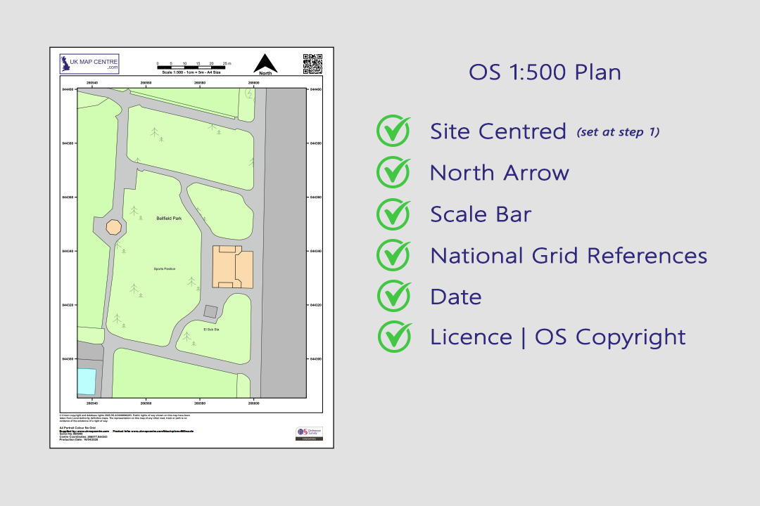
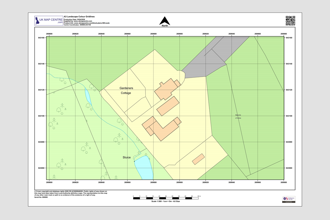
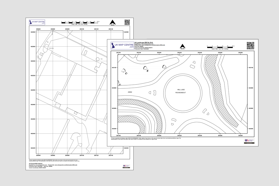
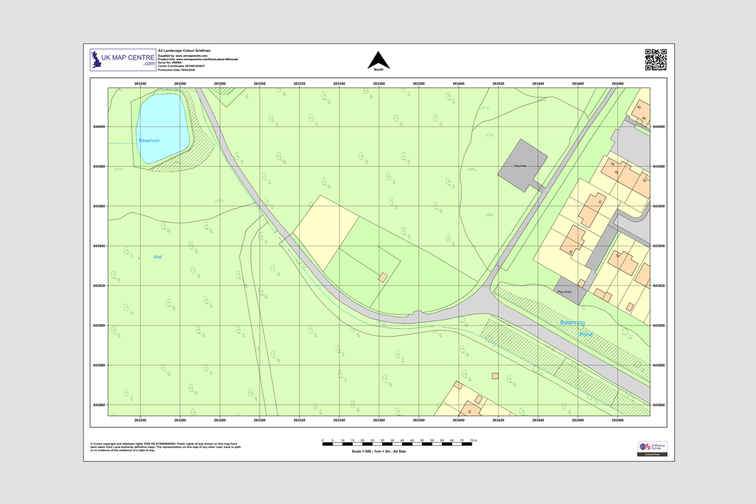
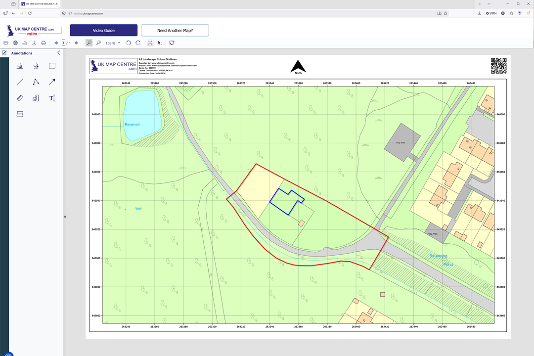
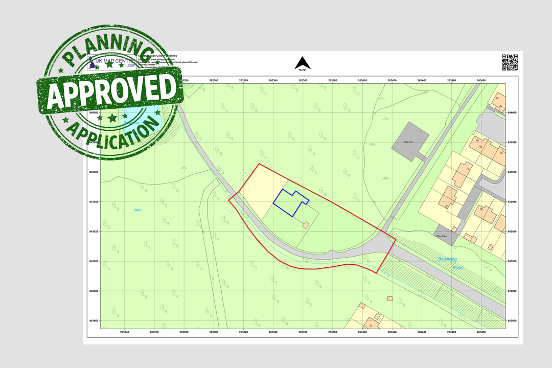
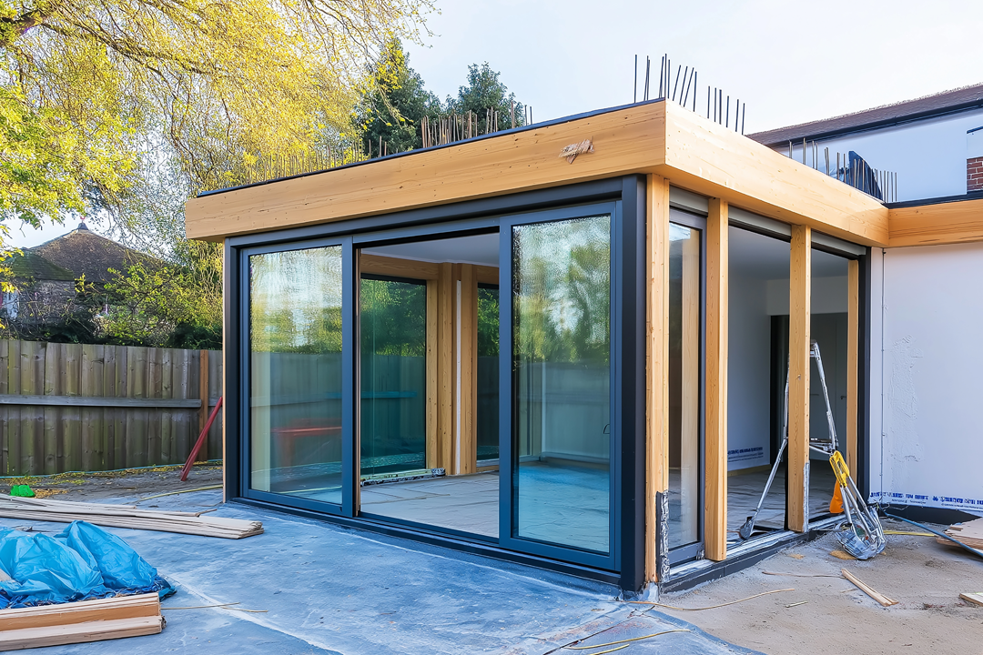
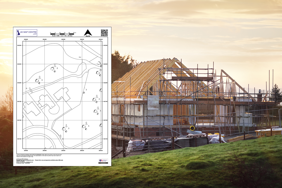
Every plan includes a north arrow, scale bar, grid references, date and OS licence number OS 1:500 Colour Block Plan - A3 landscape with gridlines showing rural farm property OS 1:500 Black & White Block Plans - urban residential area and roundabout detail OS 1:500 Colour Block Plan - A4 landscape with road, reservoir and building footprints Available in A4, A3, A2, A1 and A0 - choose the sheet size that fits your site Mark up your plan online - we forward a link to our online app so you can draw site boundaries, proposed buildings and add notes Planning-ready markup - red site boundary and blue proposed building added with our online tool Modern garden room extension - typical project supported by a 1:500 OS block plan From OS block plan to completed new build - the 1:500 drawing that starts the project
© Crown copyright and database rights 2026 OS AC0000848283
OS 1:500 Extract
- Black & White or Colour
- PDF, TIFF, JPG, BMP, PNG, WORD
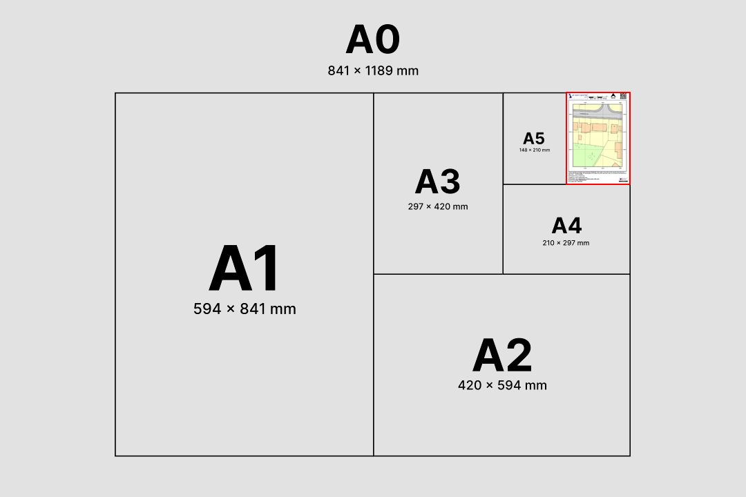
- A5 to A0 size
- Council Compliant
- North Arrow
- Scale Bar
- 1 cm = 5 m
Ordnance Survey 1:500 Scale Block Plan and Site Plan for Planning Applications
The Ordnance Survey 1:500 scale map is the go-to block plan for UK planning permission submissions, building warrant applications and detailed site drawings. Each plan is an enlargement of the official OS MasterMap® Topography Layer, zoomed in to place the property, its curtilage and the immediate access at the centre of the page.
As a Premium Licensed Partner of Ordnance Survey, UK Map Centre supplies 1:500 block plans that are accepted by every local authority in Great Britain. The drawing arrives with a printed scale bar, north arrow, OS National Grid references and the Ordnance Survey copyright statement and licence number already in place.
Choose a sheet size and file format, pay online and your 1:500 block plan is emailed to you in around 20 minutes, seven days a week. The drawing is ready to upload to the Planning Portal, to your council's building standards system or to share with your architect, utility provider or solicitor.
What Is a 1:500 Scale Block Plan?
A 1:500 block plan is a large-scale Ordnance Survey extract used to show the plot in close detail. At this scale 1 centimetre on the sheet represents 5 metres on the ground, which is two and a half times more zoomed in than the 1:1250 location plan. You see the same Ordnance Survey content, but rendered at a size that lets a planning officer or building-standards verifier read the site without zooming.
Enlargement of OS MasterMap
The 1:500 sheet is not a different dataset, it is the same OS MasterMap topography drawn at a larger scale. Building footprints, curtilage, kerb lines and access points all print at a size that reads comfortably on A4.
Also Called a Site Plan
Council validation checklists, architects and planning portals often refer to the 1:500 drawing as a site plan, block site plan or proposed site layout base. All three terms describe the same Ordnance Survey 1:500 extract supplied here.
1 cm Represents 5 m
The 1:500 ratio means every centimetre you measure on the printed sheet equals five metres on the ground. Useful for sanity-checking a proposed extension footprint or an access drive against the council's distance rules.
Works Beside a 1:1250
Most planning applications pair the 1:500 block plan with a 1:1250 location plan. The block plan focuses on the plot, the location plan sets that plot inside its street. Our planning pack bundles both at a lower combined price.
1:500 block plans are requested whenever a council wants a plot-level view of a proposed development, whether that's a house extension, a change-of-use submission, a utility connection or a commercial refit.
When Do I Need a 1:500 Block Plan?
A 1:500 scale Ordnance Survey extract is the drawing councils, surveyors and service providers reach for when the 1:1250 location plan doesn't zoom in enough. It is typically required by:
Full Planning Applications
Submitted alongside the 1:1250 location plan on most full planning applications. Planning officers use the 1:500 sheet to read the application site, check proposed positions and compare the plot to its neighbours on the same page.
Householder Applications
Homeowners applying for extensions, loft conversions, garages, outbuildings, porches and dormers use a 1:500 block plan as the base drawing for the proposed layout supplied to the council.
Building Warrants (Scotland)
Scottish building warrant applications lodged through eBuilding Standards routinely request a 1:500 block plan as part of the submission pack, sitting alongside structural, elevation and floor-plan drawings.
Change of Use Applications
Councils use the 1:500 sheet to clarify exactly which part of a building or plot is affected by a change of use, whether that's a retail unit becoming a food outlet, an outbuilding becoming a workshop or a dwelling being split.
Utility Connection Quotations
Water, electricity, gas and telecoms providers prefer a 1:500 sheet when quoting for new connections, wayleaves, meter moves and service alterations. The zoom level clearly shows service entry points and routing options.
Listed Building Consent
Applications for listed-building consent, conservation area works or tree-related consents benefit from the larger-scale view so the heritage officer can clearly see the feature being worked on relative to the building footprint.
Surveyor & Architect Base Drawings
Surveyors and architects overlay their own proposed layouts onto the 1:500 OS base, using the official topographic data as the starting point for extension designs, access plans and site layout drawings.
Conveyancing & Boundary Clarification
Solicitors working on conveyancing, boundary clarification or plot-sale transactions use the 1:500 block plan to mark the extent of the sale or the area in dispute with room to annotate.
If your proposal sits across several addresses or a wider site, you have two options: step up to a larger sheet size at 1:500, or switch to a smaller scale so more ground fits on the same sheet. Move up to a 1:1250 location plan for urban and suburban sites, or a 1:2500 rural site plan for agricultural land, large estates and wider rural extents.
Sourced Direct from Ordnance Survey
UKMapCentre.com operates as a Premium Licensed Partner of Ordnance Survey, which means every 1:500 block plan we sell carries a current, correctly attributed OS licence. That status makes our plans ready-to-submit for Planning Portal uploads, council validation, building warrants, utility connection quotations, change-of-use applications and any professional use where OS-licensed mapping is expected.
Further Reading
The 1:500 sheet is a favourite with councils, architects and utility providers, but getting the print size right and the mark-up clean matters. These short guides walk through the details:
- Understanding Ordnance Survey Map Jargon
- Correct Land Registry Map Scales: A Guide
- How to Print an Ordnance Survey Map to the Correct Scale
About UK Map Centre LLP

