


OS MasterMap Topography Layer® - GIS Vector Format Maps DXF | SHP | GML - Email delivery in minutes
Available Formats via Email: GIS Formats: SHP | GML | GPKG | GeoTIFF and DWG | DXF format for CAD
Ordnance Survey Premium Licenced Partner • Fully Licenced official OS mapping • Scalable and Layered OS Vector Data • No sign-up needed – checkout instantly • Sent Within Minutes
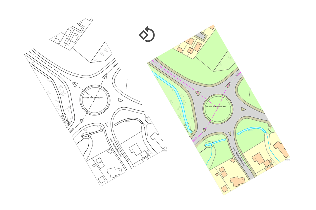

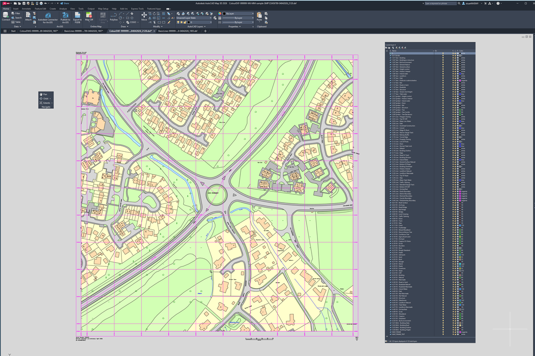
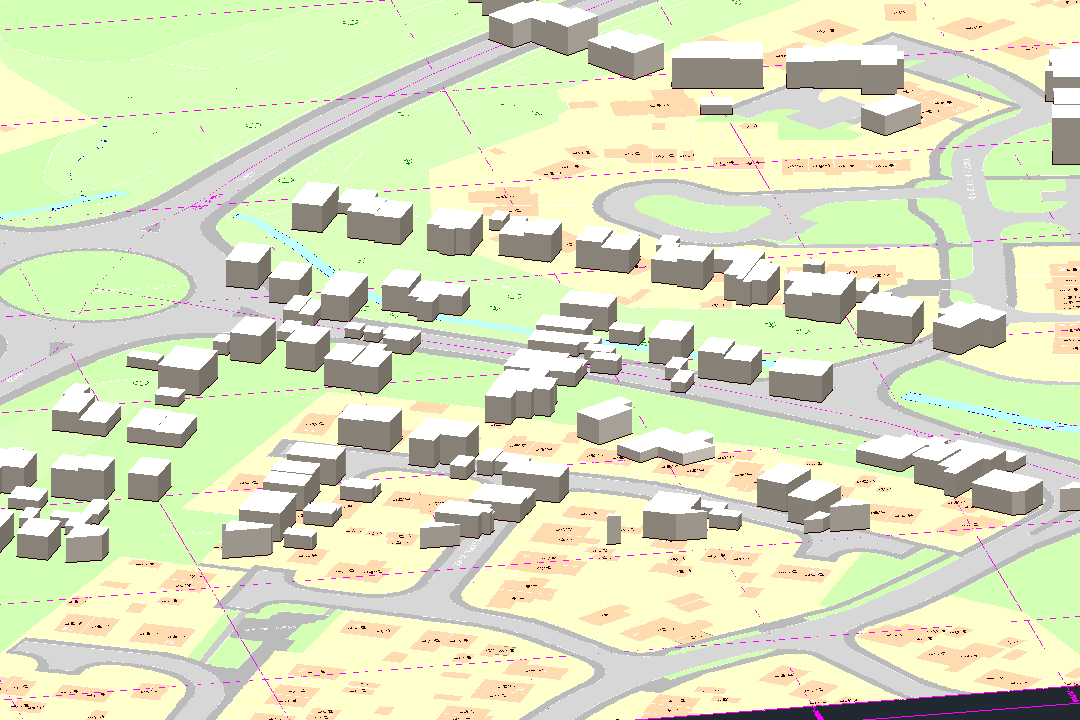
GIS vector data in GeoPackage, Shapefile and GML - up to seven attributed layers per output Define your site area at any angle - rotate the map extent to follow a road, river, boundary or building line OS MasterMap for GIS and CAD users - colour and black and white rendering options DWG Colour - full OS specification with solid fills across 50+ named layers - Building Heights included 3D building geometry from OS Building Height Attributes included with GIS vector and DWG Colour formats DWG or DXF Lines - clean line work ready for survey overlay and spatial context DWG Lines Basic - simplified layers for a lighter, faster base map Optional OS Terrain 5 contours and DTM height points on dedicated layers
© Crown copyright and database rights 2026 OS AC0000848283
Download Samples
GIS Formats
GPKG - GeoPackage ↓ GML ↓ SHP - Esri ↓ GeoTIFF | Colour ↓ GeoTIFF | BW ↓DWG Colour with BHA
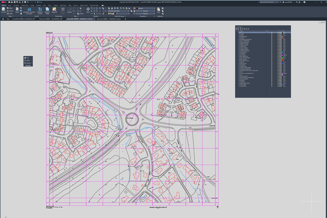
DWG - Colour ↓CAD Lines
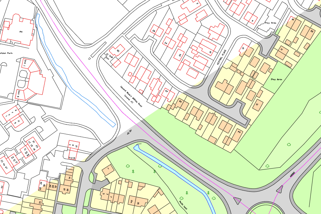
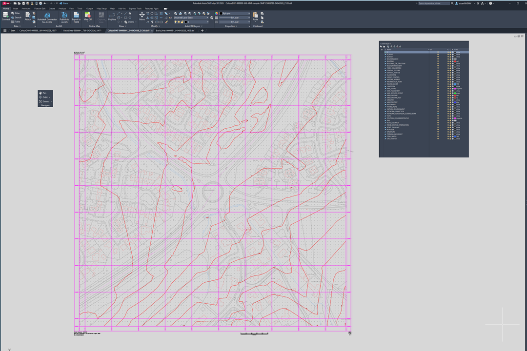
DWG - Lines ↓ More samples ↓OS MasterMap GIS Data - GeoPackage, Shapefile, GML & DWG Colour
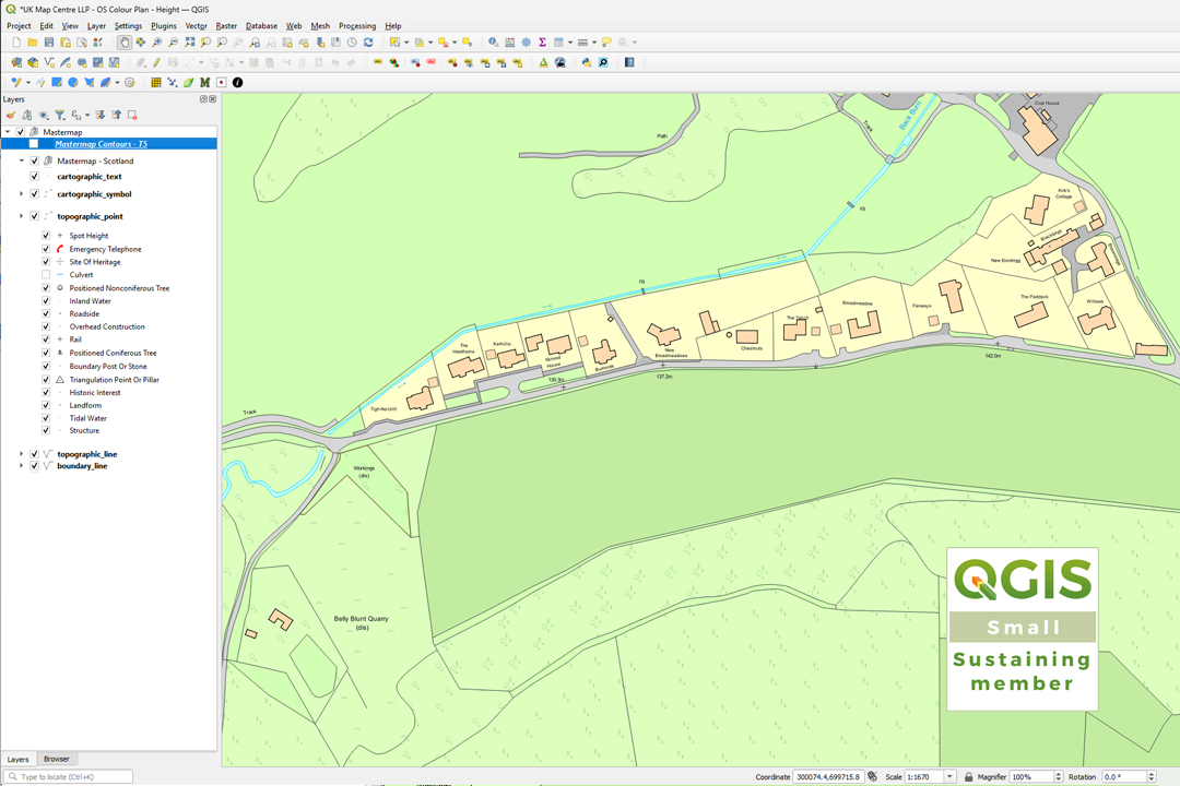
Order OS MasterMap Topography Layer data as attributed GIS vectors in GeoPackage, Shapefile or GML - or as a full-colour DWG with 3D building heights. Every format is clipped to your exact site boundary and delivered by email in British National Grid (EPSG:27700). GIS outputs include up to seven clean layers with full OS feature attributes, ready for analysis in QGIS, ArcGIS Pro, MapInfo or FME.
What You Get
GeoPackage (GPKG)
The modern OGC standard - a single-file SQLite database with all layers, full geometry and spatial indexing. No sidecar files. Natively supported in QGIS 3, ArcGIS Pro and FME.
Shapefile & GML
Industry-standard vector formats for ArcGIS, MapInfo, FME and INSPIRE workflows. Full OS attribute set on every feature with complete geometry and feature codes.
GeoTIFF Raster
Georeferenced raster image at 400 DPI with embedded CRS metadata. Available in colour or black and white. Ideal for background mapping in any GIS or CAD platform.
DWG Colour with BHA
Full-colour AutoCAD drawing to OS specification with solid fills, hatches, symbols and 3D building heights across 50+ named layers. Also available in DWG and DXF line formats.
Building Height Attributes
OS BHA data included at no extra cost - absolute and relative building heights for 3D extrusion, shadow analysis and massing studies. Available in both GIS and DWG Colour formats.
OS Terrain 5 - Optional
Overlay DTM height points and contour lines at 0.5 m, 1 m, 2 m or 5 m intervals onto your GIS or CAD output. ASCII grid files also available for surface modelling in QGIS, ArcGIS or Civil 3D.
How It Works
Draw your area of interest on the map, pick a GIS or CAD format and we clip the data to your exact boundary. Most GIS orders are delivered by email within minutes as a single ZIP file. Rectangular extents can be rotated to any angle, or send us a GeoJSON, Shapefile, KML or DXF boundary for a bespoke area clip. Flexible 1, 2 or 3-year OS licence terms with unlimited internal use.
Ordnance Survey Premium Licensed Partner
UK Map Centre LLP holds OS Premium Partner status (AC0000848283). Every GIS data cut and DWG output carries a current OS licence, accepted by local authorities, Land Registry and the Planning Portal across England, Scotland and Wales.
More Sample Downloads
Guides & Tutorials
Tips and walkthroughs to help you get the most from your GIS and CAD data:
- OS GIS Data - Tiles & Bespoke Area Extracts AOI
- How to Create a 3D Map in QGIS Using OS MasterMap BHA, Terrain DTM and Aerial Imagery
- OS MasterMap 3D Explained - Mapping Building Heights and Terrain Data for CAD
- Understanding OS MasterMap Building Height Attributes (BHA)
- OS CAD Maps with Additional Layers
About UK Map Centre LLP


