


OS 1:100 Scale Block Plan for Dropped Kerb Application Drawings
Available Formats via Email: PDF • TIFF • JPG • BMP • PNG • DOCX • WORD
OS Premium Partner • OS Licensed Data • Council Compliant • Land Registry Compliant • Utility Company Friendly • Delivered in Minutes
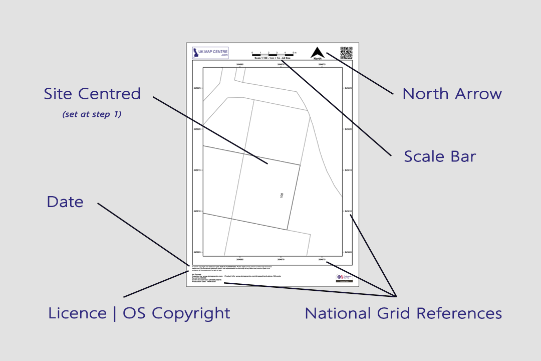
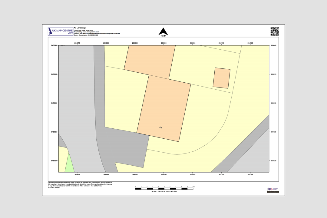
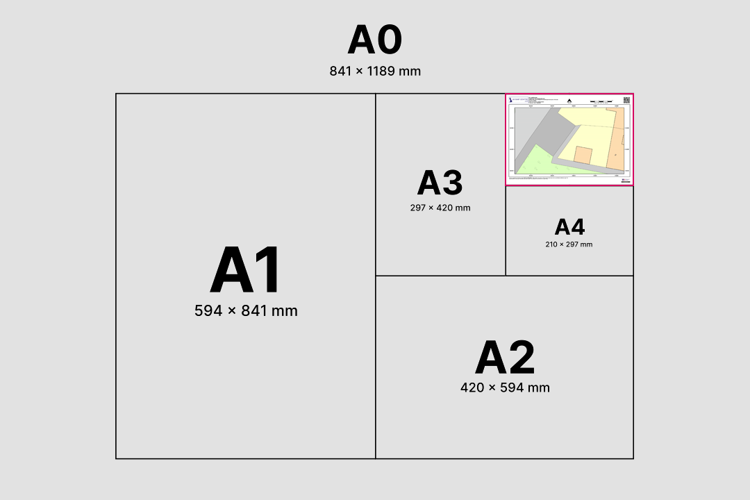


OS 1:100 Scale Colour Plan - property boundaries, footway and road detail at A4 landscape Every plan includes a north arrow, scale bar, grid references, date and OS licence number A3 size option - covers a wider site area at the same 1:100 scale Available in A4, A3, A2, A1 and A0 - choose the size that fits your site Supporting dropped kerb and footway crossing applications across the UK Ideal for driveways, vehicle crossovers and front garden conversions
© Crown copyright and database rights 2026 OS AC0000848283
OS 1:100 Extract
- Black & White or Colour
- PDF, TIFF, JPG, BMP, PNG, WORD
- A4 to A0 size
- Council Compliant
- North Arrow
- Scale Bar
OS 1:100 Scale Block Plan for Dropped Kerb Application Drawings
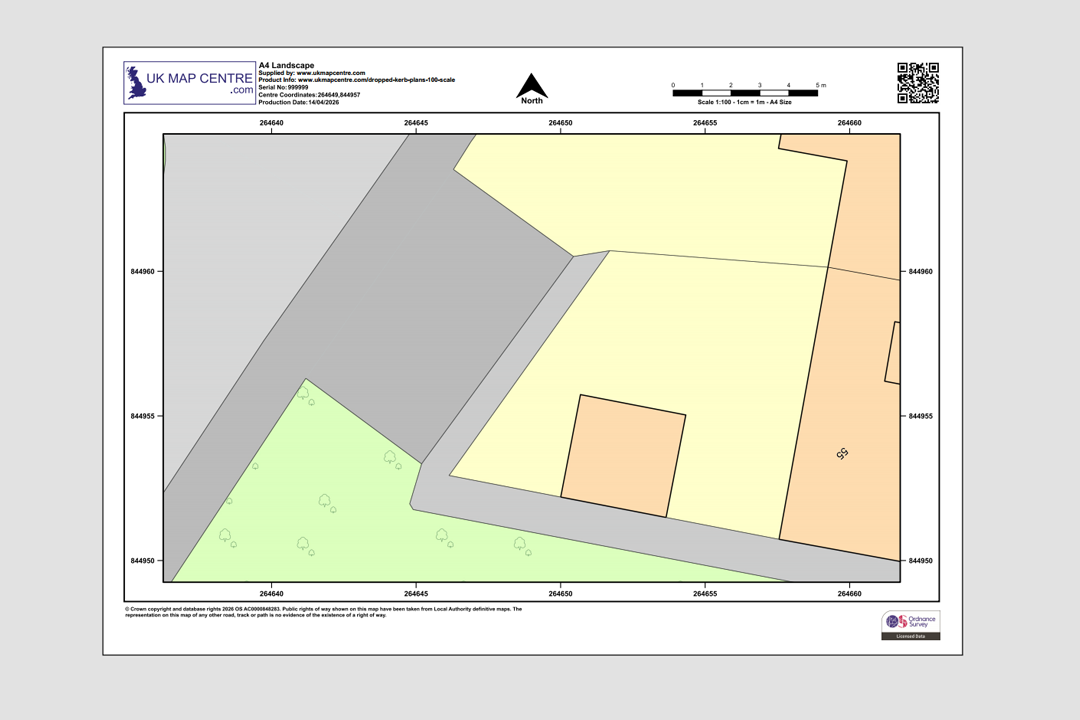
A 1:100 scale dropped kerb application drawing is a detailed extract from the OS MasterMap® Topography Layer. It is enlarged to clearly show the kerbline, footway, pavement, property frontage and vehicle access points. 1:100 scale maps support dropped kerb planning applications by accurately marking proposed driveways, parking areas or access changes.
This plan meets local council submission standards, including those required for planning permission. It features a scale bar, north arrow, grid references and an official Ordnance Survey licence number. The output is council compliant, Land Registry compliant and utility company friendly.
Order online in minutes. Our 1:100 OS maps are digitally delivered within 20 minutes, 7 days a week, and are accepted by all UK planning authorities.
What Is a 1:100 Scale Dropped Kerb Plan?
An Ordnance Survey 1:100 map is a zoomed-in extract of the OS MasterMap Topography Layer®. It's often referred to as a footway crossing plan, a 1:100 block plan, or a 1:100 dropped kerb drawing. It also functions as a dropped kerb standard drawing, accepted by many local authorities.
Driveway & Extension Proposals
Provides the scale and detail needed to support planning submissions for new driveways, vehicle crossovers and house extension proposals. The 1:100 scale clearly shows property boundaries, kerb positions and proposed access points that councils require when assessing a dropped kerb application.
Dropped Kerb Applications
Complies with the requirements for dropped kerb planning applications, clearly illustrating the proposed footway crossing and surrounding features. Most UK highways authorities accept this plan as the required block plan or site plan for a vehicle crossover application.
Access Point Detail
Shows building outlines, boundary lines and road edges at a resolution far greater than a standard 1:1250 location plan. Ideal as a base drawing for marking proposed driveway widths, visibility splays and turning areas on your dropped kerb application.
Annotation-Ready Base Map
Clean line work provides a clear base for you or your architect to annotate with proposed crossover positions, dimensions and access details before council submission.
This is not the same as a location plan. It provides greater resolution for kerb alterations or surface changes, and may be used alongside a 1:1250 location plan.
When Do I Need a Dropped Kerb Plan?
Dropped kerb plans are typically needed when applying to your local council to alter the kerb or footway of your property. It's often a required document in the application process, especially if:
Classified Road
The property is located on a classified road where the highways authority requires a detailed site drawing. A 1:100 OS plan shows building outlines and boundary positions at a scale that satisfies the council's dropped kerb assessment criteria.
Conservation Area or Listed Building
The site falls within a conservation area or near a listed building and additional scrutiny is applied to the application. The detail captured in a 1:100 scale dropped kerb plan helps demonstrate that the proposed crossover respects the character of the area.
Third-Party Consent Required
Written consent is required from neighbouring landowners or the council for trees that may be affected by the proposed works. The plan shows property boundaries and building positions so all parties can assess the layout before granting approval.
Front Garden Conversion
You plan to convert a front garden into a driveway or parking area and need to demonstrate layout, safety and visibility. A 1:100 site plan is the standard way to show the proposed hard-standing area, drainage and vehicle access to the highways department.
A site plan at 1:100 illustrates safety, visibility and layout clearly for planning review.
Who Should Use This 1:100 Dropped Kerb Plan?
1:100 scale maps are essential for both private and professional use cases. Common users include:
Homeowners
Applying to install a driveway or improve vehicle access to their property. A 1:100 dropped kerb plan is often the first document your council will ask for when you submit a vehicle crossover application.
Architects & Planning Consultants
Managing kerb change submissions and preparing drawing packages for clients. The OS MasterMap base gives you an accurate, council-accepted starting point for annotation and markup.
Contractors
Working on public paving, footway crossings or construction projects requiring accurate base mapping. The 1:100 scale provides a clear site context for planning works and annotating proposals.
Legal & Design Professionals
Handling land boundary form submissions, access redesigns or landscaping proposals. Ordnance Survey data at 1:100 is widely accepted as evidence in boundary disputes and planning appeals.
OS Premium Licensed Partner
UKMapCentre.com is a licensed Ordnance Survey partner. All data is supplied under OS terms, fully compliant for planning applications, local authority submissions and commercial use.
Need Help with Planning Terminology?
Guides, tutorials and tips to help you with your dropped kerb application:
About UK Map Centre LLP


Alternative Products
CAD Users: DWG | DXF Format GIS Users: GML | GeoPackage | GeoTIFF