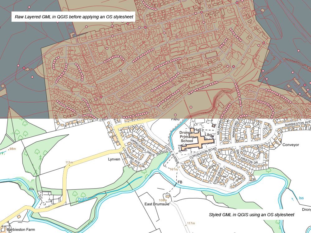
Ordnance Survey VECTORMAP LOCAL Tiles - 5km x 5km Size GeoReferenced Tiles in GML format for GIS systems
OS VectorMap Local is an Ordnance Survey product that delivers mid-scale vector mapping for GIS. It is widely used by planners, engineers and environmental consultants who need reliable geographic context without the processing demands of OS MasterMap. The data is easy to style for professional use.
Buy OS VectorMap Local online today and receive licensed vector map data direct to your inbox within 30 minutes.
What is OS VectorMap Local?
OS VectorMap Local is a mid-scale vector product from Ordnance Survey, supplied as 5km x 5km GeoReferenced tiles for GIS. It provides reliable geographic context and is widely used for creating graphical mapping without the processing demand of OS MasterMap.
Key Features of OS VectorMap Local:
- The flexibility to select and style the different feature classes makes the vector format of OS VectorMap Local a versatile contextual mapping product. Users can apply their own output styles or use free Ordnance Survey resources.
- Vector data is fully customisable, allowing you to design a VML basemap that suits your project.
- Improved generalised building outlines are derived from large-scale data, providing an accurate lie of the land while keeping files efficient.
- Features are not cut at tile edges; therefore, the topological relationships of vector map tiles are maintained, unlike in raster formats.
- The nominal viewing scale is 1:10,000, with a recommended range of 1:3,000 to 1:20,000 in GIS software.
- Available in the following formats: GML, Shapefile, and GeoPackage.
When Do I Need OS VectorMap Local?
OS VectorMap Local is most useful when you need clear, manageable cartographic outputs for wide-area projects that don’t require the property-level precision of OS MasterMap. It offers the right balance of coverage and performance in GIS.
Typical Scenarios Include:
- Regional or cross-boundary projects that require a consistent vector tiles map across multiple authorities.
- Infrastructure and utility services, where road networks, street names and surrounding context need to be shown clearly.
- Environmental analysis, forestry and agricultural studies where paths, access routes and land use patterns must be identified at scale.
- Research and education projects that need a vector map of UK regions for teaching, academic studies, or public-facing outputs.
- Creating customised cartographic outputs or presentations. OS VectorMap Local is ideal for creating map visualisations that can be shared with stakeholders.
For small-area projects or property-specific submissions, you may prefer OS MasterMap in DWG or DXF or 1:1250 Location Plans. For broader background layers, consider combining VectorMap Local with OS map tiles or OS tiles for seamless coverage.


