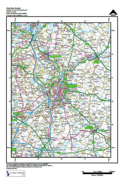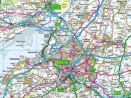
Ordnance Survey Road Map 1:250,000 Scale (Atlas Style)
Order your OS Road Map online today and get fast digital delivery within 30 minutes.
What Is a 1:250,000 Scale Road Map?
The OS 1:250,000 Road Map is a digital atlas-style product that provides a regional overview of the UK road network.
This OS road atlas is supplied as part of OS OpenMap, which can be used for commercial, educational, and personal purposes without complex licensing. The 1:250 000 Scale Colour Raster is a digital product giving a regional view, similar in content and appearance to a traditional UK road atlas:
Key Features:
- Open Government Licence
- Copy, distribute, and transmit the data freely
- Adapt the road map data for customised outputs
- Use the extract commercially or combine it with other datasets for a client-ready offering
OS 1:250k Mapping Usage Terms:
- Unlimited printing allowed
- Copying allowed
- Ideal for creating a road atlas map
- Extract sizes from A4 to A0
When Do I Need an OS UK Road Map?
The OS Road Map at 1:250,000 scale is most useful when you need a broad overview rather than street-level precision. It shows motorways, A and B roads, and towns, making it perfect for regional navigation and strategic planning.
You will find this UK atlas map particularly valuable for:
- Corporate or government reports where a road map of UK regions provides context without unnecessary detail
- Transport and logistics planning, where a road atlas view of major routes is required for coordination
- Educational projects, where students need a simplified road map of England or wider UK extracts to support research and presentation
- Travel preparation, when creating journey plans or presentations that require confidence in reliable information
Note: This map is not intended for detailed street navigation. For property or planning applications, use our 1:1250 Location Plans.