


Ordnance Survey Block Plan 1:200 Scale for Planning Applications
Available Formats via Email: PDF • TIFF • JPG • BMP • PNG • DOCX • WORD
OS Premium Partner • OS Licensed Product • Council Compliant • Planning Application Friendly
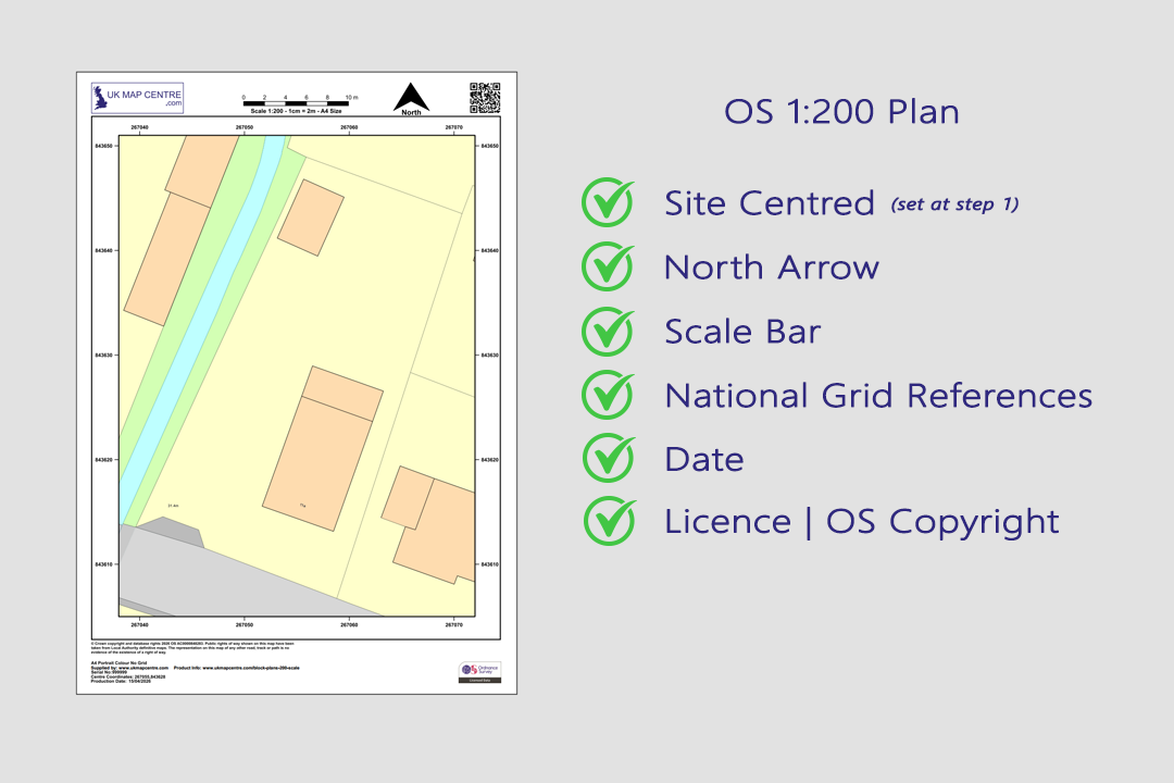
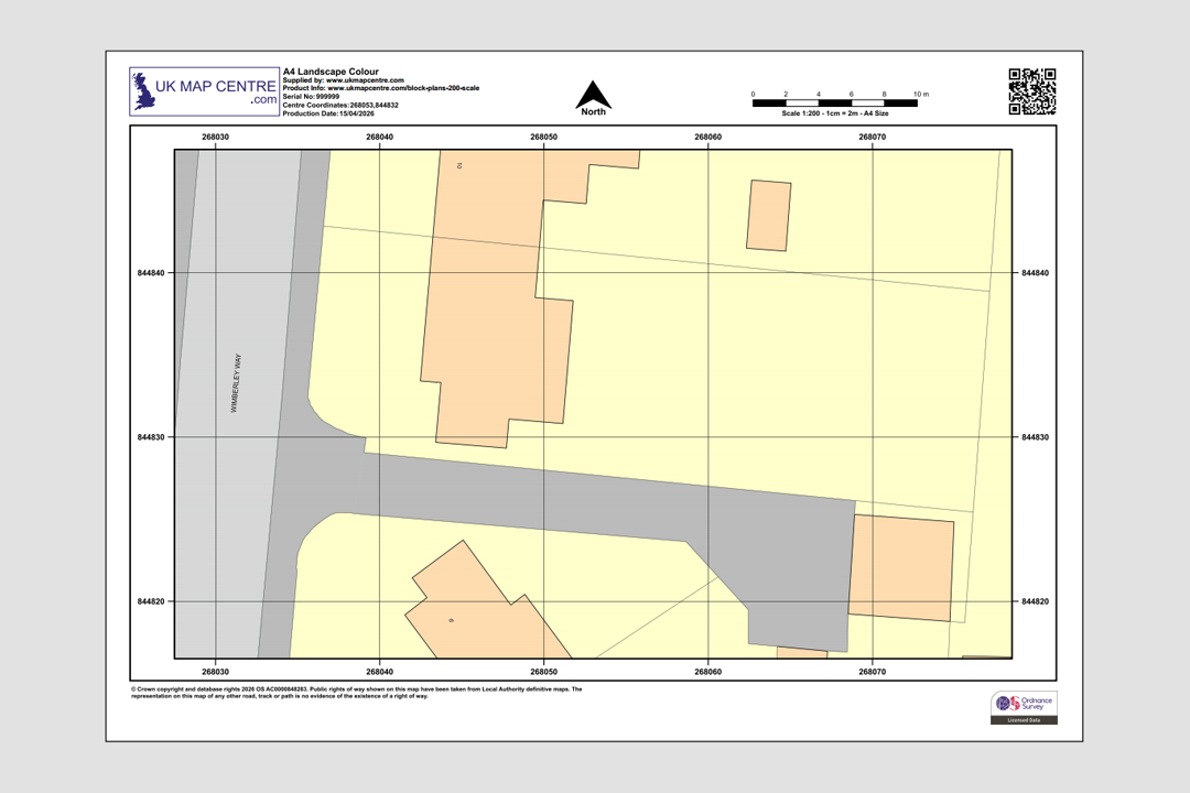
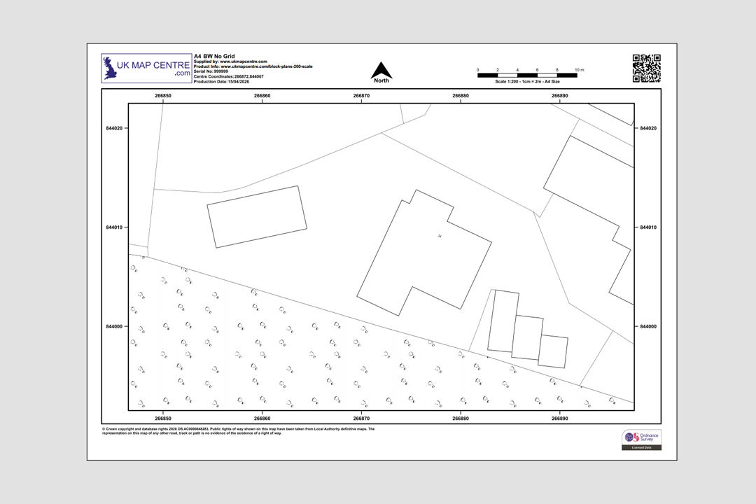
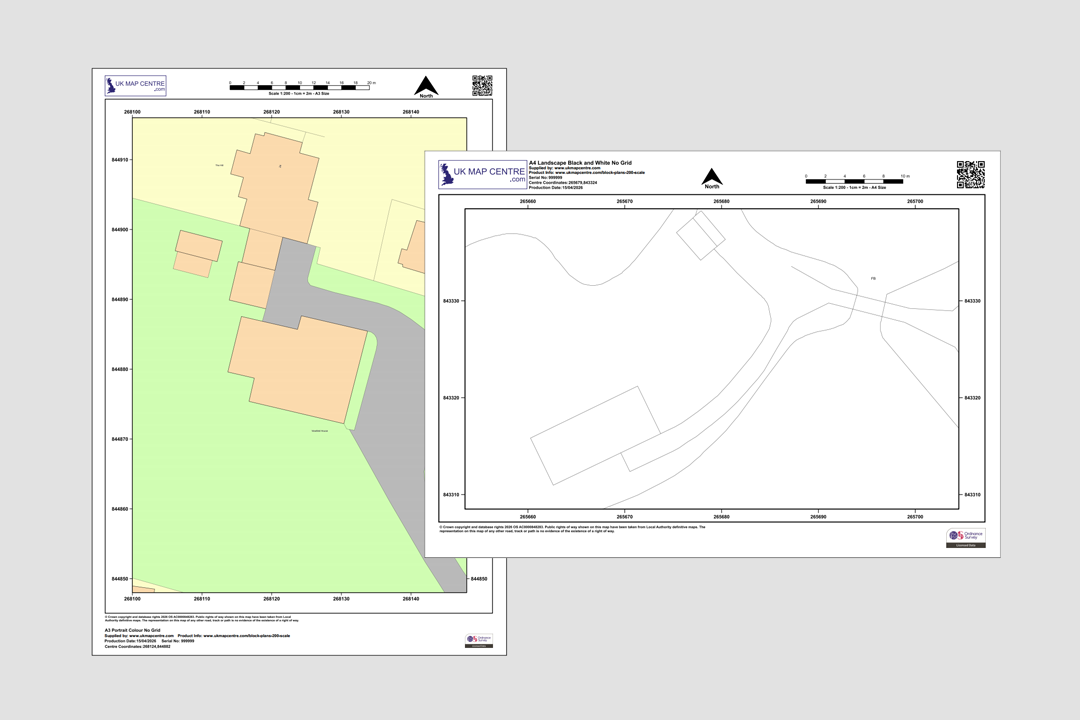
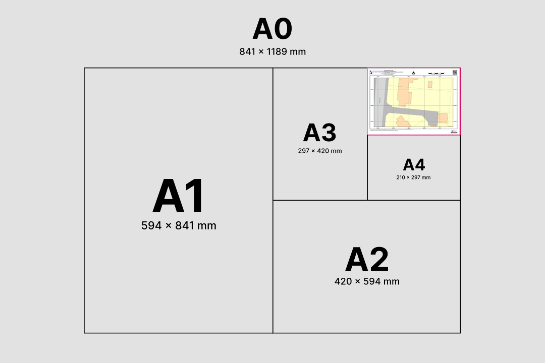
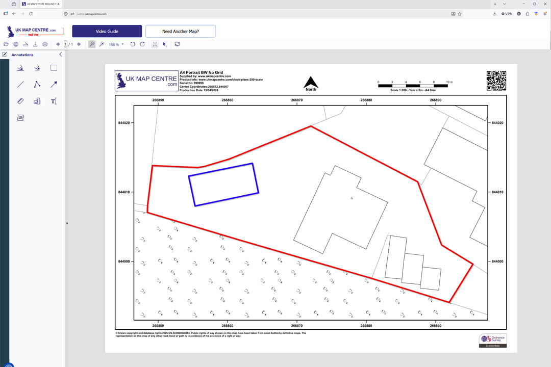
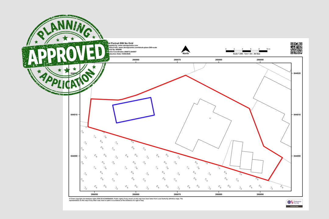

Every plan includes a north arrow, scale bar, grid references, date and OS licence number OS 1:200 Colour Block Plan - A4 landscape with building footprints and boundaries OS 1:200 Black & White Block Plan - clean line work without colour fills Choose portrait or landscape, colour or black & white - A3 and A4 examples shown Available in A4, A3, A2, A1 and A0 - choose the sheet size that fits your site Mark up your plan online - we forward a link to our online app so you can draw site boundaries, proposed extensions and add notes Planning-ready markup - red site boundary and blue proposed extension added with our online tool Ideal for new build extensions, rear gardens and access proposals Supporting garden design, landscaping and hard-standing projects at a readable 1:200 scale
© Crown copyright and database rights 2026 OS AC0000848283
OS 1:200 Extract
- Black & White or Colour
- PDF, TIFF, JPG, BMP, PNG, WORD
- A4 to A0 size
- Council Compliant
- North Arrow
- Scale Bar
- 1 cm = 2 m
Ordnance Survey 1:200 Scale Block Plan and Site Plan for Planning, Building Warrants and Garden Design
The Ordnance Survey 1:200 scale map sits right between our popular 1:500 block plan and our detailed 1:100 dropped-kerb plan. It is the close-up drawing councils, architects, surveyors and landscape designers reach for when a 1:500 block plan does not zoom in enough to show the detail of a proposal. Each 1:200 plan is an enlargement of the official OS MasterMap® Topography Layer, drawn large enough that boundaries, driveways, paving edges and outbuildings read comfortably on a single sheet.
As a Premium Licensed Partner of Ordnance Survey, UK Map Centre supplies 1:200 block plans that are accepted by every local authority in Great Britain, including the many Greater London boroughs that specifically request this scale. Every sheet arrives with a printed scale bar, north arrow, OS National Grid references and the Ordnance Survey copyright statement and licence number.
Frame your site, pick a sheet size and file format, pay online and your 1:200 block plan is emailed to you in around 20 minutes, seven days a week. Ready to upload to the Planning Portal, your council's building standards system or share with your architect, landscape designer or solicitor.
What Is a 1:200 Scale Block Plan?
A 1:200 block plan is a close-up Ordnance Survey extract where 1 centimetre on the sheet represents 2 metres on the ground. That is two and a half times more zoomed in than a 1:500 block plan and half the scale of a 1:100 dropped-kerb drawing. At 1:200 the plot fills the page: building footprints, garden walls, driveways and paths all render at a size that is ideal for planners and designers to read without zooming.
Between 1:500 and 1:100
1:200 is the sweet spot when a 1:500 block plan is too zoomed out but a 1:100 is too tight. It holds the whole plot on the page while still showing curtilage, outbuildings and access at a readable size.
Known Under Several Names
Councils and designers refer to the drawing as a site plan 1:200, block plan 1:200, OS 1:200 plan or detailed site plan. All four terms describe the same Ordnance Survey 1:200 extract supplied here.
1 cm Represents 2 m
Every centimetre on the printed sheet equals two metres on the ground. The scale makes it easy to sanity-check garden dimensions, extension footprints and driveway widths against a council's permitted-development rules.
Pairs with a 1:1250
Most councils ask for a 1:200 block plan alongside a 1:1250 location plan in a planning submission. The 1:200 zooms in on the plot, the 1:1250 sets the plot inside its street.
1:200 drawings are requested whenever a council, architect or landscape designer wants a larger-scale view than the standard 1:500, typically for urban infill, dense residential schemes or detailed garden and hard-landscaping work.
When Do I Need a 1:200 Block Plan?
A 1:200 scale Ordnance Survey extract is the drawing councils reach for when the detail on a 1:500 sheet is not enough. It is regularly requested by:
London Borough Councils
Many Greater London boroughs specifically ask for a 1:200 block plan on householder, full planning and change-of-use applications. The tighter scale matches the dense, compact sites typical of inner London planning.
Householder Extensions & Alterations
Homeowners applying for rear extensions, side returns, loft conversions, porches and garden rooms use a 1:200 sheet as the base drawing when the council's validation checklist asks for greater detail than a 1:500.
Landscape & Garden Design
Garden designers and landscape architects work on top of a 1:200 OS base because it shows the whole garden at a scale where paving layouts, planting beds, lawn shapes, pergolas and water features can all be drawn directly onto the plan.
Boundary Treatments & Fencing
Applications involving new fences, walls, gates and boundary realignments benefit from the 1:200 scale, which shows the length and run of each boundary clearly enough to annotate.
Driveway & Access Proposals
Proposals for new driveways, parking bays, turning areas, bin and bike stores often sit best on a 1:200 sheet because it captures the whole access arrangement without losing detail around the house itself.
Urban Infill Schemes
Small infill plots, subdivision schemes and conversions of outbuildings to dwellings suit a 1:200 drawing. Planners get a clear reading of the site, its curtilage and its relationship to neighbouring plots.
Scottish Building Warrants
Scottish building warrant submissions accept a 1:200 block plan as the site-identification drawing for detailed householder and small-commercial works lodged through eBuilding Standards.
Architect & Surveyor Base Drawings
Architects and measured surveyors overlay proposed footprints, section lines and dimensions onto a 1:200 OS base when working up designs for extensions, outbuildings and refurbishments.
If the plot is larger or the council asks for a wider context drawing, the 1:500 block plan is usually the right choice. If you need a very close-up view for a dropped-kerb or footway crossing, a 1:100 plan zooms in one step further.
Sourced Direct from Ordnance Survey
UKMapCentre.com operates as a Premium Licensed Partner of Ordnance Survey, which means every 1:200 block plan we sell carries a current, correctly attributed OS licence. That status makes our plans ready-to-submit for Planning Portal uploads, London borough validation, Scottish building warrants, landscape and garden design work and any professional use where OS-licensed mapping is expected.
Further Reading
The 1:200 drawing is often the first close-up base an applicant or designer works on. These short guides cover the parts customers ask about most:
- Understanding Ordnance Survey Map Jargon
- Correct Land Registry Map Scales: A Guide
- How to Print an Ordnance Survey Map to the Correct Scale
About UK Map Centre LLP

