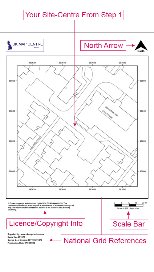
OS MasterMap 1:500 Block Plan for Planning Applications
A 1:500 block plan is required for most UK planning submissions. It supports applications submitted to the Planning Portal, local councils and other official bodies. Each map is OS-licensed and council-compliant, making it suitable for formal planning use.
Order your 1:500 block plan online. Ordnance Survey licensed, planning-approved and delivered in under 20 minutes.
WHAT IS A 1:500 SCALE MAP?
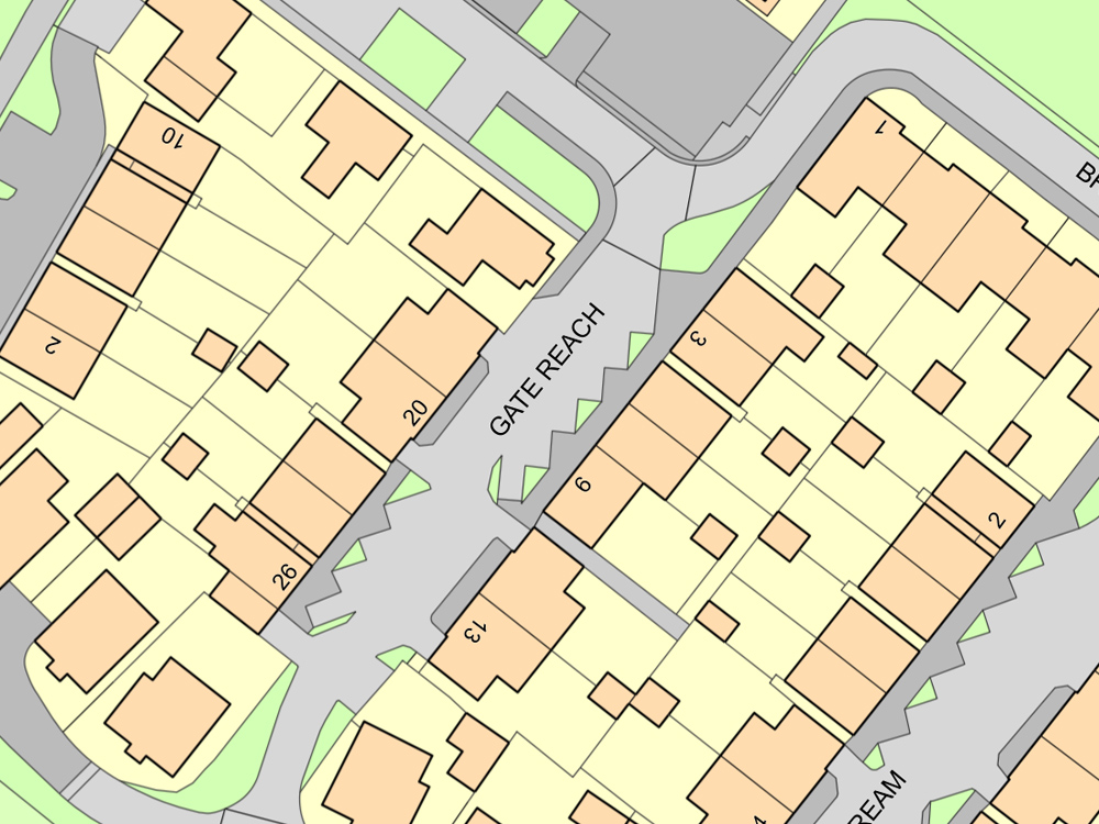
A 1:500 scale map is a detailed Ordnance Survey mapping extract that displays your property and nearby features like access points, surrounding buildings and boundary lines. It is often paired with a 1:1250 map when applying for planning permission.
Each plan is created from official Ordnance Survey mapping data and formatted to meet local authority standards:
- Enlarged view of a standard Ordnance Survey extract
- Also known as a block site plan or site plan scale 1:500
- UK block plans are suitable for all types of developments
- Meets UK council standards for planning applications
This map supports planning applications across the UK, including listed building consent and building control submissions.
WHEN DO I NEED A 1:500 BLOCK PLAN?
A detailed 1:500 scale map is vital for many formal submissions to local councils and planning authorities across the UK.
This type of site plan is commonly used by:
- Architects and planning consultants preparing detailed property layouts
- Homeowners applying for extensions, garages or outbuildings
- Builders and small-scale developers working on single homes or small residential units
- Surveyors confirming property lines or preparing plans for registered title updates
- Legal professionals handling boundary disputes or producing submission-ready mapping documents
Having difficulty understanding some of the terms used in planning applications? Check out our Understanding Ordnance Survey Map Jargon page.