Ordnance Survey 1:1250 Scale Map for Planning Applications and Land Registry Submissions
As an official Ordnance Survey partner, UK Map Centre provides council-compliant maps trusted for planning and legal submissions across the UK. Our Ordnance Survey 1:1250 scale maps are available in multiple digital and CAD-compatible formats to support accurate site analysis, planning permission and land registry submissions.
Get planning-ready maps fast with UK Map Centre. Order now and receive your map within 20 minutes.
WHAT ARE ORDNANCE SURVEY 1:1250 MAPS?
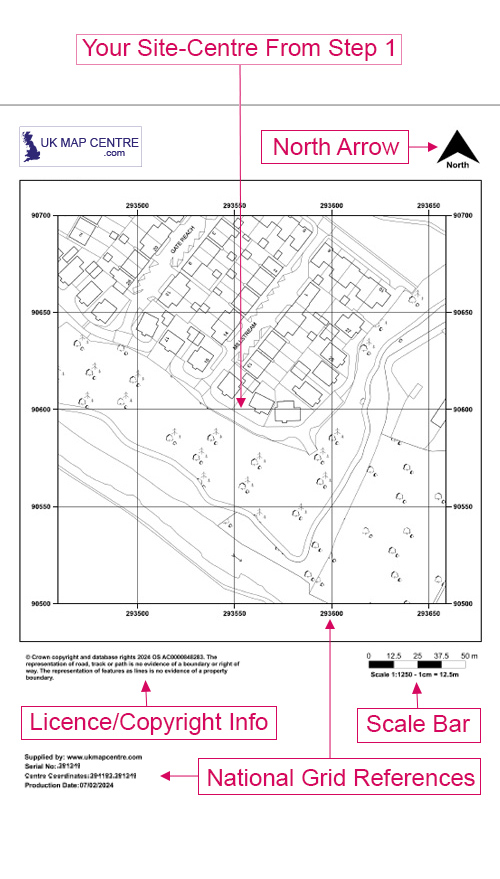
These maps are large-scale location plans used to show detailed information about a specific site and its surrounding context. At this scale,1 centimetre on the map represents 12.5 metres in real life, offering a clear view of property boundaries, building outlines, roads and access points.
These scale 1:1250 maps are commonly required for planning applications, Land Registry submissions, and demolition notices. Each map is created using the official site location plan 1:1250 map, ensuring it meets UK mapping and compliance standards.
WHEN DO I NEED A 1:1250 LOCATION PLAN?
The OS 1:1250 map is our most popular scale for ground development applications. You’ll typically need an OS 1:1250 site plan when submitting a planning application or legal document that requires a location plan. This Ordnance Survey map is commonly requested by:
- Local planning authorities, as part of outlining permission submissions
- The Land Registry for property registration and boundary updates
- Utility providers (e.g., electricity or water companies) needing accurate site information
- Legal professionals preparing plans for conveyancing or dispute resolution
- Surveyors and architects working on site development or alterations
- Applicants submitting a Section 80 demolition notice
- Crofting Commission and Registers of Scotland for decrofting applications
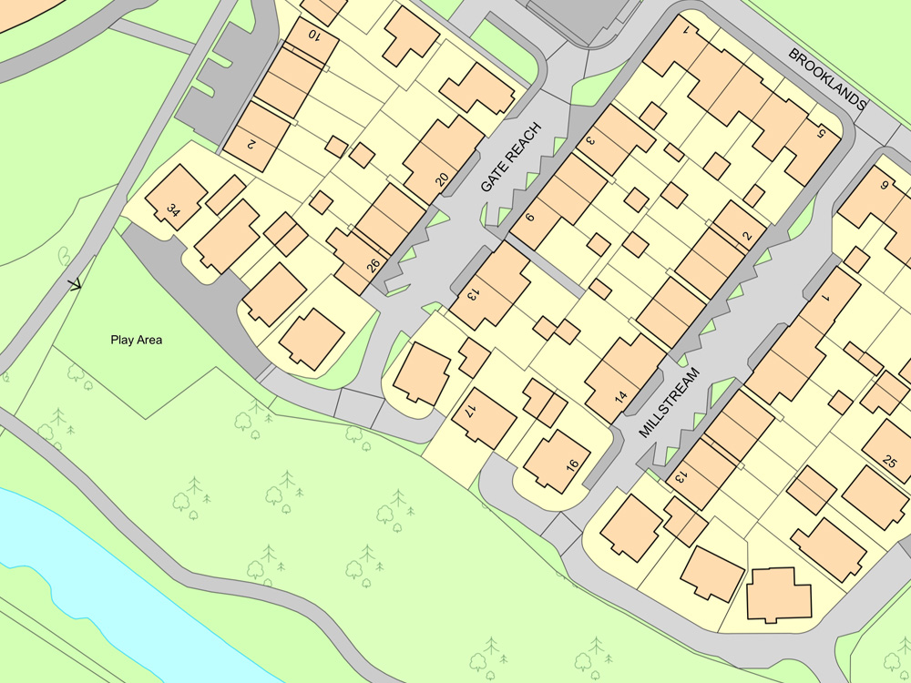
Because 1:1250 maps clearly show the property in context with its surroundings, they are ideal for projects in urban or built-up areas, where greater detail is essential.
Having difficulty understanding some of the terms used in planning applications? Check out our Understanding Ordnance Survey Map Jargon page.