OS Digital Terrain Model (DTM) 5m Grid Topographic Points with Optional Contours
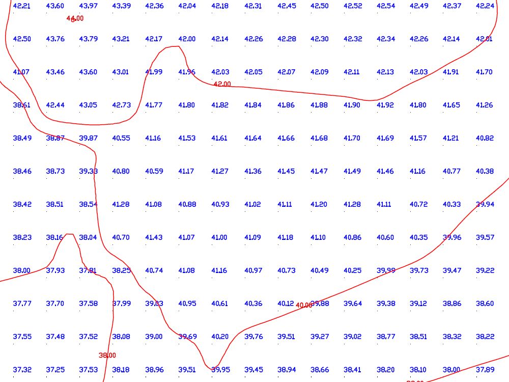
OS height data is supplied in a 5m grid with optional 2D contours to represent surface relief. OS Terrain is maintained through the same integrated revision process as OS large-scale mapping and data products, ensuring consistent updates and high accuracy. The dataset delivers reliable topographic detail that can be layered across landscape features such as roads, railways, quarries and lakes when used with OS Mastermap in DWG and DXF.
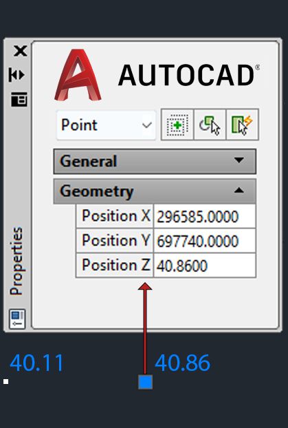
Each DTM point includes X, Y coordinates and a Z elevation value, fully georeferenced to the UK National Grid. Our height model is ideal for CAD planning, GIS analysis, and topographic map creation. Optional contours provide a clear 2D terrain reference for visualisation, although they do not include height values.
Order online and receive your topographic map data by email within 30 minutes.
What is a 5m Grid Topographic Model?
A 5m Grid Topographic Model is a digital terrain model (DTM) representing detailed surface elevations using high-resolution height data. It supports detailed terrain and topography analysis for mapping and planning purposes.
Key Benefits and Applications:
- Provides precise terrain and land elevation profiles
- Identify administrative boundaries and surface changes across any area
- Map and analyse hills, mountains, slopes, and manmade structures
- Visualise landscape features in both rural and urban settings
- Integrates seamlessly with GIS software and planning tools
- Fully compatible with OS datasets and the UK National Grid
Our terrain model is trusted by professionals across surveying, engineering, and environmental modelling industries. These topography maps with contour lines offer precision and flexibility for a wide range of mapping applications.
When Do I Need OS Height Data (DTM)?
Digital terrain models are essential when planning requires accurate elevations, surface analysis, or terrain context for design, modelling, or development. They’re particularly suited for large or sloped areas where topography and surface features influence project outcomes.
Common Users Include:
- Architects preparing location plans
- Engineers needing slope or visualisation models
- Surveyors assessing access and landform
- Environmental teams mapping terrain against external GIS data
This OS dataset is compatible with a wide range of planning, infrastructure, and GIS workflows.