Ordnance Survey (OS) Maps Scale 1:2500 for Rural Planning Applications and Land Registry Submissions
Get accurate, council-compliant OS maps scale 1:2500, ideal for rural planning applications, site boundary checks and Land Registry submissions. These large-scale maps offer a clear view of fields, buildings, boundaries and access roads, making them perfect for agricultural planning, estate management and countryside developments.
Easily obtain mapping data that meets local council standards. Order your 1:2500 OS map online – delivered by email within 20 minutes.
WHAT IS AN OS 1:2500 SCALE MAP?
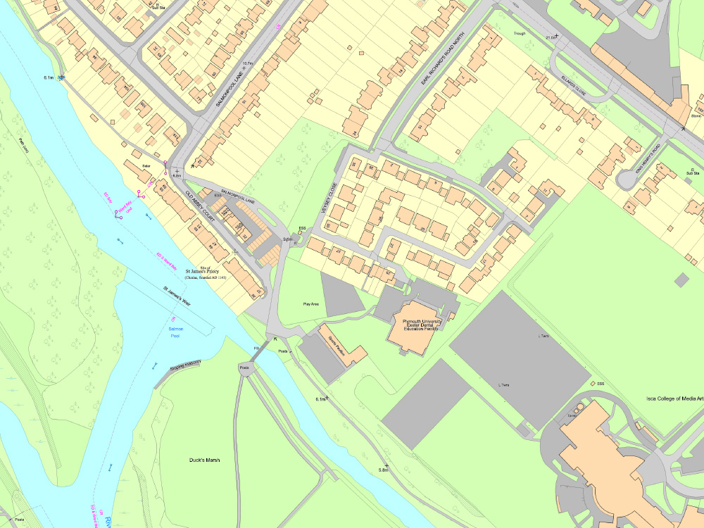
An Ordnance Survey 1:2500 map is a large-scale, detailed mapping extract where 1 centimetre on the map represents 25 metres on the ground. Sometimes referred to as a rural location plan, it offers detailed topographic data and broader coverage than a 1:1250 map. This makes it particularly suitable for rural and semi-rural properties.
This map scale is commonly used for agricultural planning, land registration and rural development proposals. It allows you to identify key site features like boundaries, access roads, footpaths, outbuildings, fences, vegetation and surrounding land.
WHEN DO I NEED A 1:2500 SCALE PLAN?
A 1:2500 scale map is typically required for rural planning applications, land registration tasks and proposed developments involving larger plots of land. It is ideal for projects that need to show the broader site context.
This rural land plan is popular with farmers, land agents, architects and planners working on countryside developments or managing land across wider areas.
- Rural planning applications such as agricultural buildings, stables or access roads
- Land Registry submissions where boundaries extend beyond the footprint of a single property
- Utility service plans covering larger areas, including farms or estates
- Crofting Commission and Registers of Scotland decrofting or registration applications
- Estate management and landscape planning for large rural properties
Having difficulty understanding some of the terms used in planning applications? Check out our Understanding Ordnance Survey Map Jargon page.