


Ordnance Survey VECTORMAP LOCAL GIS Tiles - 5km x 5km Size
Georeferenced Tiles in GML format for GIS systems
Ordnance Survey Premium Licenced Partner • Fully Licenced official OS map tiles • Scalable and Layered OS Vector Data
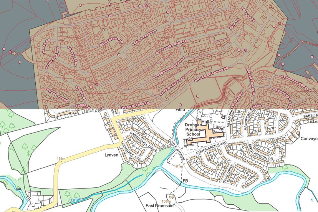
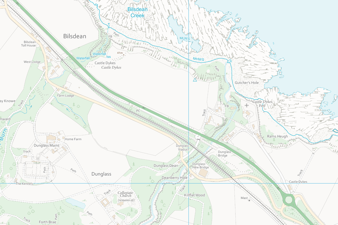
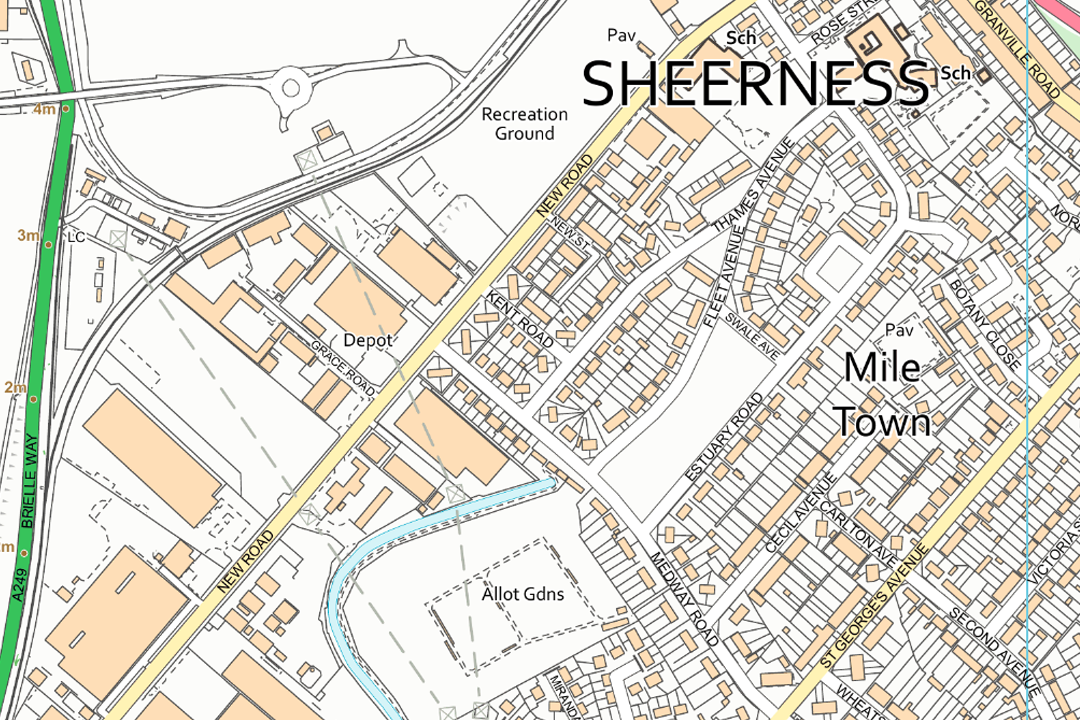
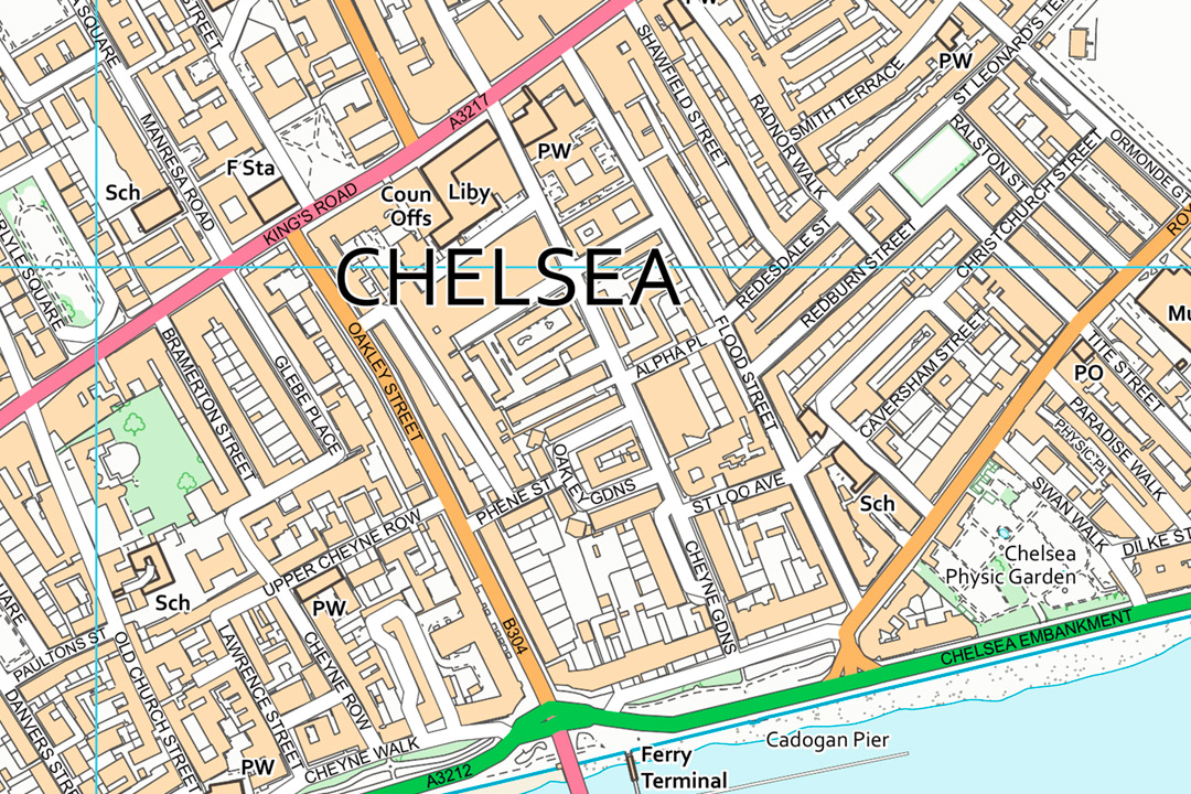
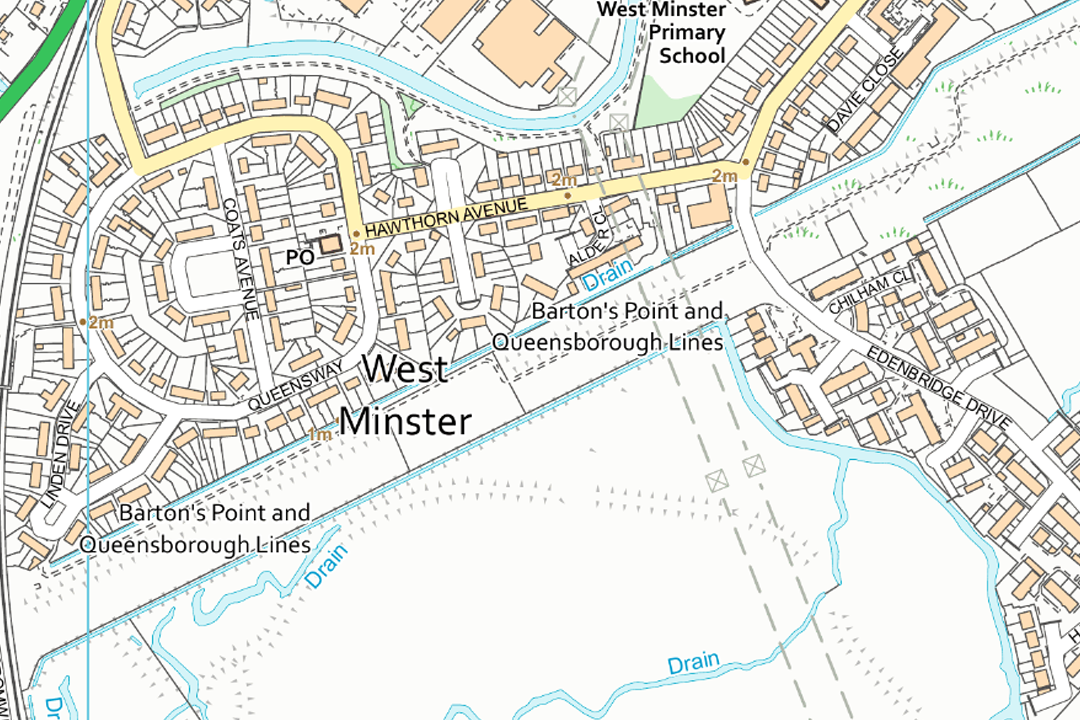
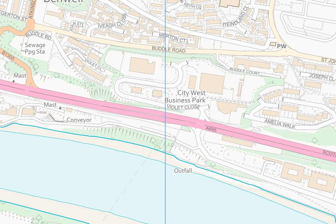
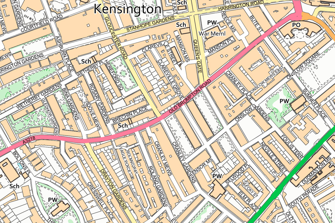
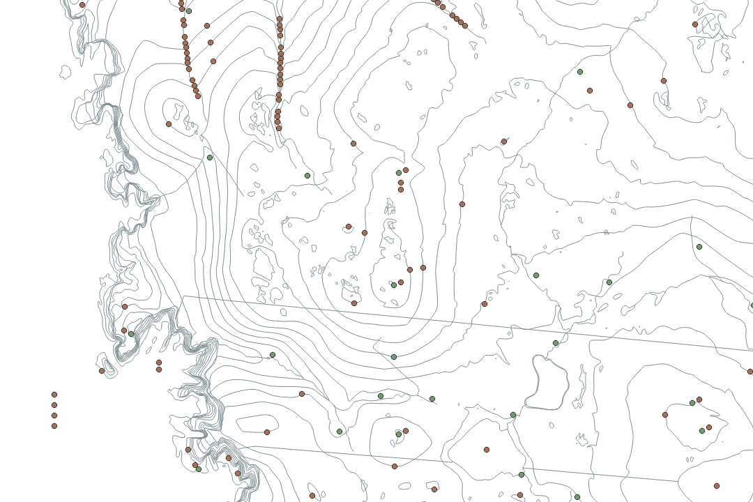
Before and after - raw GML data transformed with free OS stylesheets from GitHub into full-colour mapping Highland coast near Bonar Bridge - dual carriageway, tidal estuary and conifer woodland styled in OS colours Sheerness - recreation ground, residential streets and named roads rendered from VectorMap Local GML Chelsea - pink trunk roads, Thames riverfront and dense urban grid styled with the OS colour palette West Minster - suburban housing, primary school and coastal drainage with full feature attribution Waterfront business park - major road corridor, river channel and land use polygons in OS styling Kensington - classified roads, schools and residential blocks showing the detail available in each GML tile Raw GML before styling - contour lines, spot heights and boundaries visible without any colour fills applied
© Crown copyright and database rights 2026 OS AC0000848283
OS VectorMap Local Tiles
- 5 km x 5 km GML vector tiles
- Styleable with free OS stylesheets
- Generalised building outlines
- Features not cut at tile edges
- Nominal scale 1:10 000
- Viewing range 1:3000 to 1:20 000
- Updated quarterly
OS VectorMap Local GML Tiles - Styleable Vector Data for GIS
OS VectorMap Local GML tiles are 5 km x 5 km vector data tiles supplied in Geography Markup Language (GML) format. Unlike our raster GeoTIFF tiles which deliver a flat image, GML tiles give you the raw vector geometry and feature attributes - buildings, roads, railways, rivers, woodland, boundaries and text - ready to load into QGIS, ArcGIS, MapInfo or any GML-compatible GIS platform. You control the styling, the symbology and the layer visibility.
Ordnance Survey publish free stylesheets on GitHub that render the GML data in the standard OS colour palette - the same look you see on OS printed maps. Apply the stylesheet and the raw data transforms instantly into full-colour mapping with orange buildings, green A-roads, pink trunk roads, blue water and named streets. Prefer a different look? Modify the stylesheet or build your own from scratch - the vector data supports any cartographic treatment your project demands.
Select the tiles you need on the interactive map, pay online and the GML data is emailed to you in around 30 minutes, seven days a week.
What Are OS VectorMap Local GML Tiles?
Each tile delivers vector geometry and attributes for a 5 km x 5 km area of the OS National Grid. The data covers buildings, roads, railways, rivers, lakes, woodland, vegetation, administrative boundaries, contours, spot heights and cartographic text at a generalised level of detail suited to display between 1:3000 and 1:20 000. Features are not cut at tile edges - geometries that cross a boundary are held complete within the tile so you never lose part of a road, river or building outline at the join.
Free OS Stylesheets from GitHub
Ordnance Survey publish open-source stylesheets on GitHub that render VectorMap Local GML in the standard OS colour palette. Download the stylesheet for QGIS or GeoServer, point it at your tiles and the raw data displays as full-colour mapping in seconds. The stylesheets are free to use and modify under an open licence.
Full Feature Attribution
Every feature carries its OS classification code, descriptive group and feature type. Roads are classified by function (motorway, A-road, B-road, minor road). Buildings carry their descriptive term. Water features, woodland and boundaries all hold the attributes needed for thematic display, spatial queries and automated map production.
Seamless Tile Coverage
Tiles follow the OS National Grid 5 km scheme and join edge to edge without gaps. Features that cross tile boundaries are not clipped - they extend into the adjacent tile as complete geometries. Start with your project area and add tiles later as your coverage grows.
Derived from OS Large-Scale Data
VectorMap Local is generated automatically from the OS Large Scale Topographic Database - the same parent data behind OS MasterMap. Building outlines are generalised but geometrically accurate, and the quarterly update cycle ensures that new development, road changes and boundary revisions flow through from the source.
Want a Smaller Area or Pre-Styled Mapping?
If your project covers a single site and you do not need full 5 km x 5 km tiles, our VectorMap Local sections let you frame a custom area and receive a single file covering just the extent you need. If you prefer pre-rendered mapping with no styling required, our 1:10k raster tiles deliver the same OS data as a flat GeoTIFF image in full colour, black and white or washout.
Not a GIS User?
If you do not use GIS software and just need a printed 1:10 000 map of a specific area, our ready-to-use extracts are the easier option. They arrive as a PDF, TIFF or JPG at the paper size you choose - no specialist software required:
1:10 000 Regional Location Plan - print-ready OS map extract accepted by Land Registry, Registers of Scotland, the Crofting Commission and forestry bodies.
Styling Your GML Data
The GML tiles arrive as raw vector data with no built-in colour or symbology. You apply a stylesheet in your GIS platform to control how every feature type renders on screen. Ordnance Survey make this easy by publishing free, open-source stylesheets that replicate the standard OS cartographic palette.
QGIS Styling
Download the OS QGIS stylesheet from GitHub, load your GML tiles and apply the style. Buildings render in orange, A-roads in green, trunk roads in pink, water in blue and woodland in light green - matching the familiar OS printed map look. The stylesheet handles text placement, road casings and area fills automatically.
GeoServer Styling
For web mapping, OS publish SLD (Styled Layer Descriptor) files for GeoServer. Serve your tiles through GeoServer with the OS stylesheet and your WMS or WMTS endpoint delivers fully styled OS mapping to any web client, field app or desktop GIS that consumes OGC services.
Custom Cartography
Because the data is vector, you have complete control. Change colours to match your brand, filter out feature types you do not need, exaggerate road widths for small-scale display, or apply conditional symbology based on feature attributes. Every element can be styled independently.
Raw Data for Analysis
Not every use case needs cartographic styling. Load the GML directly for spatial queries, area calculations, network analysis, feature counting and data extraction. The full attribute table is available without applying any stylesheet at all.
Resources for getting started with styling:
- OS VectorMap Local Stylesheets on GitHub
- Download OS Legend Files (ZIP)
- Video: How to Style VectorMap Local in QGIS
- Feature Codes and Descriptions
- GML Technical Overview
- Important Buildings Classification
When Do I Need VectorMap Local GML Tiles?
GML tiles are for GIS professionals who want editable, queryable vector data at regional scale rather than a flat raster image. The 5 km grid means each tile covers a wide area with enough detail to identify individual buildings, road classifications and land use polygons. Common users and uses include:
Custom Web Mapping Services
GIS developers serve GML tiles through GeoServer, MapServer or cloud tile pipelines to provide a licensed, styleable OS base layer for internal web maps, field data collection apps and client-facing portals where commercial web mapping APIs are not an option or where full cartographic control is required.
Spatial Analysis & Data Extraction
Analysts and researchers load GML tiles to run spatial queries, calculate areas, extract road networks, count buildings within zones and perform overlay analysis against their own datasets - tasks that require access to individual feature geometries rather than a pixel image.
Automated Map Production
Organisations that produce map series, atlases or location-specific reports use GML tiles as the vector source for automated print layouts. Custom stylesheets, dynamic labelling and conditional symbology generate consistent, branded map outputs at any scale within the 1:3000 to 1:20 000 viewing range.
Estate & Land Management GIS
Land agents, estate managers and rural surveyors use GML tiles as a styleable base layer beneath ownership boundaries, tenancy parcels and management zones. The vector format lets them toggle individual feature types on and off and adjust colours to suit their estate management system.
Environmental & Ecological Mapping
Ecologists and environmental consultants use the attributed vector data for habitat mapping, Phase 1 surveys, river catchment analysis and environmental impact assessment. Feature classification codes support automated extraction of woodland, water and boundary polygons across wide study areas.
Infrastructure & Utility Planning
Windfarm developers, pipeline operators and telecoms providers load GML tiles as the editable base for corridor routing, constraint mapping and visual impact modelling. The vector format integrates cleanly with network analysis tools and CAD-to-GIS conversion workflows.
Local Authority & Public Sector GIS
Council GIS teams use GML tiles as a licensed vector base for asset registers, development control mapping, flood risk overlays and community safety analysis. The ability to style and query individual features makes the data more versatile than raster backdrops for day-to-day council operations.
Academic & Research Projects
University departments and research groups load GML tiles for geographic analysis, urban morphology studies, transport network modelling and landscape characterisation. The open GML format works with R, Python, PostGIS and any standards-compliant spatial toolkit.
Further Reading
New to working with OS VectorMap Local GML data? These resources cover the essentials:
- OS VectorMap Local Overview
- OS VectorMap Local Technical Specification
- OS Vector and Raster Mapping Fully Explained
About UK Map Centre LLP

