


Ordnance Survey 1:50 000 Scale Raster Data - GeoTiff with a worldfile
Available as GeoTIFF Tiles
Ordnance Survey Premium Partner • Fully Licenced official OS Data • Raster Geo-referenced Tile Data
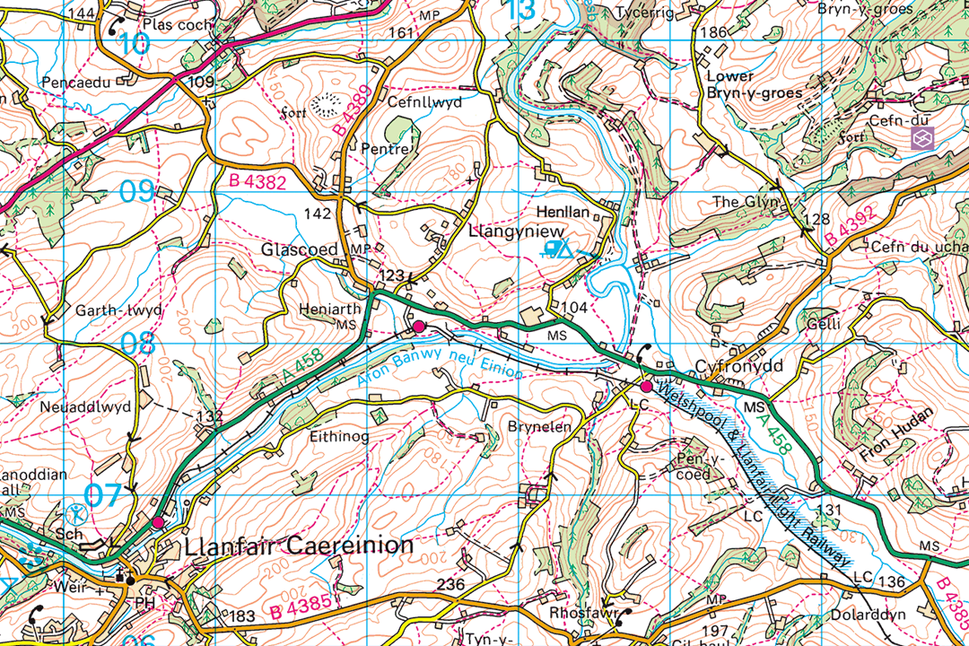
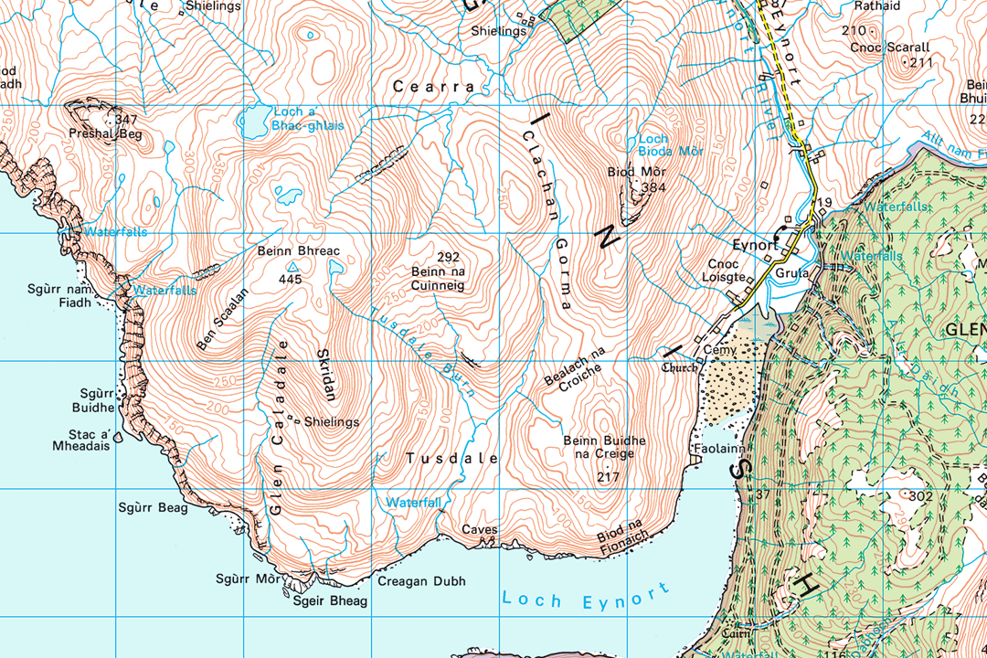
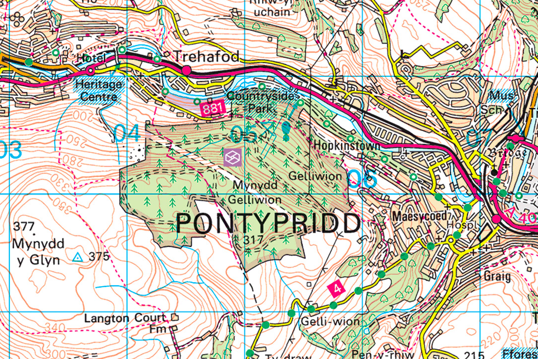
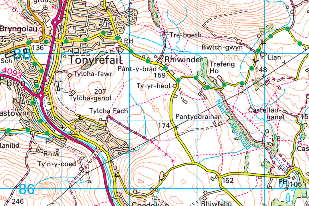
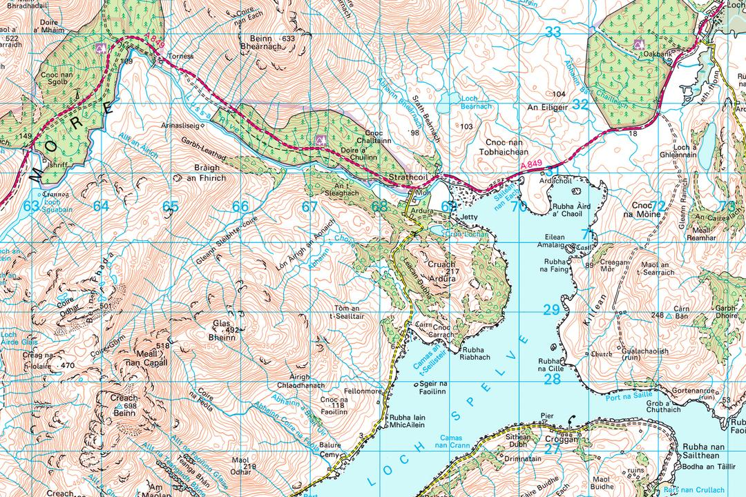
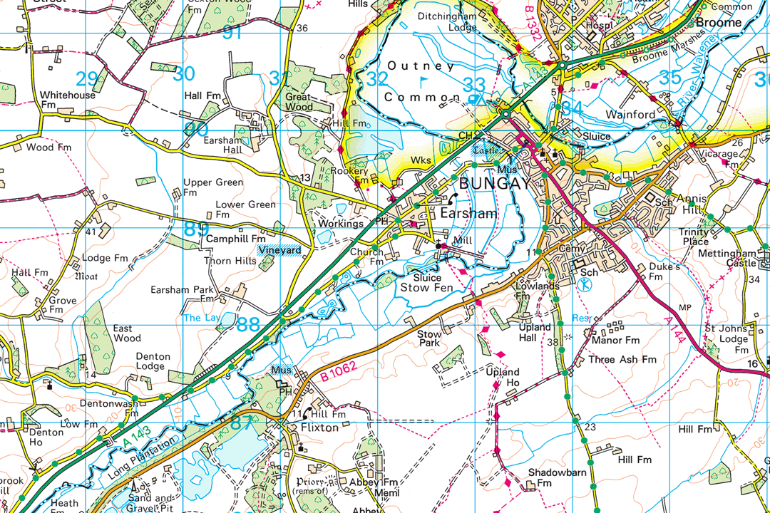

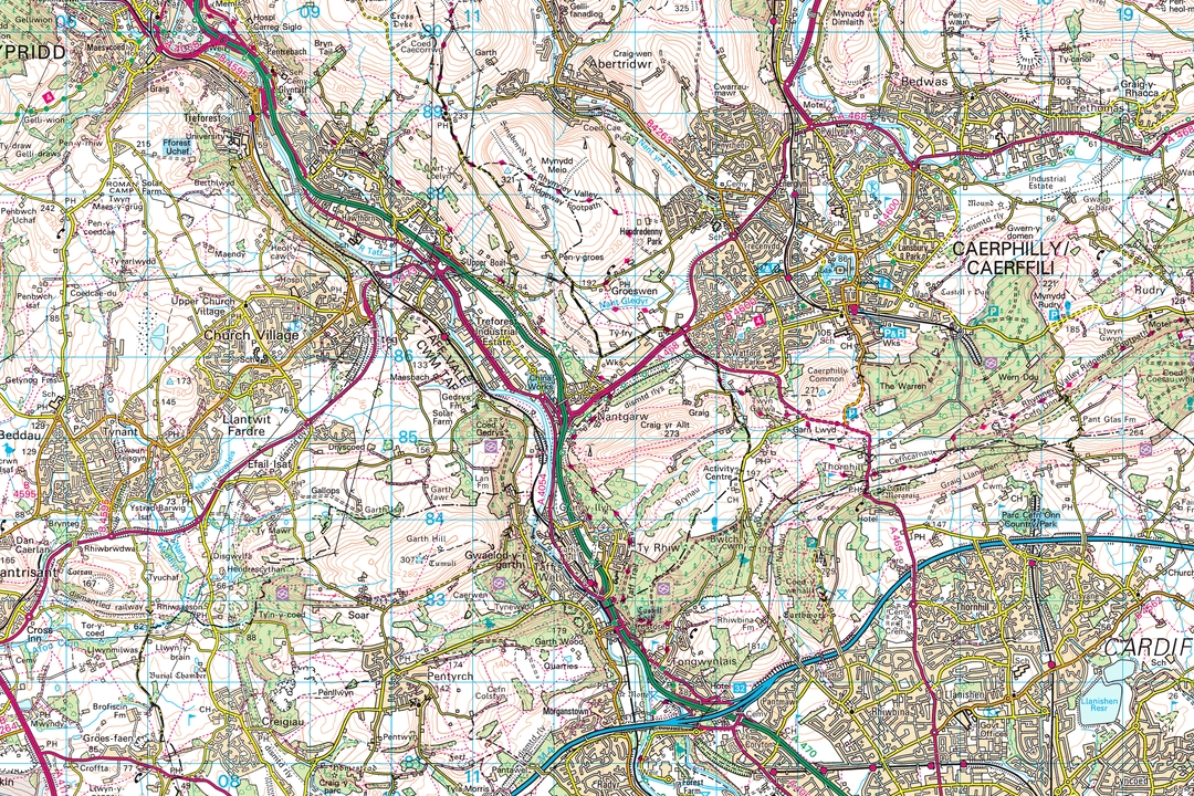
Mid-Wales tile with river valleys and the A458 - 20 km of Landranger mapping on the OS National Grid Highland coast with mountain contours and shoreline - add adjacent tiles to extend your coverage Urban tile covering Pontypridd - tiles slot together for continuous coverage across South Wales Valleys and villages at Landranger scale - systematic tile coverage for regional GIS holdings West coast sea loch and mountain roads - remote terrain detail across the full 20 km tile extent Bungay tile with river and road network - add adjacent tiles to extend coverage across East Anglia Coastal islands and shoreline - every 20 km tile covers land and sea features to the tile boundary Valleys near Caerphilly - settlements and road network on a tile ready for your GIS data library
© Crown copyright and database rights 2026 OS AC0000848283
OS 50k Raster Tiles
- 20 km x 20 km set tiles
- GeoTIFF with TFW world file
- Full colour (Landranger palette)
- Seamless tile joining
- No bounding information
- Viewing range 1:15 000 to 1:60 000
- 254 dpi resolution
- Updated quarterly
OS 1:50 000 Raster Tiles - 20 km GeoTIFF Backdrop Mapping for GIS and CAD
OS 1:50 000 raster tiles are georeferenced 20 km x 20 km GeoTIFF images derived from the OS 1:50 000 Scale Colour Raster - the same Ordnance Survey dataset that underpins the printed Landranger map series. Each tile ships with a TFW world file and covers a fixed 20 km square on the OS National Grid. Tiles join seamlessly so you can build continuous Landranger-level backdrop coverage across any area of Great Britain.
The 1:50 000 scale provides a clear regional overview of the landscape, showing the road and rail network, settlement pattern, terrain, woodland, water features, airports and other landmarks. It is designed for both recreational and professional use - detailed enough for navigation and route planning, broad enough to show how a project area relates to its wider geographic setting. The data is refreshed quarterly in March, June, September and December.
Select the 20 km tiles you need on the interactive map, pay online and the GeoTIFF data is emailed to you in around 30 minutes, seven days a week.
What Are OS 1:50 000 Raster Tiles?
Each tile is a flat, georeferenced raster image covering exactly 20 km x 20 km - or 400 km² - of the OS National Grid. There are no grid lines, no title block and no bounding frame, just a clean GeoTIFF that your software positions automatically using the embedded British National Grid coordinate reference system (EPSG:27700). The 254 dpi resolution maintains the clarity needed for road classifications, contour labels, place names and tourist symbols across the full tile extent.
Build a Tile Library That Grows
Every tile follows the OS National Grid and joins seamlessly to its neighbours. Start with the tiles you need today and add adjacent tiles as your coverage requirements expand - new purchases slot straight into your existing holding without overlap or alignment issues.
Predictable File Management
Each tile is referenced by its National Grid square, giving you a consistent naming and storage structure. Replacing a tile with a newer quarterly edition is as simple as swapping one file - no re-downloading or re-tiling required.
400 km² Per Tile
At 20 km x 20 km each tile covers a substantial area. Four tiles give you 80 km of continuous Landranger-level mapping in any direction - enough to span most county-level or regional project areas with just a handful of files.
Need a Single Project Area Rather Than Full Tiles?
If your project covers a single region and you do not need full 20 km x 20 km tiles, our 1:50k raster data sections let you frame a custom rectangle and receive a single GeoTIFF covering just the extent you need. Sections are ideal for one-off project areas; tiles are better when you are building systematic coverage or plan to extend your data holding over time.
Not a GIS User?
If you do not use GIS or CAD software and just need a printed 1:50 000 Landranger map of a specific area, our ready-to-use extracts are the easier option. They arrive as a PDF, TIFF or JPG at the paper size you choose - no specialist software required:
1:50 000 Landranger Map Extract - the same mapping as the pink fold-out OS Landranger maps, site-centred and delivered digitally. Ideal for hillwalking, cycling, Scouts and Duke of Edinburgh expeditions, outdoor instruction and general reference.
When Do I Need 1:50 000 Raster Tiles?
Tiles are for organisations and professionals who need a licensed OS backdrop at regional or national scale. The 20 km grid means each tile covers a substantial area - four tiles give you 80 km of continuous mapping in any direction. Where raster sections suit single-region project work, tiles are designed for building systematic data holdings that grow with your needs. Common users and uses include:
Enterprise & Multi-Region GIS
Organisations running GIS across multiple offices, regions or divisions build a tile-based library of 50k mapping that everyone can draw from. Tiles follow a fixed grid so data management is straightforward - each tile is referenced by its National Grid square and sits in a predictable position in the file catalogue.
Transport & Logistics Planning
Fleet managers, highway authorities and logistics companies tile continuous 50k coverage across their operating region for route optimisation, depot catchment analysis, delivery zone mapping and driver briefing sheets. The road classification and settlement detail helps explain travel times and route choices.
Environmental & Landscape Assessment
Environmental consultants use tiles as a base for cumulative impact studies, zone of theoretical visibility modelling, strategic habitat mapping and landscape character assessment where the study area extends across multiple 20 km grid squares.
Emergency Services & Resilience
Police, fire, ambulance and military users tile continuous Landranger-level coverage across their operational area for incident command mapping, evacuation routing, search and rescue coordination and resilience planning. The familiar Landranger style is immediately recognisable to all agencies.
National Parks & Countryside Bodies
National park authorities, Areas of Outstanding Natural Beauty management teams and countryside agencies build tile holdings covering their entire designated area for visitor management, access monitoring, landscape monitoring and development control mapping.
Utility & Infrastructure Asset Registers
Water companies, gas networks, electricity distributors and telecoms operators tile 50k coverage across their licence or franchise area as a permanent backdrop for asset registers, maintenance scheduling, outage mapping and regulatory reporting.
Retail & Marketing Analysis
Retailers, property agents and marketing teams tile coverage across trading regions to map customer locations, competitor positions, catchment boundaries and sales territories against a clear OS backdrop that shows roads, settlements and terrain.
Outdoor & Recreation Organisations
Scouting groups, Duke of Edinburgh centres, mountain rescue teams, outdoor activity providers and walking clubs use tiles as a GIS base for route planning, event mapping, safety briefings and training material where Landranger-level detail is needed across a wide area.
Further Reading
New to working with GeoTIFF tiles in GIS? These guides cover the essentials:
- How to Open TIF and TFW Files in QGIS - Step by Step
- OS Raster Maps: What They Are and When to Use Them
- OS Vector and Raster Mapping Fully Explained
About UK Map Centre LLP

