


Status: System Live - 24/7 delivery in minutes
Using OS CAD Data in Vectorworks
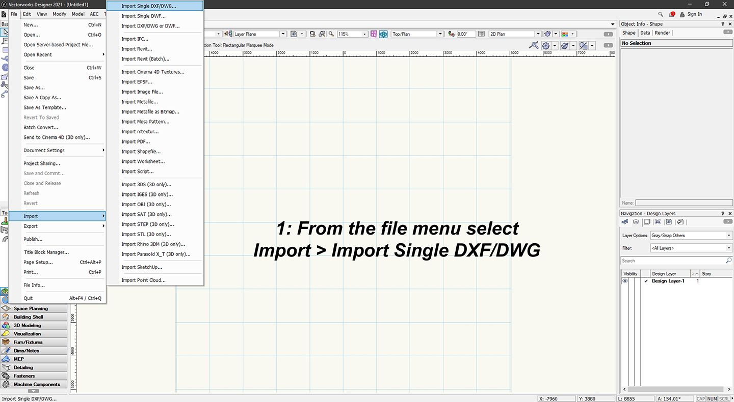
STEP 1:
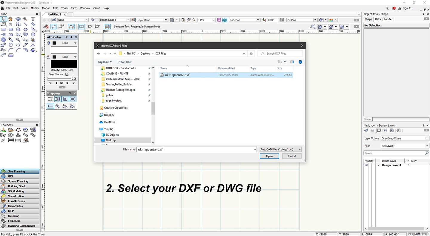
STEP 2
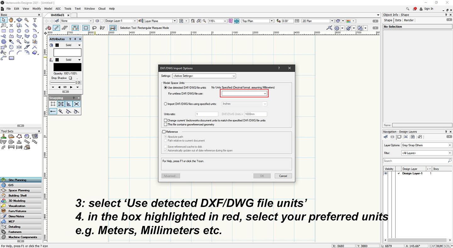
STEP 3 & 4
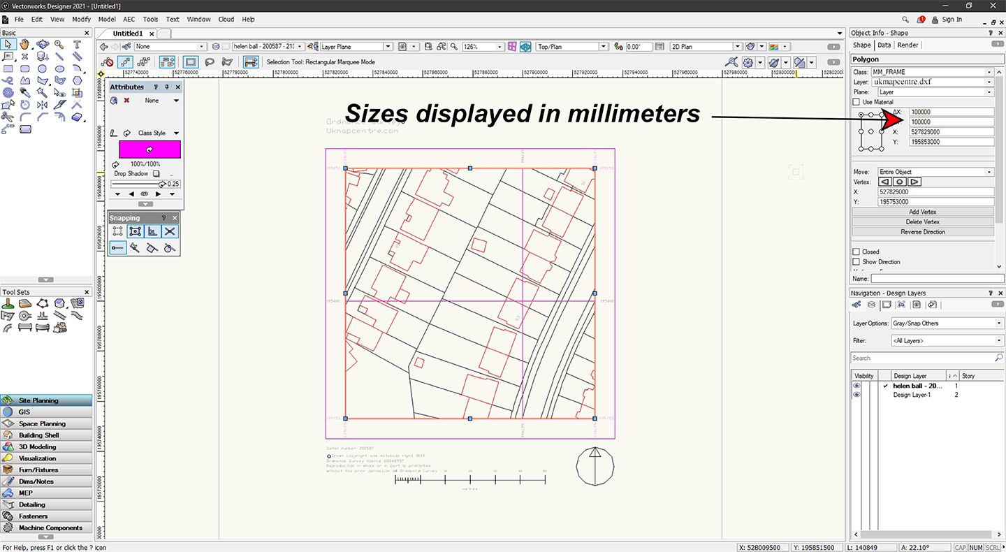
STEP 5
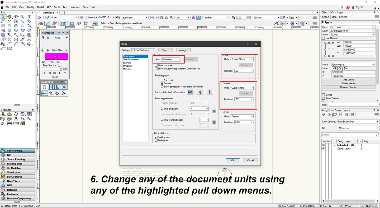
STEP 6
Why Buy from Us?
Account Verification
No Account Required. All major Credit Cards accepted.
Many Scales and Styles
1:100 Kerb Plans to 50K Raster Style. Block Plans, Location Plans, Planning Packs.
Digital Formats
PDF, JPG, TIFF, GeoTIFF, CAD in minutes.
Vector CAD Data
For expert users with CAD tools. DXF/DWG formats.
Keep Legal
Council, Land Registry and Utility Compliant.
Map, Size and Shape Options
Find your location, select your size and shape as needed. Easy and clear options.
Ordnance Survey Maps Compliance
