


Ordnance Survey 1:1250 Scale Map for Planning Applications and Land Registry Submissions
Available Formats via Email: PDF • TIFF • JPG • BMP • PNG • DOCX • WORD
OS Premium Partner • OS Licensed Product • Council Compliant • Ideal for Land Registry • Utility Company Compliant • No sign-up needed – checkout instantly
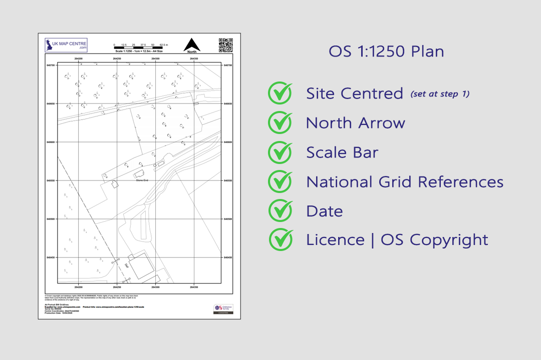
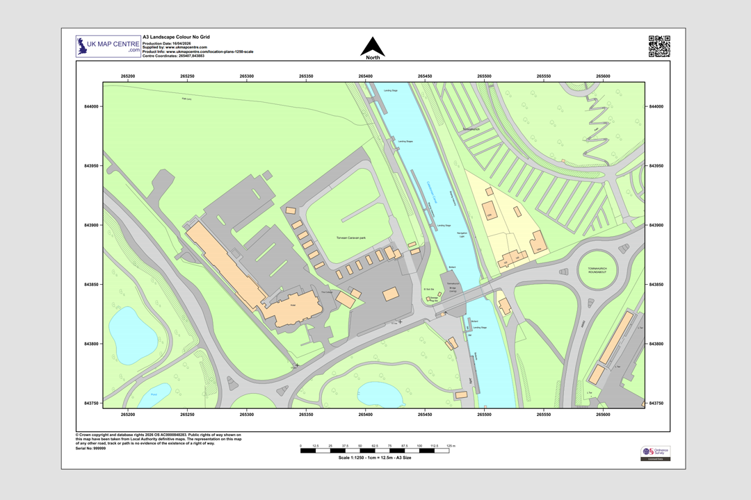
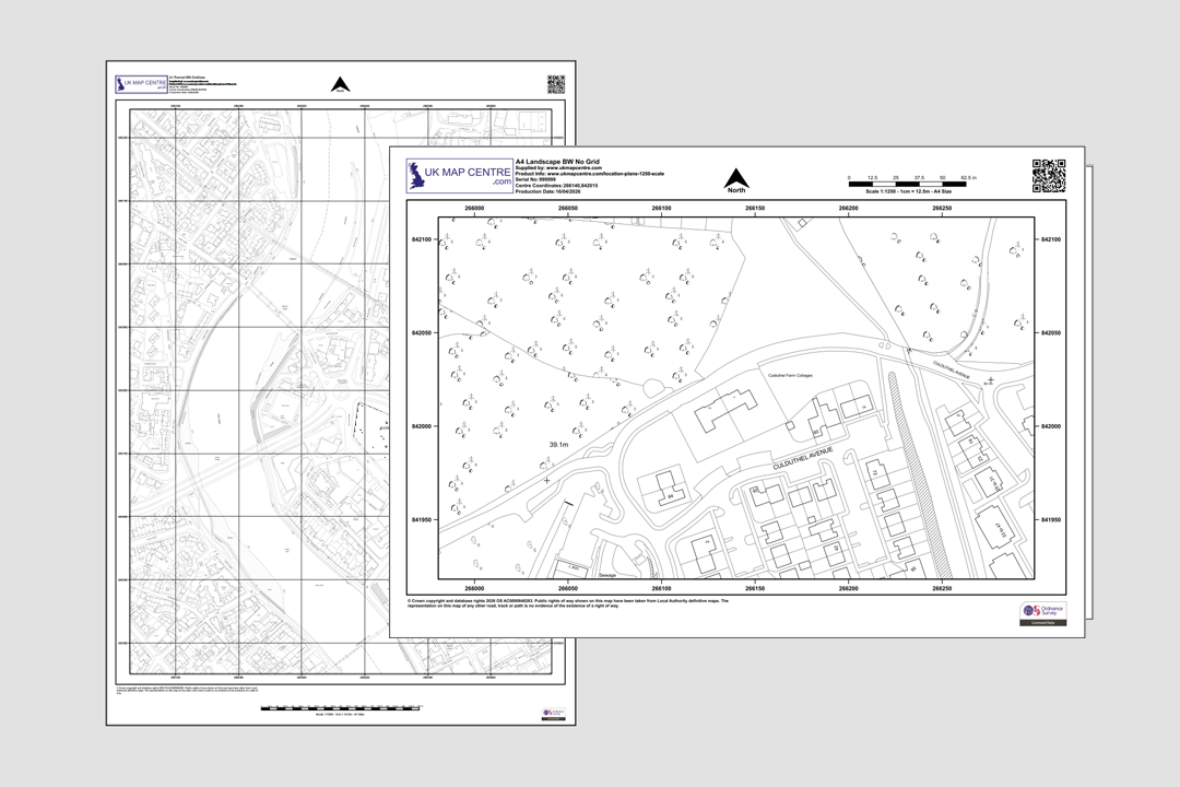
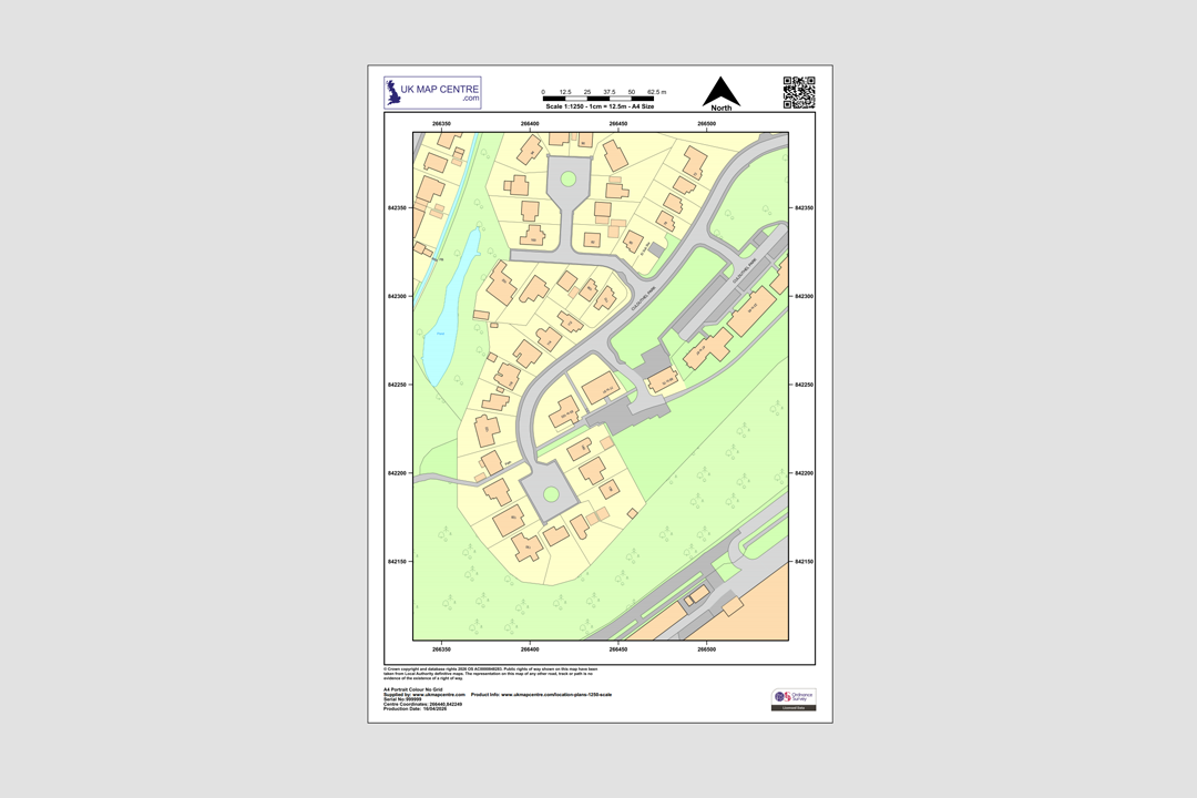
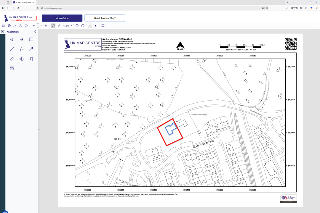
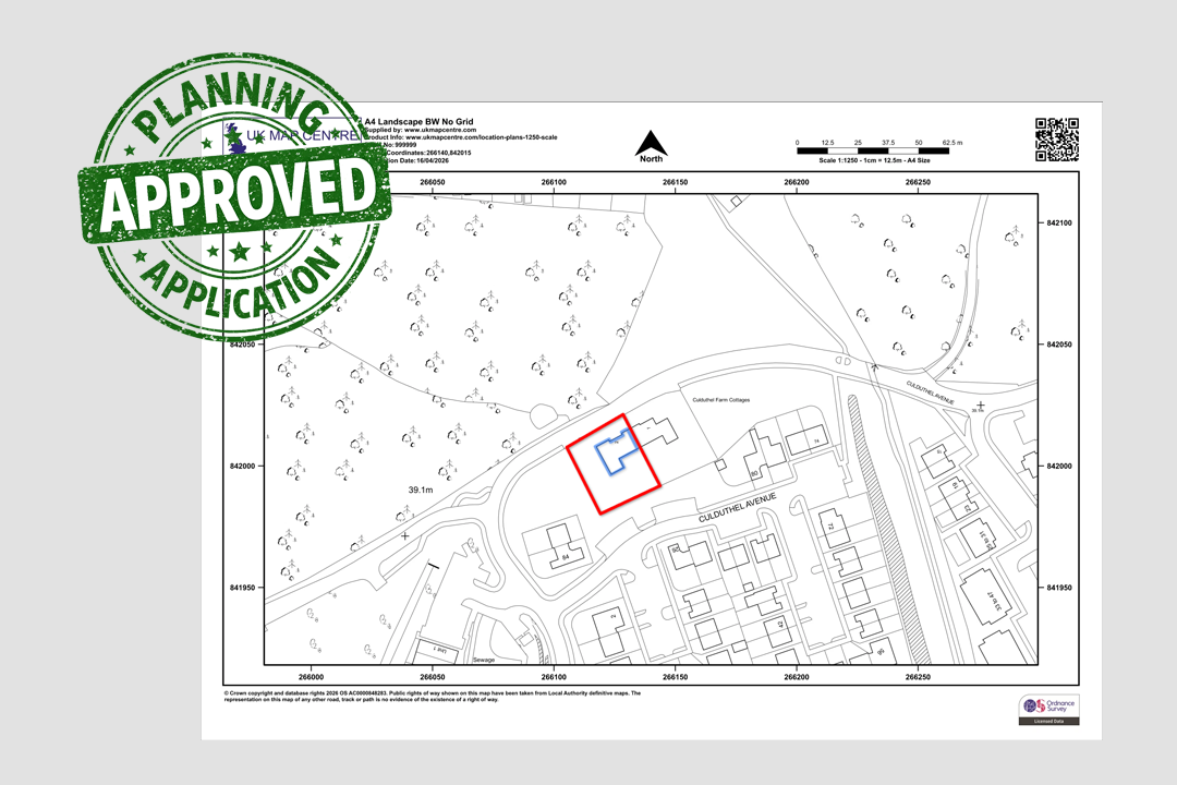
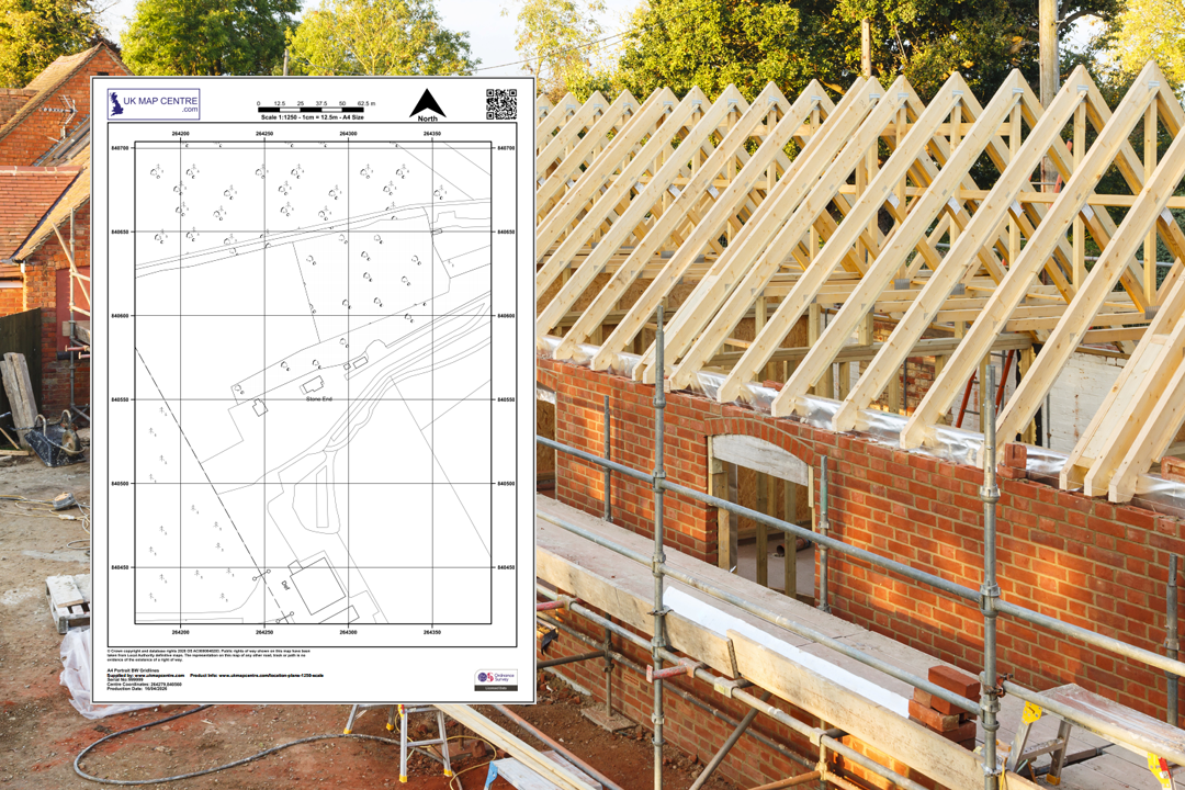

Every plan includes a north arrow, scale bar, grid references, date and OS licence number OS 1:1250 Colour Location Plan - A4 landscape with buildings, river and roundabout detail OS 1:1250 Black & White Location Plans - rural and urban examples side by side OS 1:1250 Colour Location Plan - A4 portrait showing a housing estate and surrounding area Available in A5, A4, A3, A2, A1 and A0 - choose the sheet size that fits your site Mark up your plan online - we forward a link to our online app so you can draw site boundaries, proposed buildings and add notes Planning-ready markup - red site boundary and blue proposed building added with our online tool From OS location plan to building site - the 1:1250 drawing that starts the project Professional planning context - OS 1:1250 location plan alongside architectural drawings
© Crown copyright and database rights 2026 OS AC0000848283
OS 1:1250 Extract
- Black & White or Colour
- PDF, TIFF, JPG, BMP, PNG, WORD
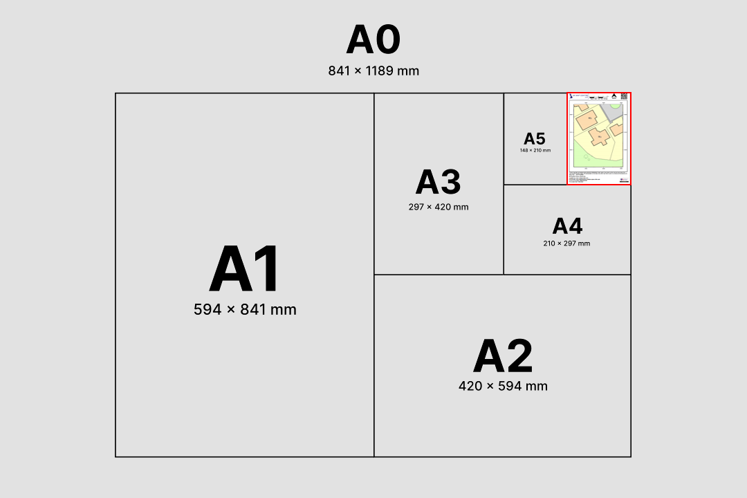
- A5 to A0 size
- Council Compliant
- North Arrow
- Scale Bar
- 1 cm = 12.5 m
Ordnance Survey 1:1250 Scale Map for Planning Applications and Land Registry Submissions
An Ordnance Survey 1:1250 scale map is the standard location plan used across the UK for planning permission applications, building warrant submissions and Land Registry registrations. Each map is produced from the official OS MasterMap® Topography Layer and clearly shows the property in the context of its surrounding roads, buildings and boundaries.
As an official Ordnance Survey partner, UK Map Centre supplies council-compliant 1:1250 location plans trusted for planning and legal submissions across the UK. Every plan includes a scale bar, north arrow, grid references and the official Ordnance Survey licence number, meeting all standard local authority and Land Registry requirements.
Choose your sheet size, pick a format and pay online. Your 1:1250 location plan lands in your inbox within about 20 minutes, seven days a week, ready to upload straight to the Planning Portal, your council's submission system, HM Land Registry or Registers of Scotland.
What Are Ordnance Survey 1:1250 Maps?
A 1:1250 scale map is a large-scale location plan used to show detailed information about a specific site and the surrounding area. At this scale 1 centimetre on the paper represents 12.5 metres on the ground, offering a clear view of property boundaries, building outlines, roads, footpaths and access points. This is the level of detail councils and HM Land Registry expect from a site location plan.
Site Location Plan
The 1:1250 map is the standard site location plan required by UK local planning authorities. It clearly shows the application site in relation to neighbouring roads, properties and boundaries, which is exactly the context planning officers need to assess an application.
Land Registry Compliant
HM Land Registry and Registers of Scotland accept 1:1250 plans for property registration, boundary updates, transfers of part and first registrations. Each plan carries the Ordnance Survey licence number and Crown copyright statement required by the Registry.
Built-Up Area Detail
Because the 1:1250 scale shows the property alongside its surroundings in fine detail, these plans are ideal for projects in urban, suburban and built-up areas where neighbouring buildings, access routes and boundaries need to be clearly visible on the same sheet.
OS MasterMap Topography Layer
Each 1:1250 map is generated from the Ordnance Survey MasterMap Topography Layer, the most detailed, up-to-date topographic dataset available for Great Britain. The output is council compliant, Land Registry compliant and utility company friendly.
1:1250 maps are commonly requested for planning applications, Land Registry submissions, demolition notices and decrofting applications, ensuring the plan meets the relevant UK mapping and compliance standards.
When Do I Need a 1:1250 Location Plan?
The OS 1:1250 scale plan is our most popular map and is typically needed whenever you submit a planning application or legal document that requires a site location plan. This Ordnance Survey map is commonly requested by:
Local Planning Authorities
Required as part of outline and full planning permission submissions, householder applications, prior approval notices and building warrants. A 1:1250 location plan is the default scale accepted by councils across England, Scotland and Wales. (For Northern Ireland mapping, please see OSNI.)
HM Land Registry
Used for property registration, first registrations, transfers of part and boundary updates. Land Registry guidance names 1:1250 as a preferred scale for urban properties, and our plans include the copyright statement and licence number the Registry requires.
Utility Providers
Electricity, water, gas and telecoms companies request 1:1250 location plans to confirm the exact site when processing new connections, service alterations or wayleaves. The scale shows sufficient surrounding detail for accurate routing decisions.
Legal Professionals
Solicitors and conveyancers use 1:1250 plans for property conveyancing, boundary dispute resolution, leases, easements and title plans. The Ordnance Survey base provides a trusted, independent reference that stands up in legal correspondence.
Surveyors & Architects
Essential for site development, extensions, alterations and change-of-use proposals. A 1:1250 location plan sits alongside more detailed block or site plans in a typical drawing package submitted to the local authority.
Section 80 Demolition Notices
Applicants submitting a Section 80 demolition notice under the Building Act 1984 must include a clear site location plan. A 1:1250 OS plan is the standard scale accepted by building control and local authority demolition teams.
Decrofting & Scottish Applications
Required by the Crofting Commission and Registers of Scotland for decrofting applications, resumption applications and croft registration. The plan clearly identifies the land parcel being removed from croft tenure.
Building Warrants
Scottish building warrant applications, English building regulations submissions and prior approval notices all accept a 1:1250 location plan as the standard site identification drawing in the application pack.
Because 1:1250 maps clearly show the property in context with its surroundings, they are ideal for projects in urban or built-up areas where greater detail is essential.
Sourced Direct from Ordnance Survey
UKMapCentre.com operates as a Premium Licensed Partner of Ordnance Survey, which means every 1:1250 location plan we sell carries a current, correctly attributed OS licence. That status makes our plans ready-to-submit for Planning Portal uploads, council validation, Land Registry and Registers of Scotland registrations, utility applications and any commercial use where OS-licensed mapping is expected.
Further Reading
Getting a location plan right is only part of the paperwork. These short blog guides unpack the jargon, the Land Registry scale rules and how to print a 1:1250 drawing at the correct size first time:
- Understanding Ordnance Survey Map Jargon
- Correct Land Registry Map Scales: A Guide
- How to Print an Ordnance Survey Map to the Correct Scale
About UK Map Centre LLP

