FREQUENTLY ASKED QUESTIONS
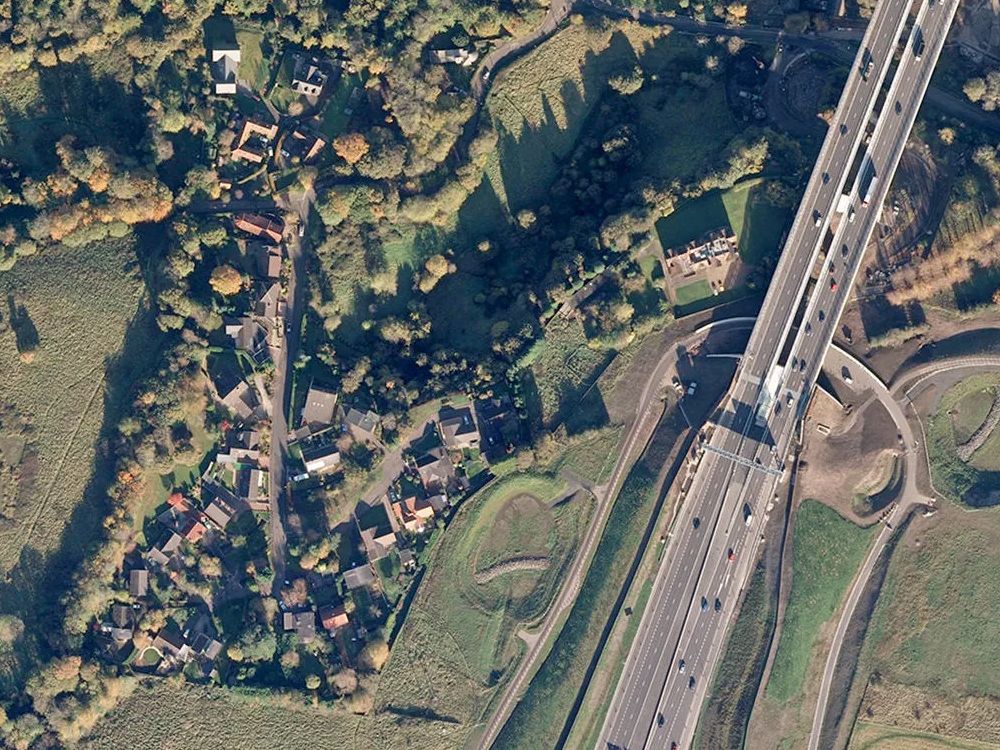
What are OS MasterMap Aerial GIS Sections?
OS MasterMap Aerial GIS Sections are high-resolution, true-orthorectified aerial images clipped to custom GIS-ready sizes (ranging from 100m × 100m up to 4 km × 4 km). Precisely aligned to the OS MasterMap Imagery Layer, they are delivered as fully georeferenced GeoTIFF files, accompanied by world files (.tfw) and XML metadata, making them ready for immediate use in any GIS platform.
Which GIS formats are available for OS MasterMap Aerial GIS Sections?
OS MasterMap Aerial GIS Sections are supplied in GeoTIFF format, complete with accompanying .tfw world files and XML metadata. These fully georeferenced files ensure compatibility with major GIS software platforms such as QGIS, ArcGIS, AutoCAD Map 3D, and MicroStation.
What are typical tile sizes for OS MasterMap Aerial GIS Sections?
Custom sections can be ordered in any size ranging from 100m × 100m up to 4 km × 4 km. The aerial imagery has a detailed 25 cm ground resolution, with a positional accuracy of approximately 1.1m RMSE, making it suitable for mapping at scales from 1:1,250 up to 1:10,000.
What is the usual delivery time for OS MasterMap Aerial GIS Sections?
Digital delivery occurs via email, typically within 30 minutes during operational hours (7 am–11 pm daily). Larger or more complex orders may take slightly longer, though we strive to deliver as promptly as possible.
Can I overlay OS MasterMap Aerial GIS Sections with vector data?
Absolutely—these aerial GIS sections are specifically designed to integrate seamlessly with OS MasterMap vector layers (e.g., Topography or CAD layers). They overlay perfectly within GIS and CAD environments such as QGIS, ArcGIS, AutoCAD, and MicroStation.
What are common use cases for OS MasterMap Aerial GIS Sections?
OS MasterMap Aerial GIS Sections are commonly used for:
- Risk assessment and management
- Asset monitoring
- Detailed site planning and analysis
- Environmental studies
- Agriculture and land management
- Property development
Providing visual context and backdrop imagery for vector mapping
Is the imagery georeferenced and OS-licensed?
Yes—each section is provided as a fully georeferenced GeoTIFF file, with accompanying world files (.tfw) and detailed XML metadata. The imagery is fully licensed under UK Map Centre’s Ordnance Survey agreement, and all necessary licensing details are clearly included in your delivery email.
What geographic coverage is available for OS MasterMap Aerial GIS Sections?
Coverage extends across the entirety of Great Britain (excluding Northern Ireland). You can clip custom sections precisely where you need them, ranging from small, specific sites to extensive multi-kilometre areas.
What is the starting price and available licence terms for OS MasterMap Aerial GIS Sections?
Pricing starts from approximately £25.94 + VAT for a 125m × 125m section. The cost will vary depending on the selected coverage size and the chosen licence duration, which can range from 1, 2, or 3 years, or even a perpetual licence.
From Planning to Analysis – OS Mapping for Every GIS Need - direct from UK Map Centre.