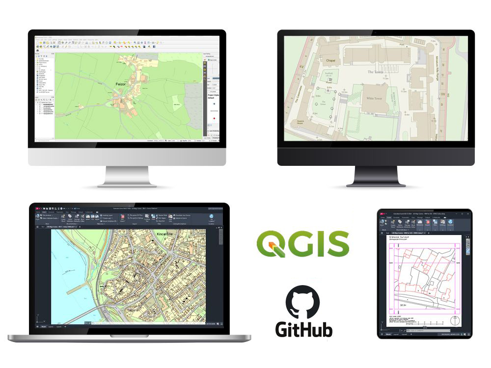
OS MasterMap Topography Layer® - GIS Maps (GML / GeoPackage / SHP / GeoTiff) CAD format Vector (DWG / DXF)
The OS MasterMap Topography® Layer is a digital mapping dataset representing over 500 million real-world features across Great Britain. Each feature includes roads, buildings, parks and waterways, each uniquely identified and maintained by Ordnance Survey in one of the world’s largest spatial databases. Built using Ordnance Survey data, it’s ideal for GIS mapping and CAD-based projects that require precise spatial referencing.
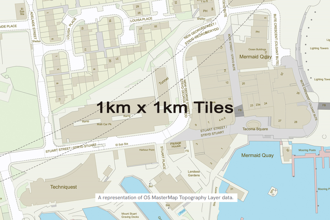
Select 1km x 1km tiles and create your area of interest. Ideal for following features like roads and railways.
WHAT IS GIS DATA?
GIS data comes in two main types: raster and vector:
- Raster = a picture made of tiny squares (like pixels). Each square has a value (e.g., height or land type). Great for things that vary smoothly across an area
- Vector = dots, lines, and shapes. Used for exact things with clear edges, like trees (dot), roads (line), and property boundaries (shape). Each feature can store extra details (with attribute tables for GML, SHP, Geopackage formats)
Trade-offs: raster excels at surface analysis and remote sensing; vector is best for accurate mapping, querying, and network/parcel analysis.
You can convert between them (rasterise/vectorise), but each is optimised for different kinds of tasks.
With tools like ArcGIS and QGIS, professionals use GIS mapping in the UK to support spatial analysis, manage assets, and plan land use. Ordnance Survey MasterMap data is ideal for detailed geographic information across multiple categories, helping users make better decisions with reliable mapping.
About the product:
- OS MasterMap Topography Layer was created to meet the need for a national topographic dataset that models the real world more faithfully and supports the growing use of GIS and spatial databases across organisations
- Developed in response to demand for a national, high-detail topographic dataset, OS MasterMap Topography Layer offers a more realistic representation and aligns with the expanding use and capabilities of GIS and spatial database technology
- OS MasterMap Topography Layer originated to provide a national topographic dataset with richer, more realistic detail, designed for organisations increasingly using GIS and spatial databases
- Built to address the need for a national, sophisticated topographic dataset, OS MasterMap Topography Layer better reflects reality and fits modern GIS and spatial database workflows
- OS MasterMap Topography Layer was initially developed to deliver a more realistic, advanced national topographic dataset that keeps pace with the rising adoption of GIS and spatial database technology in organisations
Some experience with GIS software is recommended for styling GML and GeoPackage formats. GeoTIFF, DWG and DXF files are ready to use out of the box.
I need a smaller footprint than 1km x 1km?
No problem—we’ve got you covered. > Get areas from 100 m × 100 m here
Typical Users Include:- Local authorities using geographic information system tools for planning
- Utility companies managing location data and routes
- Surveyors and engineers producing custom GIS maps
- Environmental teams modelling land use and relationships
- GIS consultants presenting data for development or policy decisions