


OS MasterMap Topography Layer® 1km x 1km Tiles in DXF | DWG format
CAD and GIS Format Map Tiles in DWG | DXF | GML | GeoPackage | SHP | GeoTiff
OS Premium Licenced Partner • Fully Licenced official OS Data • Scalable and Layered Seamless OS Vector Data Tiles • No sign-up needed – checkout instantly

OS MasterMap 1km Tiles - buy just the tile you need, not the whole 5km grid square DWG Colour - full OS specification with solid fills, BHA heights and 50+ named layers 3D building geometry from OS Building Height Attributes included with every Colour tile DWG or DXF Lines - clean line work on a single layer for survey overlay Lines Multi Layer - 50+ named layers without colour fills, ideal for engineers Optional OS Terrain 5 contours, DTM height points and ASCII grid add-ons GIS data cuts also available - GeoPackage, Shapefile and GML with full attributes GeoTIFF georeferenced raster at 400 DPI - colour or black and white
© Crown copyright and database rights 2026 OS AC0000848283
Download Samples
DWG Colour with BHA
DWG Colour ↓Lines & Multi Layer
DWG Lines ↓ DWG Lines Multi Layer ↓GIS Formats
GeoPackage ↓ GeoTIFF ↓ All samples & add-ons ↓Smaller Tiles. Lower Cost. Less Waste.
Ordnance Survey supply MasterMap in 5km × 5km grid squares - 25 square kilometres of data per tile. That is far more than most projects need. Our 1km × 1km tiles cover just 1 square kilometre each, so you buy only the data your site actually sits on. Smaller files, faster delivery, and a fraction of the price.
OS MasterMap Topography Layer® - 1km × 1km Tile Extracts
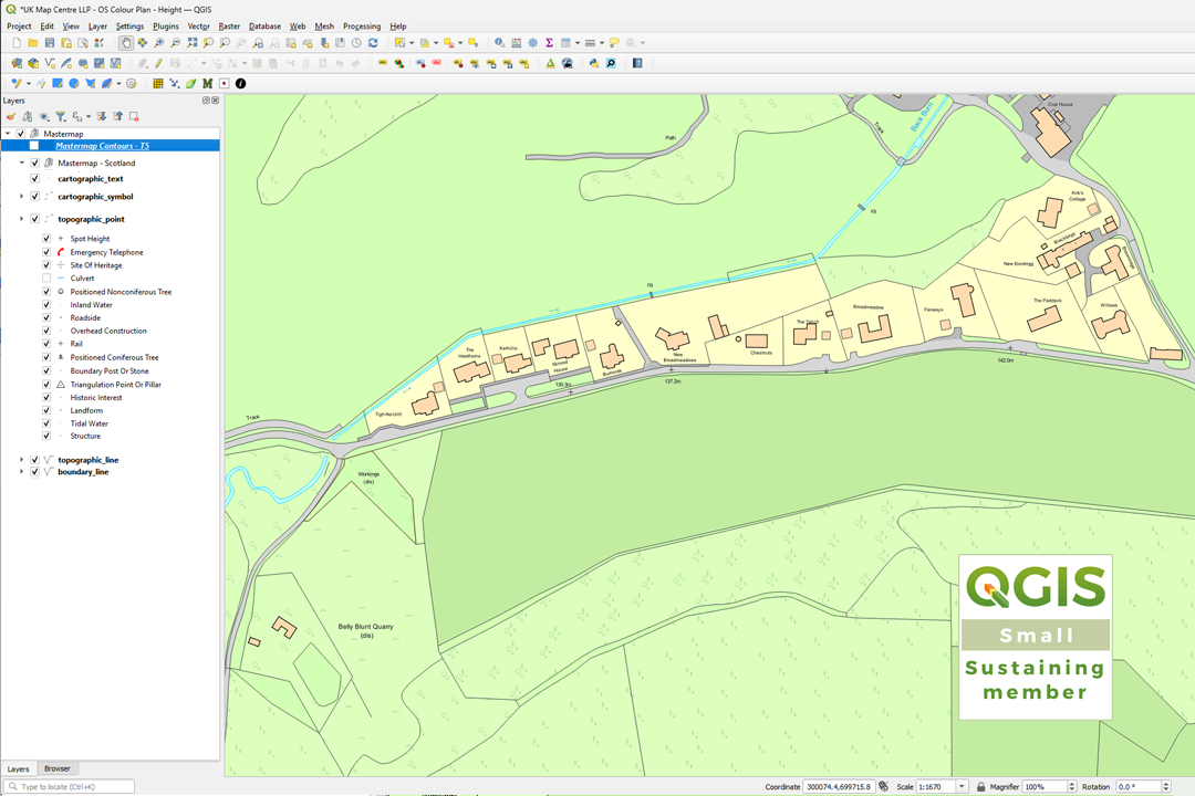
The OS MasterMap Topography Layer is a digital mapping dataset representing over 500 million real-world features across Great Britain. Roads, buildings, parks, waterways, boundaries and structures are each uniquely identified and maintained by Ordnance Survey in one of the world's largest spatial databases. Built for precise spatial referencing, it is the foundation dataset for GIS analysis and CAD projects throughout the UK.
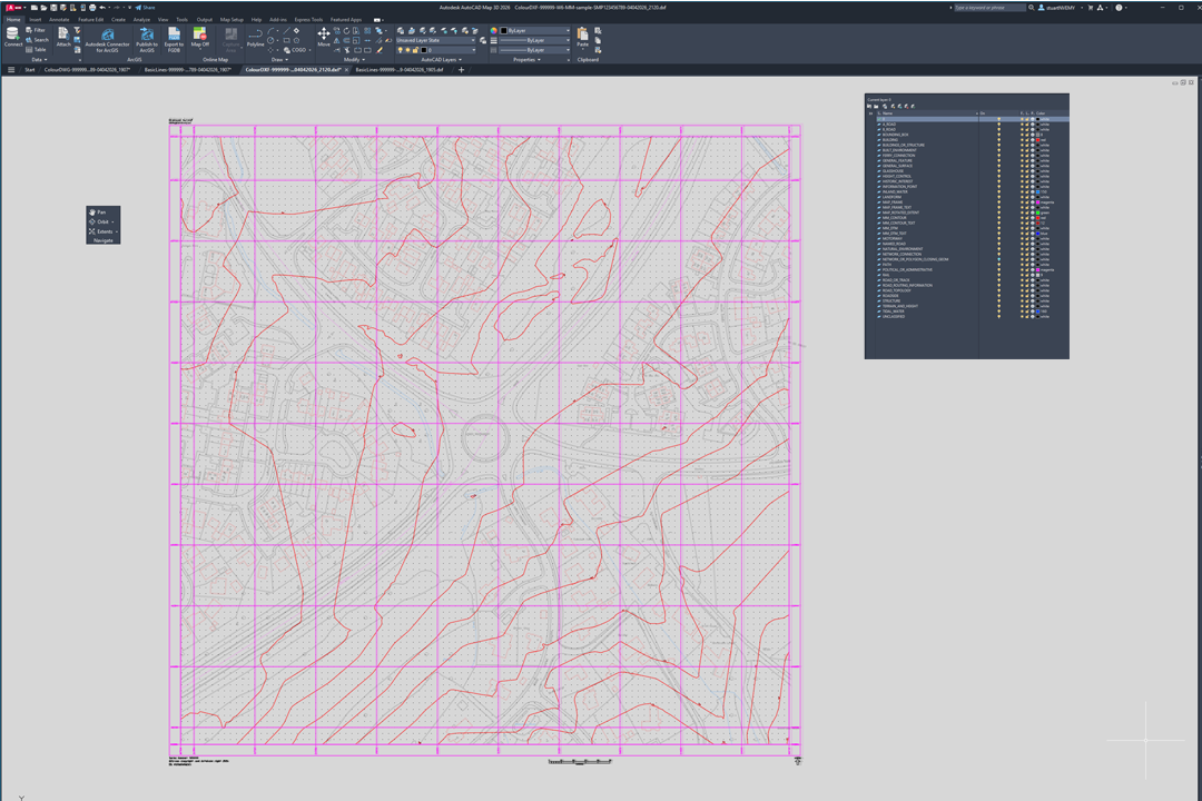
Purchase individual 1km × 1km tiles in DWG, DXF or GIS formats - GeoPackage, Shapefile, GML and GeoTIFF. Select tiles on the map and build your area of interest tile by tile, ideal for following linear features like roads, railways and river corridors. The DWG Colour format includes full Ordnance Survey colour specification with 3D Building Height Attributes as standard. Add OS Terrain 5 contours, DTM height points or ASCII grid data as optional bolt-ons.
What You Get
DWG & DXF Colour
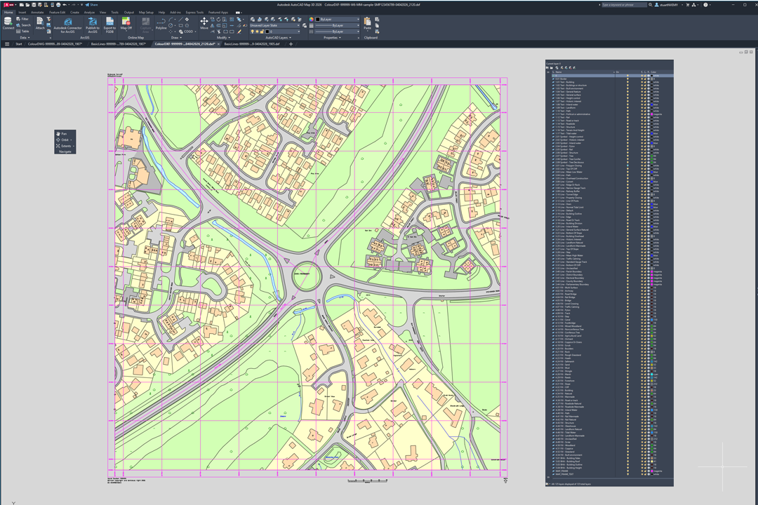
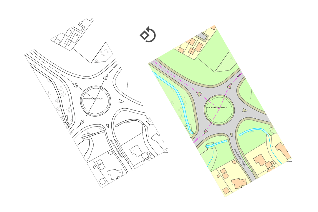
The flagship tile format. Full OS MasterMap rendering with solid colour fills, hatches, symbols, stitched text and 3D Building Height Attributes across 50+ named CAD layers. Five colour palettes available.
DWG & DXF Lines
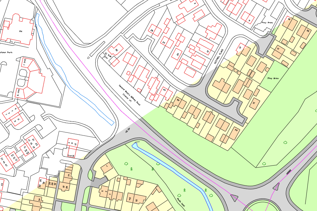
Clean OS line work on a single layer per tile. The most popular choice for overlaying MasterMap onto your own topographic survey or site plan. Lightweight and fast in any CAD package.
Lines Multi Layer
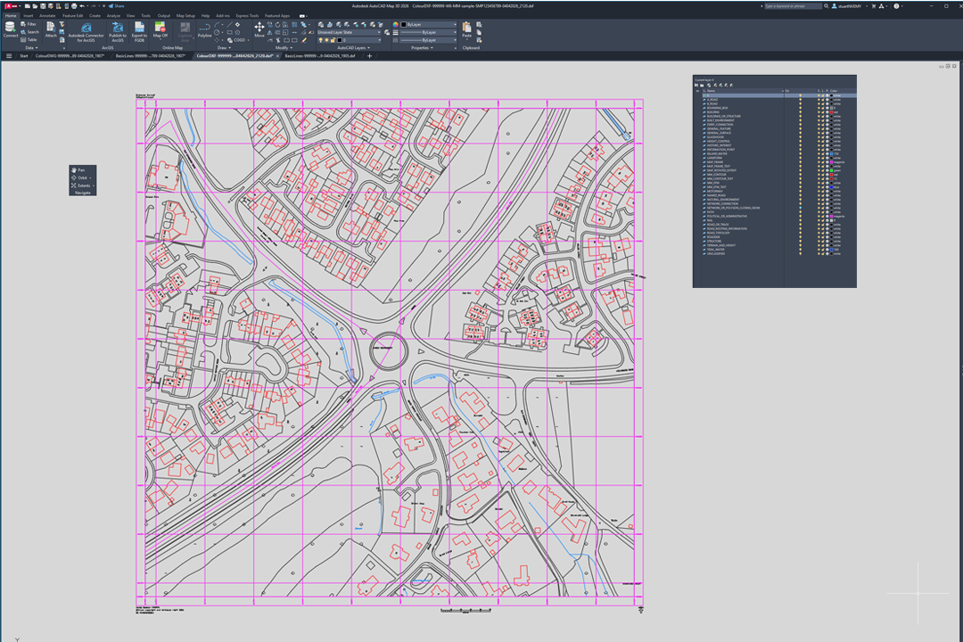
All the line work, text and symbols spread across 50+ named layers - without solid fills. Freeze, isolate or restyle any feature group independently. Perfect for engineers and surveyors.
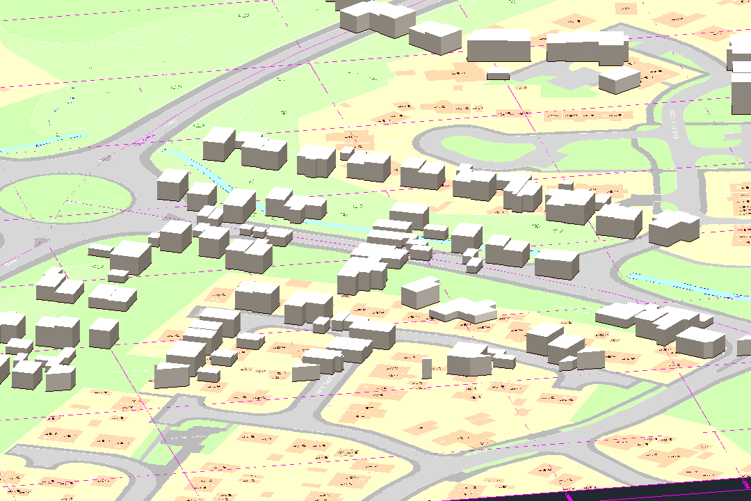
3D Building Heights
OS Building Height Attributes give you real extruded 3D building geometry per tile - walls, roofs and ground footprints at correct OS heights. Included automatically with every Colour tile.
Terrain & Contours - Add-on
Bolt on OS Terrain 5 DTM points and contour lines at 0.5 m, 1 m, 2 m or 5 m intervals. Also available: OS Terrain 5 ASCII grid (.asc) files for surface modelling in Civil 3D, Revit or QGIS.
GIS Data Cuts
Full vector tiles in GeoPackage, Shapefile or GML with complete OS attributes. Plus georeferenced GeoTIFF rasters at 400 DPI. Same 1km tile boundary, same low price.
Why Choose 1km Tiles?
Standard OS MasterMap supply comes in 5km × 5km tiles. For most projects, that means paying for 25 square kilometres of data when your site covers a fraction of one. Our 1km × 1km tiles solve that problem: each tile contains exactly one square kilometre of OS MasterMap data, aligned to the OS National Grid. You pick the tiles that cover your site, pay only for those, and receive smaller files that open faster and are easier to manage in CAD or GIS.
For single sites, a 1km tile is often all you need. For larger projects, order multiple adjacent tiles and merge them in your CAD or GIS software - the grid alignment guarantees seamless edge-matching with no gaps or overlaps.
How Tile Selection Works
Browse the OS National Grid on our map, click the 1km tiles that cover your area, choose your format and style, and we deliver each tile by email. Most orders arrive within minutes. Need help identifying which tiles to order? Send us a site plan or postcode and we will confirm the tile references for you.
Optional Add-ons
OS Terrain 5 Contours
Contour lines at 0.5 m, 1 m, 2 m or 5 m intervals overlaid on your tile. Available as 2D polylines with height labels or 3D polylines with Z values in every vertex for direct surface modelling.
OS Terrain 5 DTM Points
Elevation values at 5-metre grid spacing placed on dedicated layers. Each point carries the OS Terrain 5 height above Ordnance Datum Newlyn - ideal for spot-checking levels against your own survey data.
OS Terrain 5 ASCII Grid
The raw .asc grid file clipped to your tile extent. Import directly into Civil 3D, Revit, QGIS or any terrain modelling tool for surface generation, hillshade, slope and cut-and-fill analysis.
All Sample Downloads
CAD Formats
DWG Colour with BHA ↓ DWG Lines ↓ DWG Lines Multi Layer ↓ DXF Colour with BHA ↓ DXF Lines ↓ DXF Lines Multi Layer ↓Guides & Tutorials
Help articles and walkthroughs for working with OS MasterMap tile data:
- OS CAD Maps with Additional Layers - DTM, Contours and Terrain
- Understanding OS MasterMap Building Height Attributes (BHA)
- 3D Mapping in QGIS with OS MasterMap, BHA and Terrain Data
- AutoCAD Map 3D - Draping Terrain and Aerial Imagery onto MasterMap
- Using OS MasterMap in Civil 3D with Terrain Surfaces and DTM
About UK Map Centre LLP


