Ordnance Survey 1:500 Scale Block Plan & 1:1250 Scale Location Plan - Planning Pack Maps for Planning Applications
Get council-compliant maps designed for official planning submissions across the UK. This dual-scale planning pack includes everything you need when applying for planning permission, land registry and construction use, fully licensed and centred on your chosen site.
Order online now and receive your digital copy within 20 minutes. Call 0141 552 7722 for assistance.
WHEN DO I NEED AN OS 1:500 & 1:1250 MAPS PLANNING PACK?
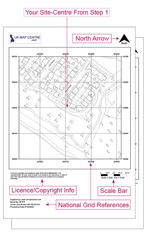
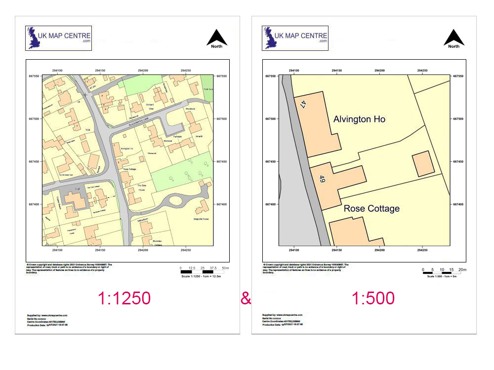
Whether you’re building a house or a block of flats, all planning applications need a map called a ‘Location Plan’ that shows the proposal and its surrounding context. Some local authorities also require a ‘Block Plan’ (sometimes called a site plan) which outlines the development on a larger scale, but not necessarily in greater detail. A Location Plan is the 1250 scale, and the Block Plan/Site Plan is the 500 map scale.
Each plan is created from official Ordnance Survey mapping data and formatted to meet local authority standards.
- Two maps of different scales centred on the same location
- Most popular for Planning Applications
- Also used for Building Control Applications and Home Buyer Packs
- Save money than buying them individually
All planning maps are designed to meet the specific requirements of planning applications across the UK.
Having difficulty understanding some of the terms used in planning applications? Check out our Understanding Ordnance Survey Map Jargon page.