


Ordnance Survey Planning Pack - 1:500 Scale Block Plan & 1:1250 Scale Location Plan
Available Formats via Email: PDF • TIFF • JPG • BMP • PNG • DOCX • WORD
OS Premium Partner • OS Licensed Product • Council Compliant • Dual Pack for Local Authority Planning Applications • No sign-up needed – checkout instantly
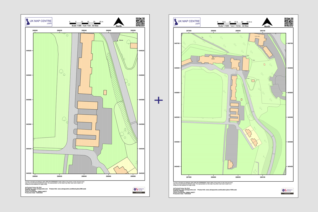
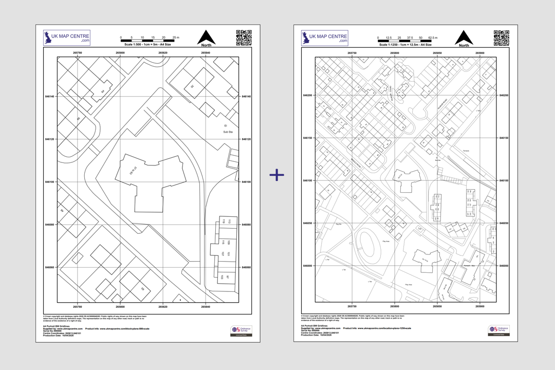
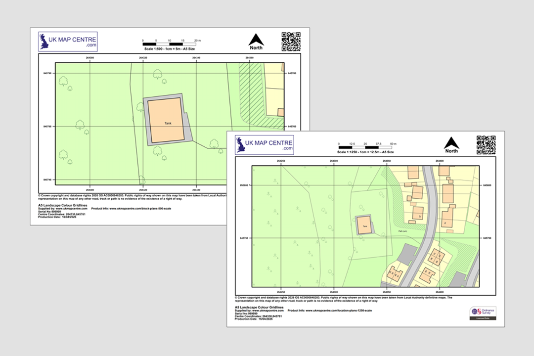
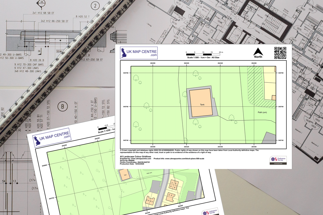
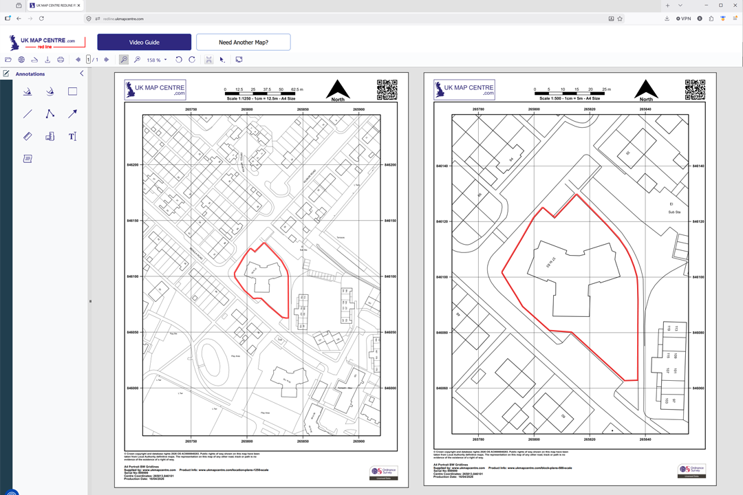
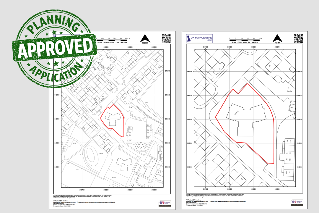
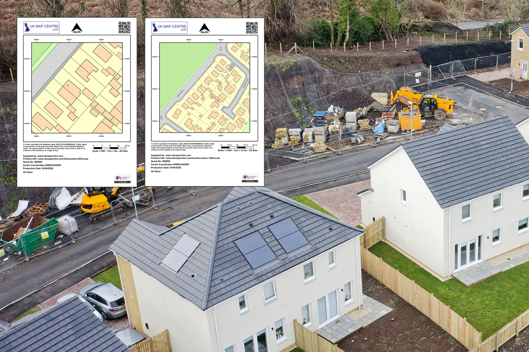
Planning Pack includes a 1:500 block plan and a 1:1250 location plan - both with north arrow, scale bar, grid references and OS licence Colour Planning Pack - 1:500 block plan (left) + 1:1250 location plan (right) centred on the same site Black & White Planning Pack - 1:500 block plan + 1:1250 location plan with clean line work 1:500 block plan shows the plot in close detail, 1:1250 location plan sets it in the wider street context Both plans ready to submit alongside your architect's design drawings Available in A5, A4, A3, A2, A1 and A0 - choose the sheet size that fits your site Mark up both plans online - we forward a link to our online app so you can draw site boundaries on your 1:500 and 1:1250 Planning-ready markup - red site boundaries added to both plans with our online annotation tool From planning pack to completed new build - the two OS drawings that start the project
© Crown copyright and database rights 2026 OS AC0000848283
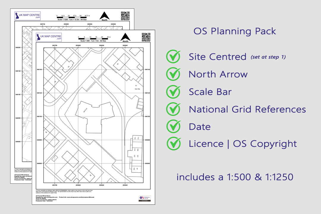
Planning Pack Contents
- One 1:500 Block Plan
- One 1:1250 Location Plan
- Both centred on the same site
- Black & White or Colour
- PDF, TIFF, JPG, BMP, PNG, WORD
- A5 to A0 size
- Council Compliant
- North Arrow & Scale Bar
OS 1:500 Block Plan and 1:1250 Location Plan Combined Planning Pack
The OS Planning Pack bundles together the two Ordnance Survey extracts most often requested by UK local authorities for a planning submission: a 1:500 block plan and a 1:1250 location plan, both produced for the same site at the same time. Buying them as a pack gives you the close-up site detail and the wider street context in a single, council-ready set of drawings.
Each plan in the pack is generated from the official OS MasterMap® Topography Layer, carries the Ordnance Survey licence number, scale bar, north arrow and grid references, and is supplied as a digital file ready to upload to the Planning Portal, your local authority's submission system, HM Land Registry or Registers of Scotland.
Order online and your two plans are emailed to you within around 20 minutes, seven days a week.
Why Buy a Planning Pack?
A planning application normally needs two different scales of map: a location plan that shows the site against its surroundings, and a block plan that zooms in on the development itself. Ordering both as a planning pack saves you time, keeps the two drawings perfectly aligned to the same centre point, and works out cheaper than buying each plan on its own.
Two Scales, One Site
Both maps are centred on the same coordinate so the block plan zooms straight into the area shown on the location plan. There is no manual lining-up to do, and the planning officer sees exactly the same site in both views.
Saves Time at Checkout
You search once, choose your settings once and pay once. No need to repeat the order journey for each scale. Both files arrive together so you can move straight to mark-up and submission.
Works Out Cheaper
Bought as a pack, the combined price is lower than ordering a 1:500 and a 1:1250 separately. Useful when you are preparing a full planning application and need both scales anyway.
Council-Ready Format
Each plan in the pack is produced to UK local-authority standards, with an OS-licensed base, scale bar, north arrow and grid references already in place. Upload-ready for the Planning Portal and council validation systems.
When Do You Need an OS 1:500 and 1:1250 Planning Pack?
The pack covers the two scales asked for again and again across the UK planning system. Whether you are putting up a single house extension, building a small block of flats or applying for change of use on a commercial unit, this combination of drawings is what most validation checklists ask for as the minimum set of supporting maps.
Full Planning Applications
The standard pack for outline and full planning permission submissions. The 1:1250 sets the wider site context and the 1:500 gives the council the close-up view of the proposed building, driveway, garden or extension.
Building Warrants & Building Control
Scottish building warrant applications and English building regulations submissions both ask for a location plan plus a more detailed block plan. The pack delivers both at the scales most commonly accepted.
Change of Use Applications
When converting a property between residential, commercial or mixed use, councils want to see both the surrounding land use (1:1250) and the building itself in detail (1:500). Both scales arrive as a single pack.
Land Registry Submissions
HM Land Registry and Registers of Scotland accept the 1:1250 as the standard urban site plan, with the 1:500 useful as a supporting drawing where extra clarity on the building footprint or boundary edge is needed.
Home Buyer & Conveyancing Packs
Solicitors and conveyancers often request both scales for a complete property pack. The 1:1250 places the property in context, while the 1:500 records the building footprint and immediate boundary detail.
Section 80 Demolition Notices
Demolition notices submitted under the Building Act 1984 are usually backed by a location plan and a block plan. The pack is a quick way to file both at the scales building control teams expect.
Sourced Direct from Ordnance Survey
UKMapCentre.com operates as a Premium Licensed Partner of Ordnance Survey, which means every plan in your planning pack carries a current, correctly attributed OS licence. Both the 1:500 block plan and the 1:1250 location plan are ready-to-submit for Planning Portal uploads, council validation, building warrant submissions, Land Registry and Registers of Scotland registrations and any commercial use where OS-licensed mapping is required.
Further Reading
Short blog guides to help you make sense of the planning paperwork and get the most out of your planning pack:
- Understanding Ordnance Survey Map Jargon
- Correct Land Registry Map Scales: A Guide
- How to Print an Ordnance Survey Map to the Correct Scale
About UK Map Centre LLP

