


Ordnance Survey Terrain 5 - Digital Terrain Tiles 5km x 5km size
SHP & GML Contours + ASCII Grid format for GIS Systems
Ordnance Survey Premium Licenced Partner • Fully Licenced official OS Contour Data • Scalable and Layered OS Height Data
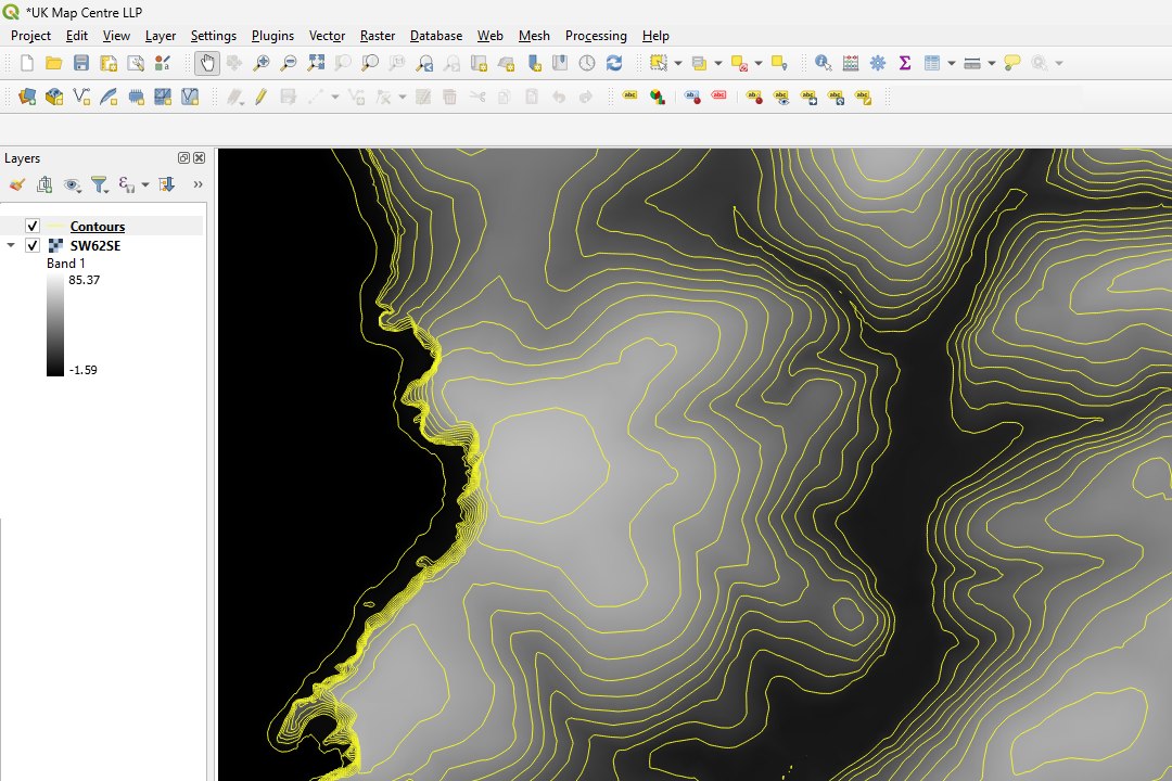
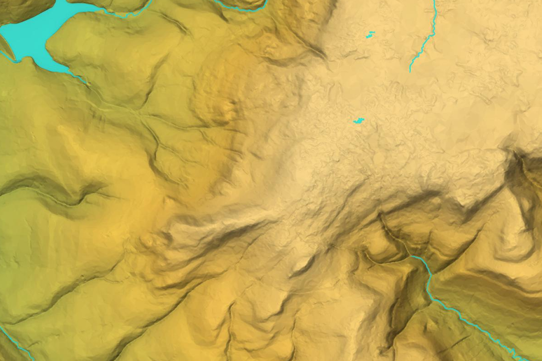
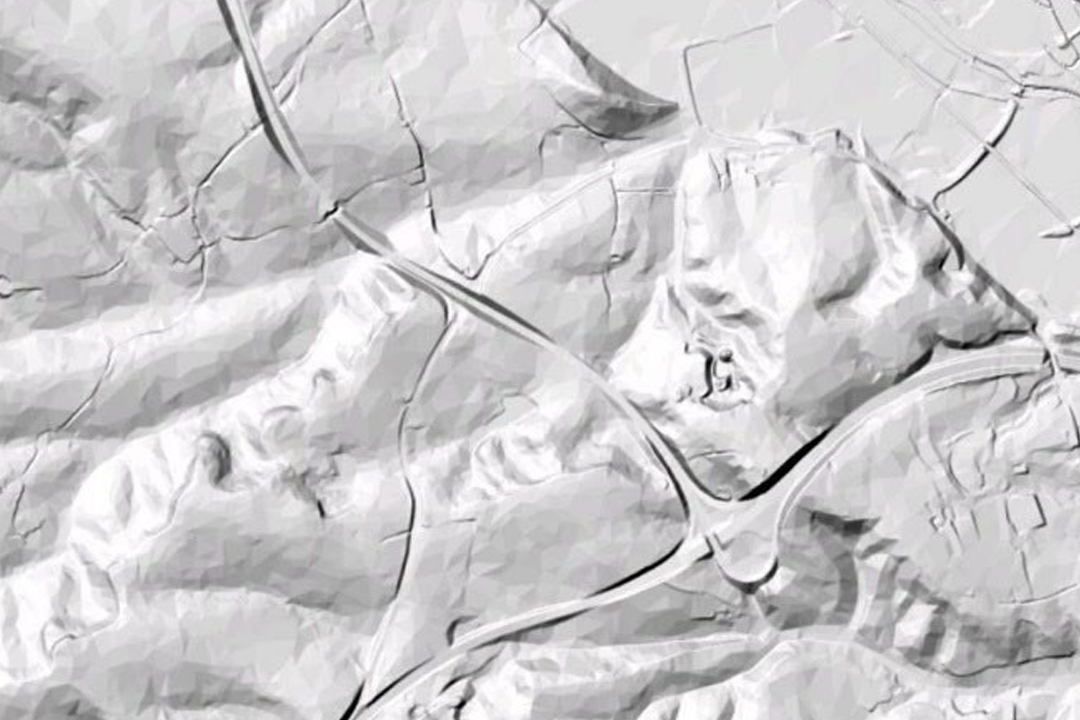

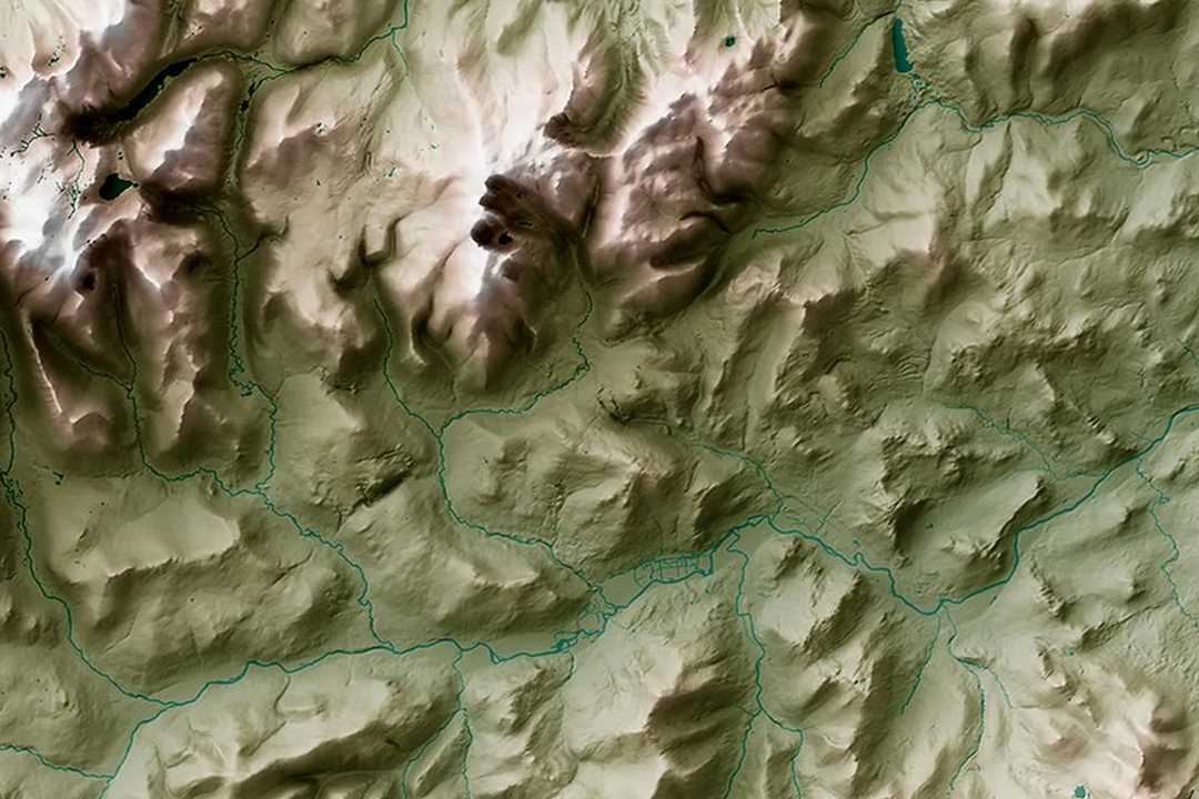
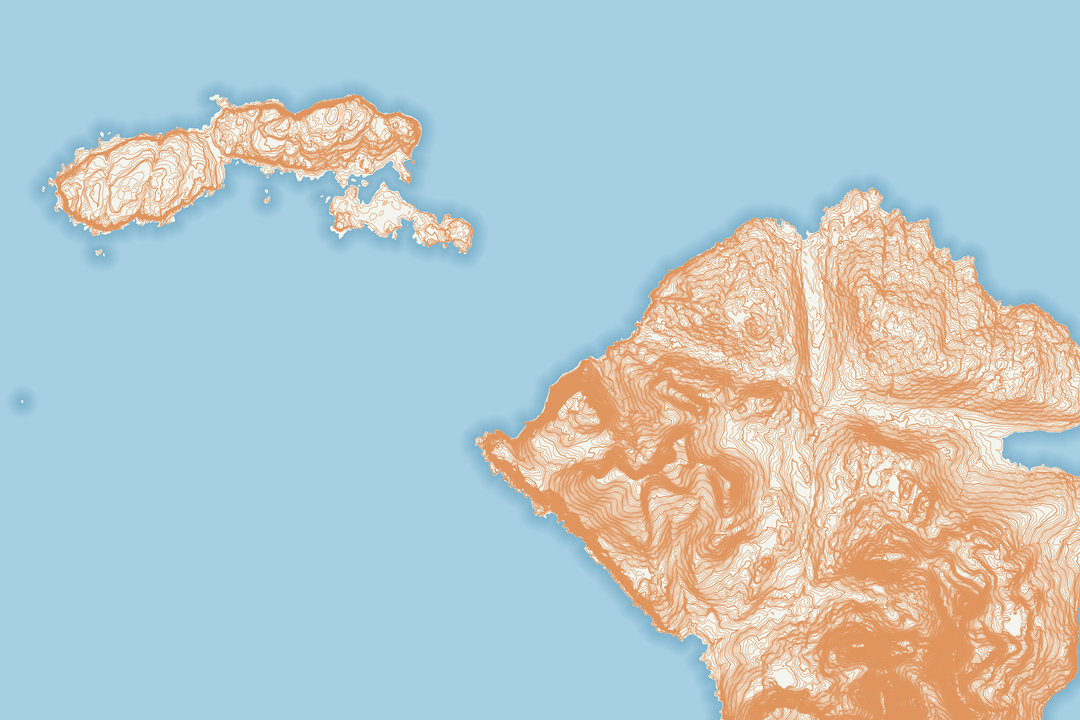
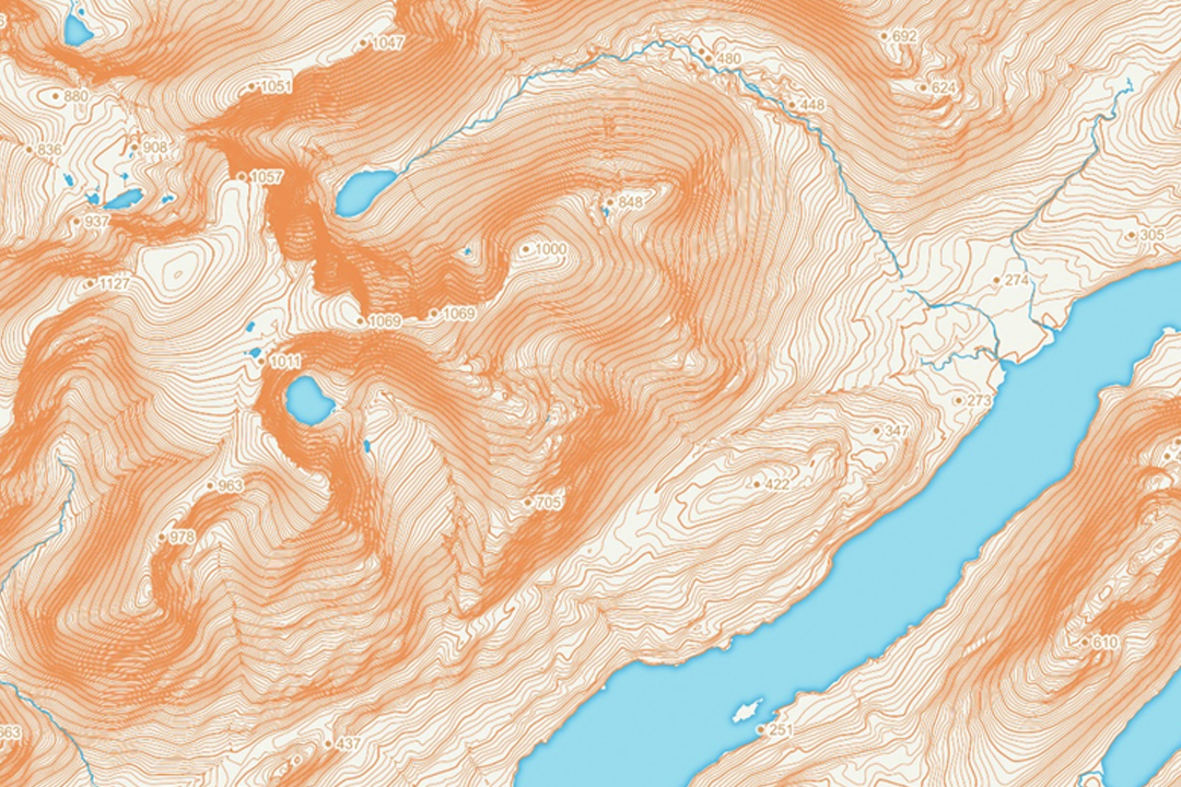
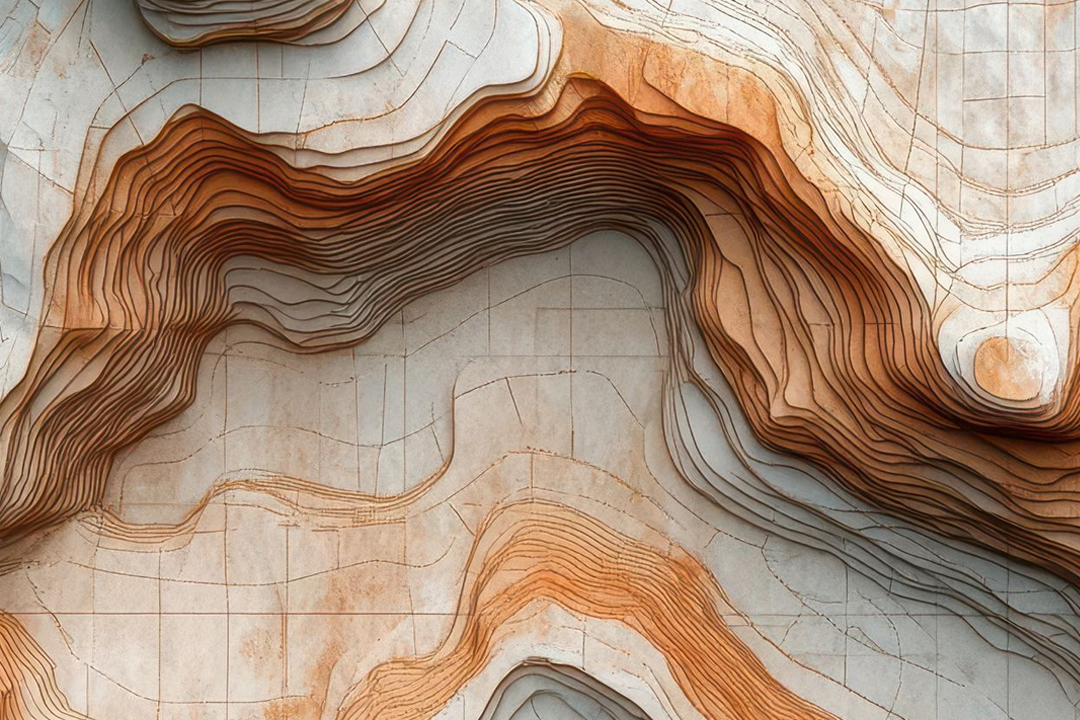
QGIS tile library: ASCII grids loaded with 5-metre contour coverage generated from the systematic tile grid. 3D hillshade render of multiple 5km tiles mosaicked into a seamless regional terrain surface. Greyscale shaded relief from a single 5km x 5km tile - ridgelines and valleys in subtle tonal detail. Physical terrain model showing the contour structure that underpins the 5-metre grid elevation data. 3D surface demonstrating seamless joining across tile boundaries - valleys and ridges flow continuously. Coastal tile library showing island and peninsula coverage with seamless offshore tile joining. Highland 5km tiles with 5-metre SHP contours overlaid on slope-shaded terrain. Artistic contour layer stacking visualising the elevation bands within a tile-based height dataset.
© Crown copyright and database rights 2026 OS AC0000848283
OS Terrain 5 Tiles
- 5 km x 5 km fixed tiles
- ASCII grid (.asc) format
- 5-metre grid spacing
- Contours included: SHP and GML
- Contour interval: 5 m
- Heights above Ordnance Datum Newlyn
- Seamless tile joining
- Updated quarterly
OS Terrain 5 Tiles - Build a Systematic Height Data Library for GIS
OS Terrain 5 Tiles deliver fixed-size 5 km x 5 km elevation data on the OS National Grid. Each tile contains a 5-metre grid spacing ASCII dataset (.asc format) with heights measured in metres above Ordnance Datum Newlyn, georeferenced to British National Grid (EPSG:27700). Tiles join seamlessly edge to edge, so you can mosaic multiple tiles into a continuous regional terrain surface without gaps or overlaps.
Contours are included as standard at 5-metre intervals in two vector formats - Shapefile (SHP) and Geography Markup Language (GML). Use whichever format fits your GIS workflow, or generate your own contours at a different interval from the raw ASCII grid. This product replaces the legacy OS Landform Profile dataset and is updated quarterly (January, April, July, October) with the latest survey data.
Select tiles on the interactive map, pay online and the data is emailed to you in around 30 minutes. Tiles are organised by OS National Grid reference for simple file management and long-term archiving.
Why Choose OS Terrain 5 Tiles?
Build a Tile Library That Grows
Start with a single 5 km tile and expand over time. Tiles follow the fixed OS National Grid, so new purchases slot in next to existing ones without overlap or processing. Archive by grid reference and maintain a regional or national height data library that grows with your project portfolio.
Three Contour Formats Included
Every tile includes 5-metre contours in both Shapefile and GML format as standard. Both carry the same 3D polyline geometry with elevation values embedded at every vertex - use whichever fits your workflow.
Predictable Tile Structure
Every tile is exactly 1000 columns x 1000 rows at 5 m spacing. Fixed dimensions mean predictable file sizes, consistent processing pipelines and simple batch scripting. No surprises when you load a new tile into your analysis workflow.
Combine with OS MasterMap
Load terrain tiles beneath OS MasterMap topography for 3D building context, drainage catchment analysis or infrastructure corridor planning. Drape aerial imagery over the DTM surface for visual impact assessments and client presentations.
Updated quarterly - OS Terrain 5 is refreshed every three months (January, April, July, October), so your tile library always reflects the latest elevation survey revisions across Great Britain.
Need a Custom Area of Interest?
If your project area does not align to 5 km tile boundaries, see our OS Terrain 5 ASCII Sections product. Sections trim the ASCII grid to a custom rectangle around your site - you pay only for the area you need, with no tile boundaries or wasted coverage.
Not a GIS User?
If you work in CAD (AutoCAD, Civil 3D, BricsCAD) and want height data with pre-generated contour lines ready to use, see our OS Terrain 5 DTM for CAD product. We supply DWG and DXF format with contours at your chosen interval - no GIS tools required.
When Do You Need OS Terrain 5 Tiles?
Tiles are designed for organisations that need systematic, repeatable height data coverage across a defined region. Common tile-based workflows include:
Regional Flood Risk Assessment
Stack multiple tiles to model flood extents, drainage catchments and water flow across administrative regions. The 5-metre resolution captures valleys and ridgelines critical for flood pathway analysis in HEC-RAS, MIKE FLOOD or TUFLOW.
Infrastructure Corridor Planning
Analyse elevation change along proposed pipelines, power lines, water mains or transport routes. Tile-based coverage simplifies multi-phase corridor design and cost estimation across long linear schemes.
Telecommunications and Signal Propagation
Model radio signal propagation, site visibility and line-of-sight analysis for mast placement and network planning. Seamless tile joining ensures continuous coverage across service areas without data gaps.
Strategic Wind Farm Assessment
Evaluate wind resource and turbine placement using elevation data and slope aspect analysis. Tile-based approach allows staged site assessment without waiting for custom area processing.
Catchment and Hydrology Modelling
Generate drainage networks, watershed boundaries and stream profiles from ASCII grids. Included SHP and GML contours support manual hydrological interpretation and regulatory reporting.
National Park and Landscape Monitoring
Track terrain change and landscape evolution across large conservation areas. Accumulated tiles provide multi-temporal analysis capability for environmental management and visitor planning.
Military and Defence Terrain Analysis
Systematic tile coverage supports operational planning, route analysis and defensive terrain assessment. Fixed grid structure aids rapid tile selection and data integration with military GIS platforms.
Academic Research and Teaching
Standardised tile datasets for geography, geology, environmental science and engineering coursework. Fixed tile dimensions simplify group projects and long-term research datasets across departments.
Further Reading
Guides and tutorials to help you load and work with OS Terrain 5 tile data in GIS software:
- Turning an ASC File into Contours in QGIS
- How to Open GIS Raster Files in QGIS Easily
- OS Vector and Raster Mapping Fully Explained
About UK Map Centre LLP

