


Ordnance Survey (OS) Maps Scale 1:2500 for Rural Planning Applications and Land Registry Submissions
Available Formats via Email: PDF • TIFF • JPG • BMP • PNG • DOCX • WORD
Ordnance Survey Premium Partner • OS Licensed Product • Council Compliant • Ideal for Rural Planning Applications
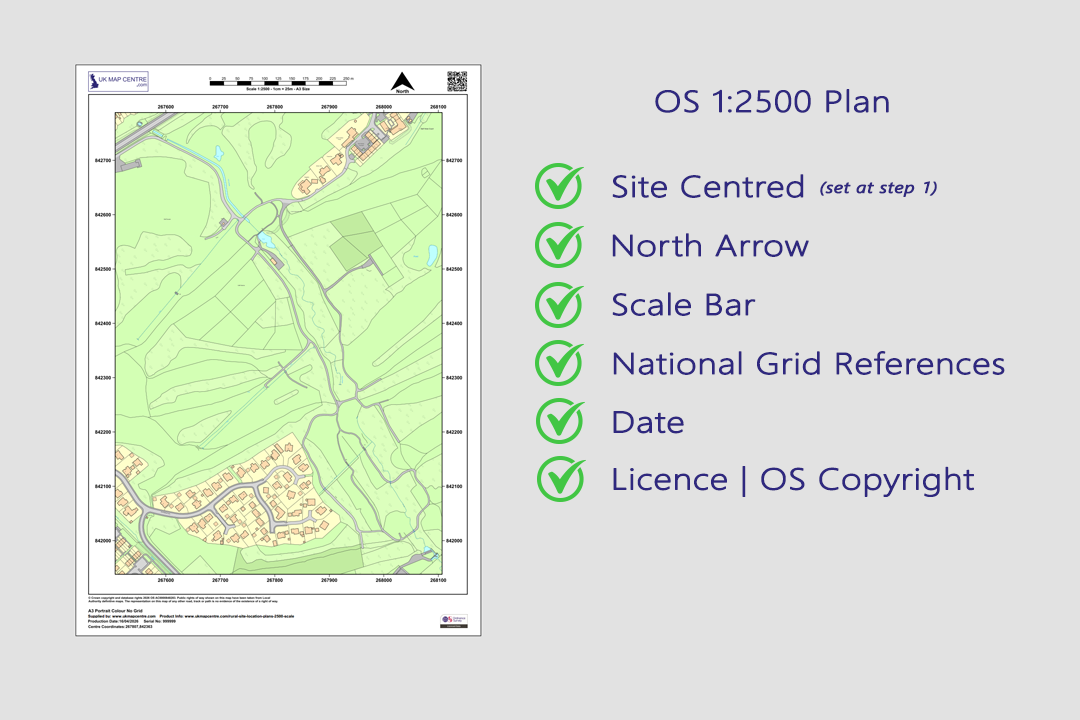
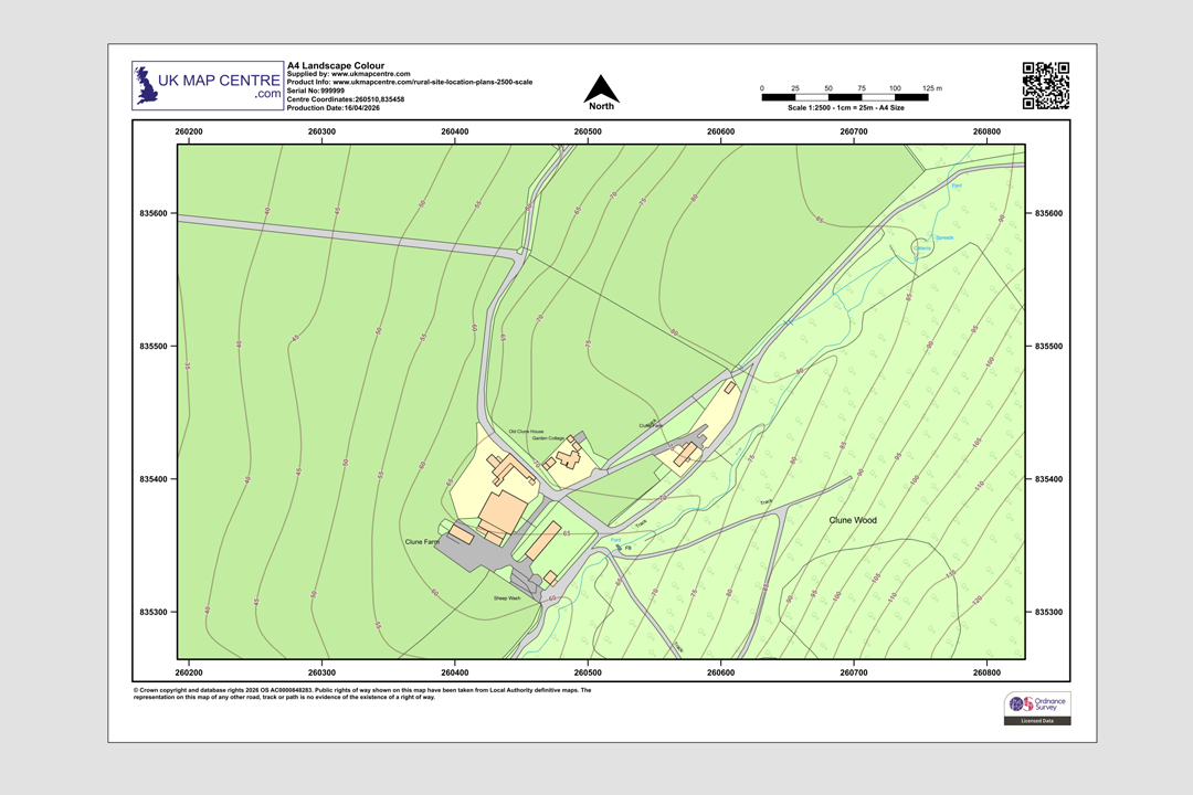
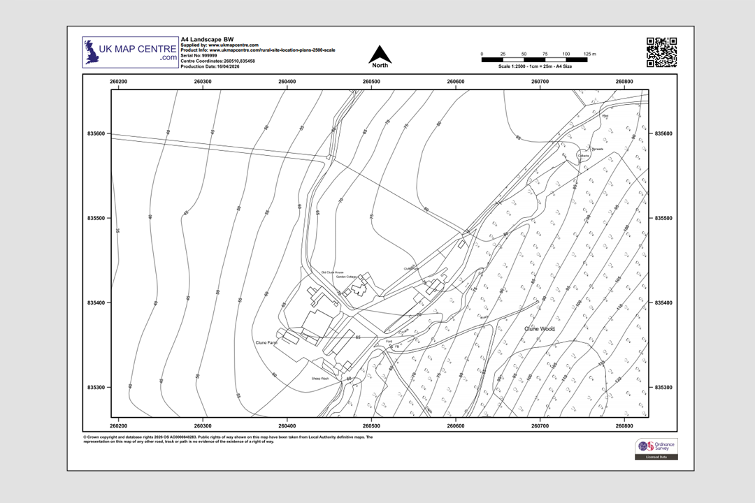
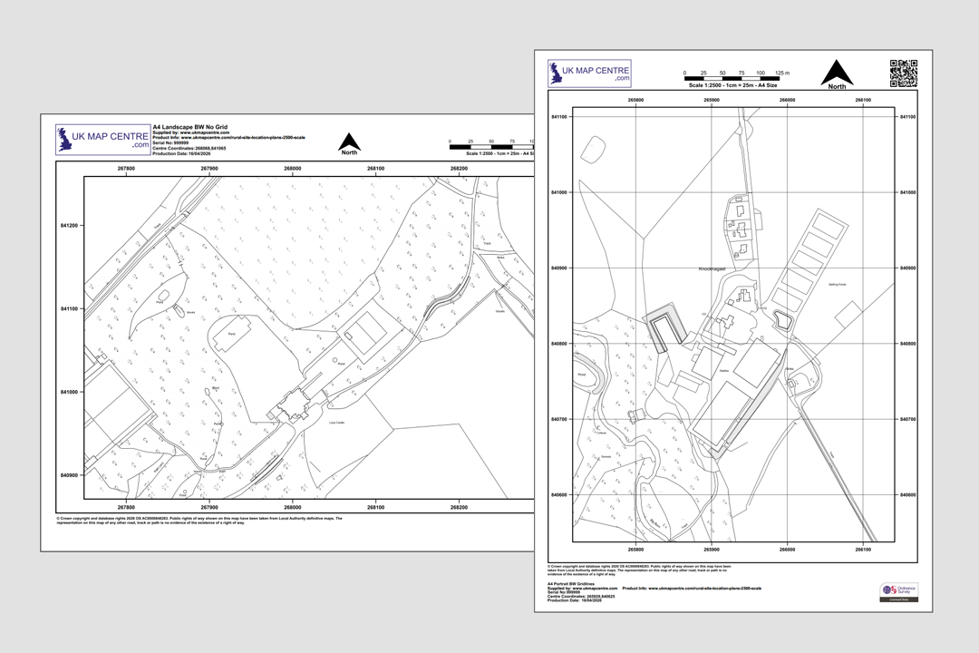
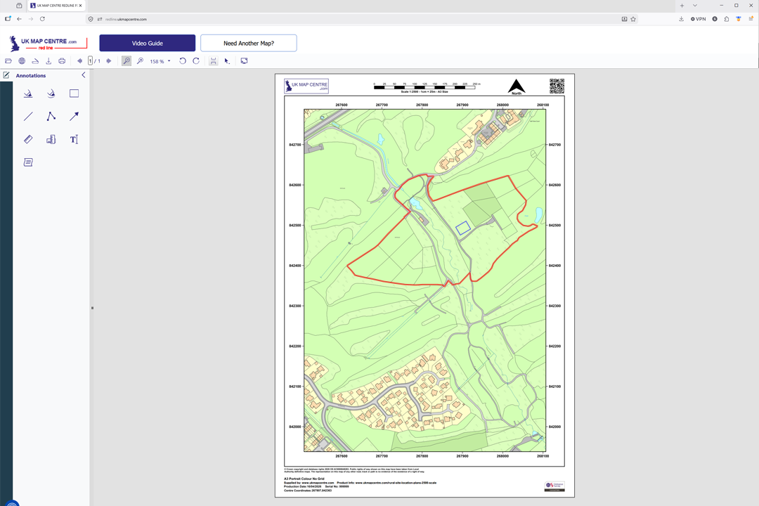
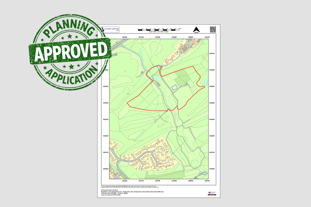
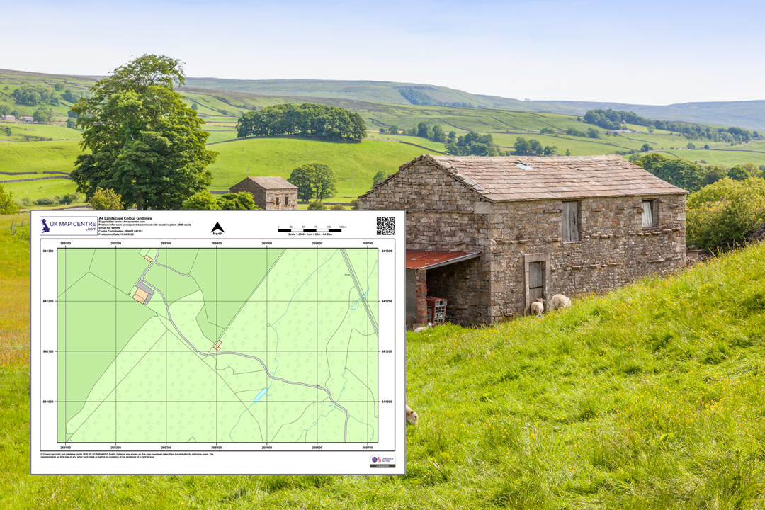
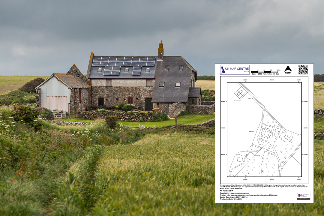
Every plan includes a north arrow, scale bar, grid references, date and OS licence number OS 1:2500 Colour Rural Plan - A4 landscape with farm buildings, fields and woodland OS 1:2500 Black & White Rural Plan - clean line work without colour fills Choose landscape or portrait, with or without grid lines - two B&W examples shown Available in A5, A4, A3, A2, A1 and A0 - choose the sheet size that fits your site Mark up your plan online - we forward a link to our online app so you can draw site boundaries and add notes Planning-ready markup - red site boundary added with our online annotation tool Rural barn conversion - typical project supported by a 1:2500 OS rural location plan From OS rural plan to completed farmhouse renovation - the 1:2500 drawing that starts the project
© Crown copyright and database rights 2026 OS AC0000848283
OS 1:2500 Extract
- Black & White or Colour
- PDF, TIFF, JPG, BMP, PNG, WORD
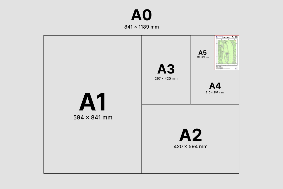
- A5 to A0 size
- Council Compliant
- North Arrow
- Scale Bar
- 1 cm = 25 m
Ordnance Survey 1:2500 Scale Rural Location Plan for Planning, Land Registry and Decrofting
The Ordnance Survey 1:2500 scale map is the wider-area location plan used for rural and semi-rural sites across Great Britain. Pulled from the official OS MasterMap® Topography Layer, the 1:2500 sheet zooms out far enough to place fields, field boundaries, farm buildings, access tracks and outlying outbuildings on a single page. That extra ground coverage is why councils, Registers of Scotland, HM Land Registry and the Crofting Commission accept the 1:2500 sheet for applications that a standard urban 1:1250 cannot cover on a single page.
As a Premium Licensed Partner of Ordnance Survey, UK Map Centre supplies 1:2500 rural location plans that are accepted by every local authority in Great Britain. Every sheet is supplied with a printed scale bar, north arrow, OS National Grid references and the Ordnance Survey copyright statement and licence number.
Frame your site, pick a sheet size and file format, pay online and the 1:2500 rural plan is emailed to you in around 20 minutes, seven days a week. Ready to upload to the Planning Portal, to your council's rural planning team, to HM Land Registry, Registers of Scotland or to the Crofting Commission.
What Is an Ordnance Survey 1:2500 Plan?
A 1:2500 scale map is a wider-area Ordnance Survey extract where 1 centimetre on the sheet represents 25 metres on the ground. That makes it twice as zoomed out as a 1:1250 location plan, which means double the linear coverage (and four times the area) fits on the same sheet. It is the go-to scale whenever the site, holding or parcel of land is simply too large to sit comfortably inside a 1:1250 drawing.
Rural Location Plan
Referred to in many council validation checklists as a rural location plan or agricultural location plan. At 1:2500 a whole field, small holding or farmyard can be shown on A4 with the approach roads and adjoining parcels visible on the same sheet.
Twice the Reach of 1:1250
Because 1 cm on the paper equals 25 m on the ground, a 1:2500 sheet covers four times the area of the same-size 1:1250 plan. That is why it is the default location-plan scale once you move outside built-up areas.
Field Boundaries & Access
1:2500 is the scale at which field boundaries, hedge lines, farm tracks, outbuildings and adjoining land and property all read clearly. It is the natural base drawing for agricultural, equestrian and countryside proposals.
OS MasterMap Topography Layer
Each 1:2500 sheet is generated from the Ordnance Survey MasterMap Topography Layer, the most detailed topographic dataset available for Great Britain. Output is council compliant, Land Registry compliant and accepted by the Crofting Commission.
The 1:2500 rural plan sits alongside our 1:1250 location plan and 1:500 block plan as part of a full rural planning submission when a council asks for both the wider context and the closer detail.
When Do I Need a 1:2500 Rural Plan?
The OS 1:2500 plan is requested whenever a site is rural, semi-rural or simply too large to fit sensibly on a 1:1250 sheet. Typical customers and uses include:
Rural Planning Applications
Used for agricultural buildings, barn conversions, stables, livestock sheds, new farm access tracks, polytunnels, slurry stores, grain stores and other countryside proposals submitted to local planning authorities across Great Britain.
Farmers, Land Agents & Estates
The working scale for farmers, land agents, rural surveyors and estate managers dealing with field reorganisation, grazing leases, tenancy changes and the day-to-day management of a larger holding.
HM Land Registry
Preferred by HM Land Registry for rural registrations, first registrations of agricultural land, transfers of part across larger holdings and boundary agreements where the parcel extends beyond a single urban plot.
Registers of Scotland
Used for voluntary and first registration of rural titles and for plans submitted to the Scottish Land Register where the property extends over fields, woodland or an entire holding.
Crofting Commission
The 1:2500 sheet is the standard mapping scale for decrofting applications, croft registration, resumption applications, croft assignations and other Crofting Commission paperwork for land in the Highlands and Islands.
Rural Building Warrants
Scottish building warrant submissions for rural properties (farmhouses, steadings, converted outbuildings) accept a 1:2500 plan as the wider site-identification drawing in the warrant pack lodged through eBuilding Standards.
Utility Plans for Holdings
Water, electricity, gas and telecoms providers use 1:2500 plans when quoting for connections, new supplies, pole runs, wayleaves and service alterations across farmyards, estates and larger rural parcels.
Landscape & Estate Management
Woodland management plans, forestry grant applications, habitat mapping, rural grant schemes and estate-scale landscape proposals all start with a 1:2500 OS base because of the breadth of ground it covers on a single page.
If your site sits in a built-up area and fits comfortably inside a smaller sheet, the urban 1:1250 location plan is likely the right choice. If the holding is larger than a single A0 at 1:2500, get in touch before ordering and we will advise on the right sheet size or alternative scale such as 1:5000 or 1:10 000.
Sourced Direct from Ordnance Survey
UKMapCentre.com operates as a Premium Licensed Partner of Ordnance Survey, which means every 1:2500 rural plan we sell carries a current, correctly attributed OS licence. That status makes our plans ready-to-submit for Planning Portal uploads, rural council validation, HM Land Registry and Registers of Scotland registrations, Crofting Commission submissions, building warrants, utility quotations and any professional use where OS-licensed mapping is expected.
Further Reading
Rural planning paperwork comes with its own set of terms and scale rules. These short guides cover the parts most customers ask about before ordering a 1:2500 plan:
- Understanding Ordnance Survey Map Jargon
- Correct Land Registry Map Scales: A Guide
- How to Print an Ordnance Survey Map to the Correct Scale
About UK Map Centre LLP

