


Ordnance Survey 1:5000 Map for Rural Planning Applications and Decrofting
Available Formats via Email: PDF • TIFF • JPG • BMP • PNG • DOCX • WORD
Ordnance Survey Premium Partner • OS Licensed Product • Enlargement of 1:10k Data • Ideal for Forestry or Estate Management use
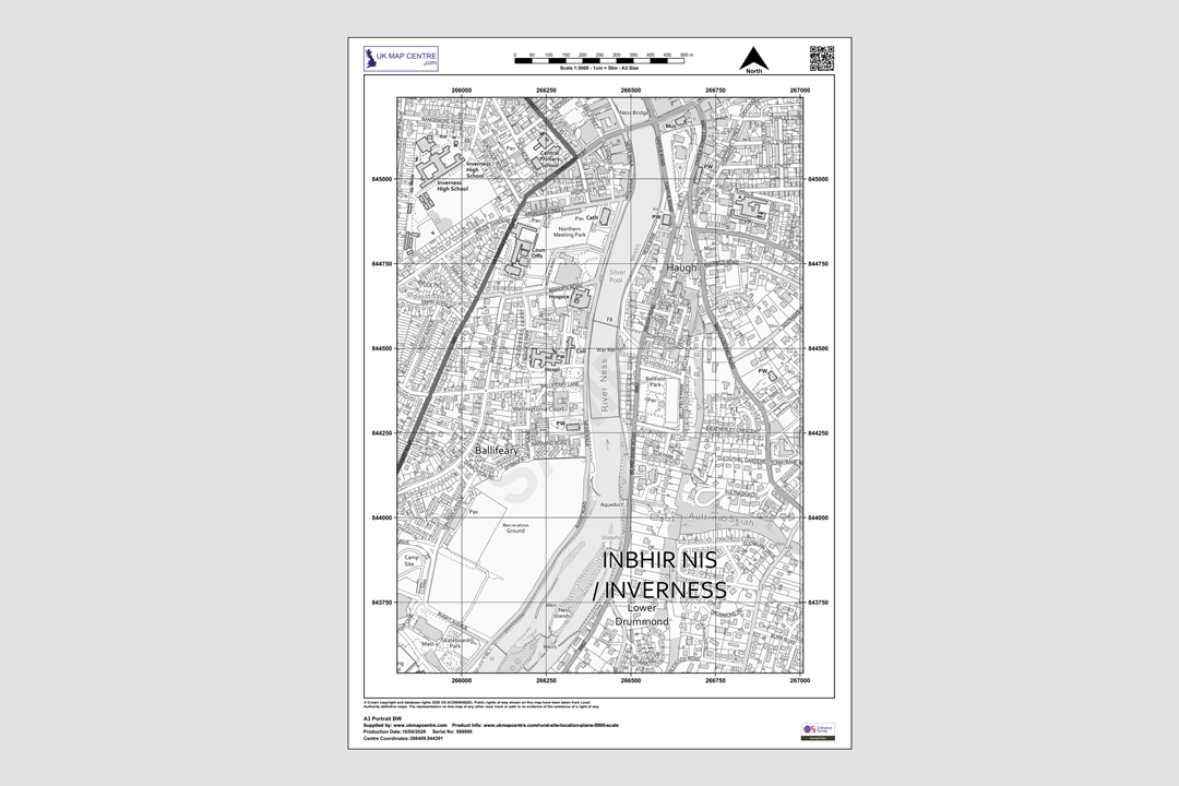
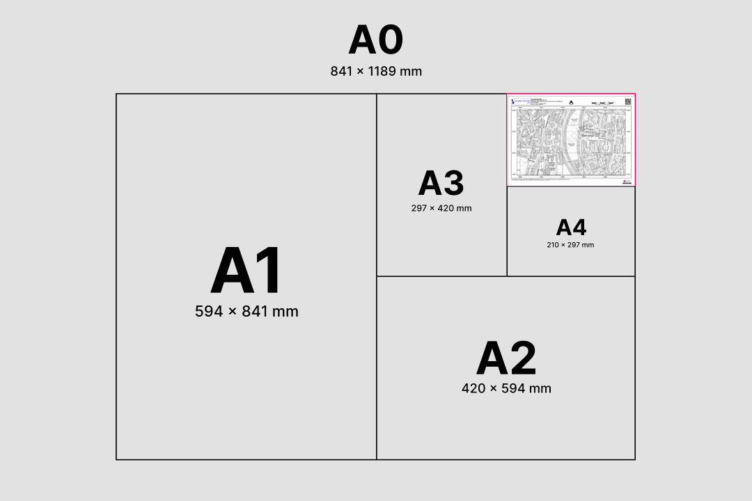
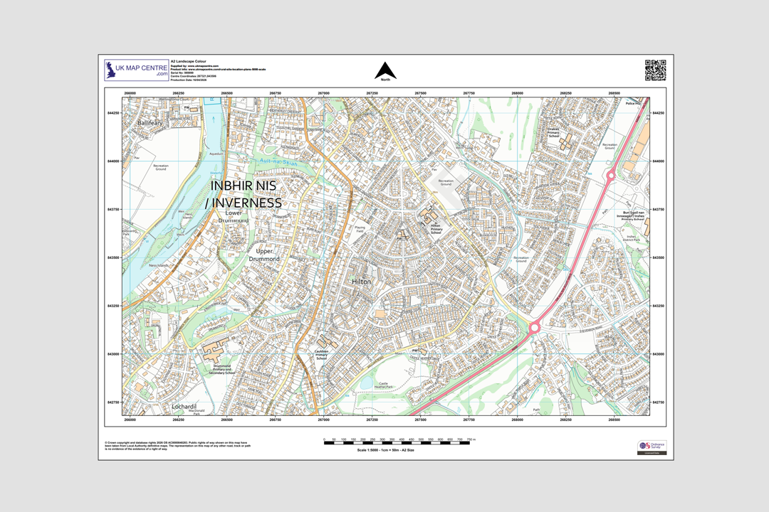
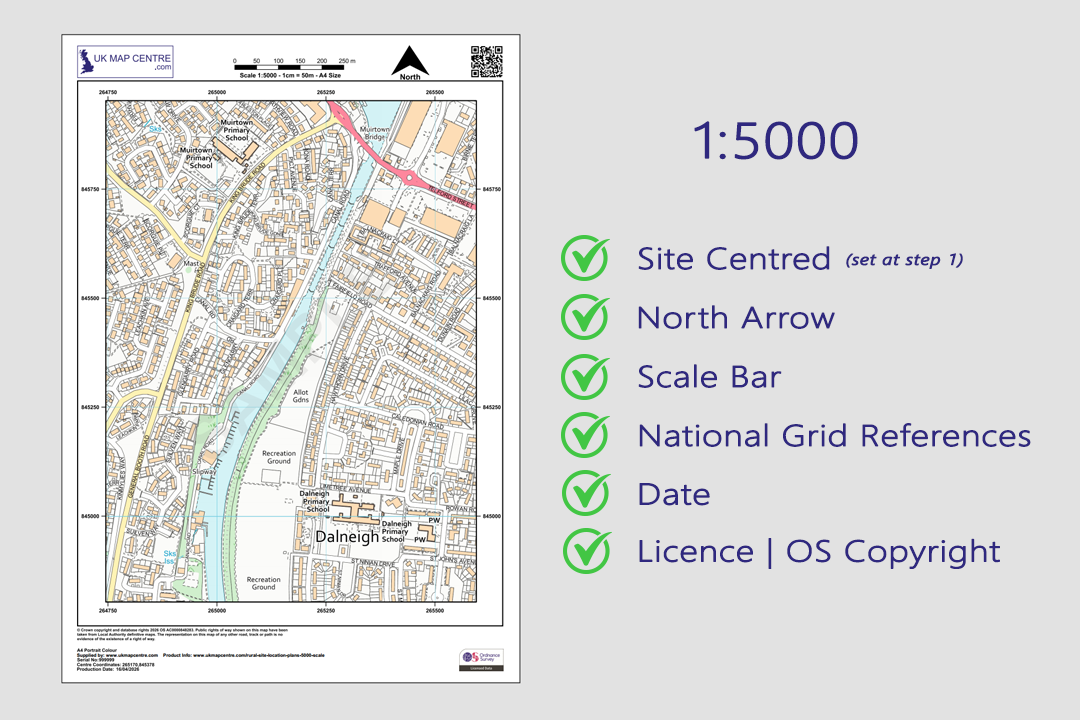
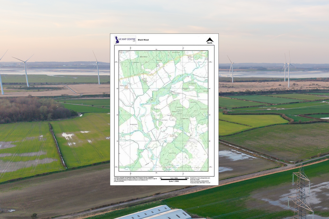
OS 1:5000 colour rural plan - covers four times the ground area of a 1:2500 sheet on the same paper size OS 1:5000 Black & White plan of Inverness - clean line work ideal for redlining site boundaries Available from A4 to A0 - choose the sheet size that covers your holding OS 1:5000 Colour plan - full OS palette showing roads, buildings, green spaces and water features Every plan includes a north arrow, scale bar, grid references, date and OS licence number OS 1:5000 rural plan - ideal for wind farm, forestry and renewable energy site location drawings OS VectorMap Local rural detail at 1:5000 - field boundaries, roads and place names clearly shown Your 1:5000 plan arrives as a PDF ready to download, mark up and submit
© Crown copyright and database rights 2026 OS AC0000848283
OS 1:5000 Extract
- Black & White or Colour
- PDF, TIFF, JPG, BMP, PNG, WORD
- A4 to A0 size
- Optional 5 m contours
- Council Compliant
- North Arrow
- Scale Bar
- 1 cm = 50 m
Ordnance Survey 1:5000 Rural Location Plan for Planning, Forestry and Land Management
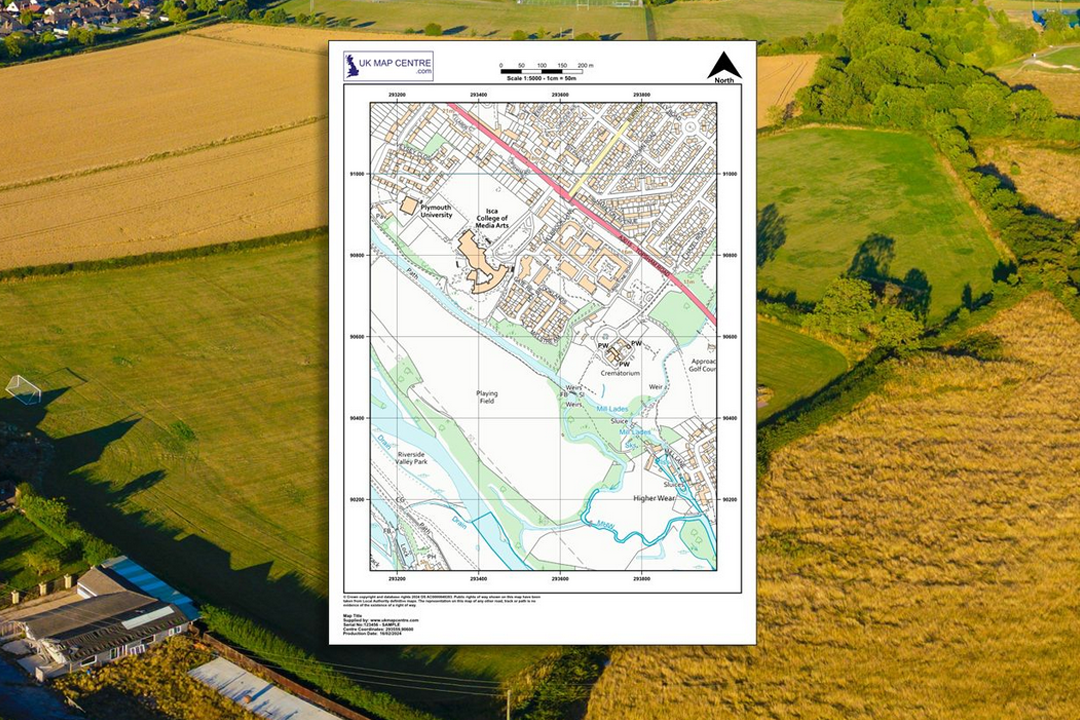
The OS 1:5000 location plan is the mid-scale raster map for rural sites that are too large to fit on a 1:2500 sheet. Derived from OS VectorMap® Local, it shows fences, field boundaries, building outlines, paths, road names and the wider terrain around a holding on a single page. It is four times the ground coverage of a 1:2500 plan on the same sheet size, making it the practical choice for farms, forestry blocks, estates and energy-infrastructure sites across Great Britain.
The 1:5000 plan replaces the discontinued OS Landplan product and is fully licensed for submission to local planning authorities. OS VectorMap Local data is updated quarterly in January, April, July and October, so your plan reflects current mapping at the time of order.
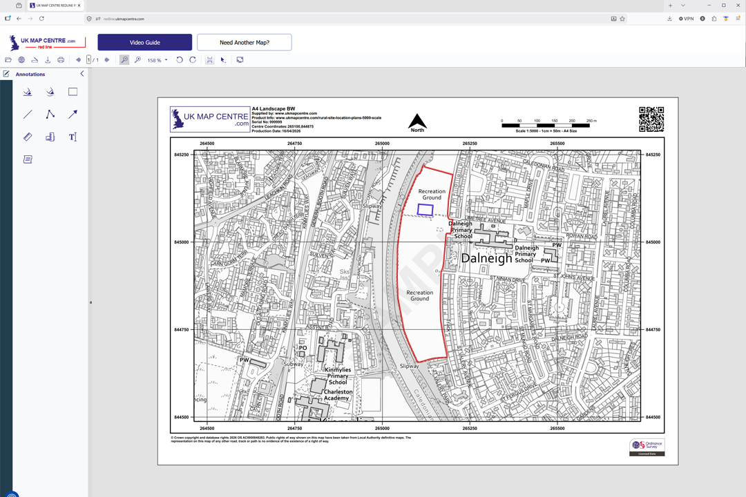
Frame your site, choose a sheet size and file format, pay online and the plan is emailed to you in around 20 minutes, seven days a week. Ready to upload to your council, the Planning Portal, or any registration body that requires an OS-licensed rural location plan.
What Is an Ordnance Survey 1:5000 Plan?
A 1:5000 scale map is an enlarged raster extract from OS VectorMap Local where 1 centimetre on the sheet represents 50 metres on the ground. It sits between the tight 1:2500 rural plan and the regional 1:10 000 sheet, occupying the mid-ground that covers an entire working farm, forestry compartment or rural estate on a manageable paper size.
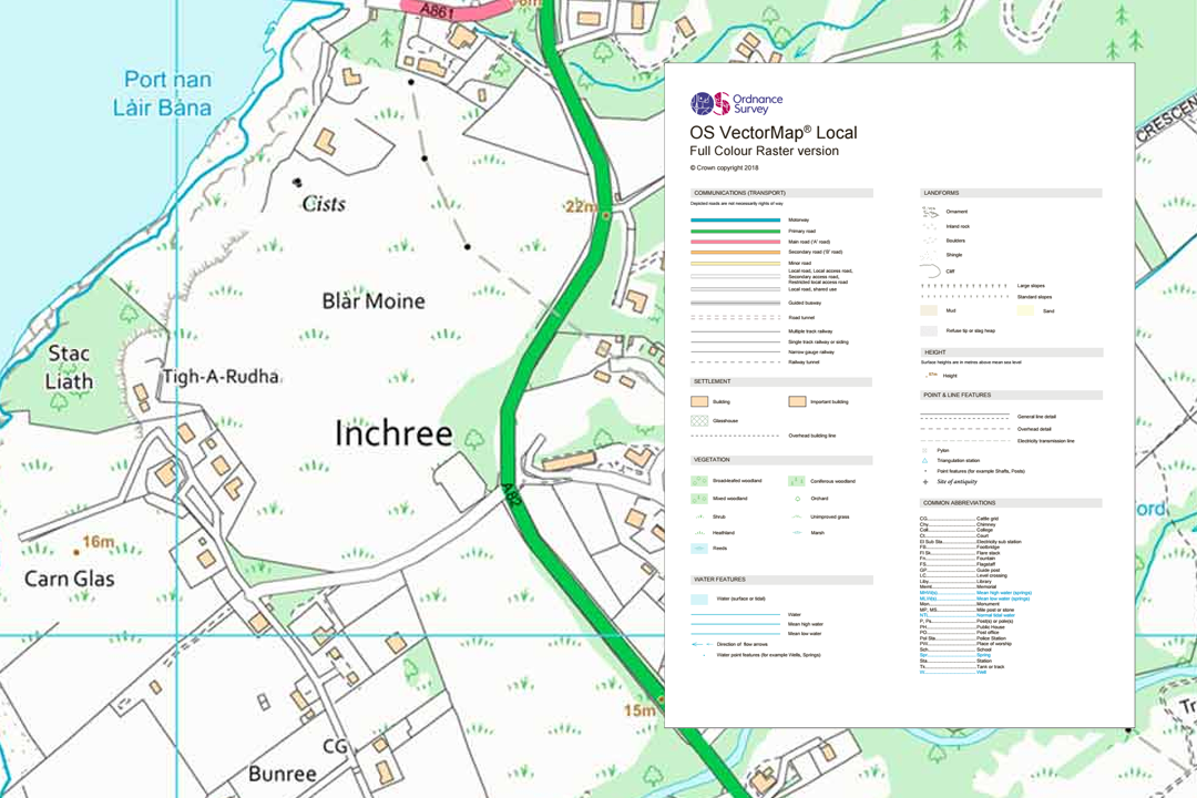
Based on OS VectorMap Local
OS VectorMap Local is a highly detailed, street-level dataset showing fences, building outlines, paths and street names. The 1:5000 plan is a raster rendering of this data - not a CAD or GIS import, but a print-ready map designed for planning and registration submissions.
Four Times the Reach of 1:2500
1 cm on the paper equals 50 m on the ground, so a 1:5000 sheet covers four times the area of the same-size 1:2500 plan. That multiplier is what makes it the right scale for larger holdings, forestry blocks and estate-wide submissions.
Optional 5 m Contours
Add 5-metre contour lines at checkout for a terrain overview across the site. Contours are useful for slope analysis, drainage assessments, forestry planting layout and environmental impact work where elevation matters.
Replaces OS Landplan
The OS 1:5000 plan directly replaces the discontinued OS Landplan product. If you previously ordered Landplan sheets for rural submissions, this is the current equivalent - same purpose, same acceptance, updated quarterly from OS VectorMap Local.
Because 1:5000 sits midway between our 1:2500 rural plan and 1:10 000 regional plan, it fills the gap for sites that are too spread out for 1:2500 on A0 but do not need the broad sweep of 1:10 000.
When Do I Need a 1:5000 Location Plan?
The 1:5000 plan is detailed enough to show individual buildings, property boundaries, footpaths, minor roads, trees, walls, fences and small landscape features - while covering far more ground than a 1:2500 sheet. Common users and uses include:
Rural Planning & Development
Local councils, architects and developers use 1:5000 plans for housing development proposals, land-use assessments and planning applications where the site and its surroundings need to be shown in context on a single sheet. Ideal when a 1:2500 cannot cover the full extent.
Land Surveying & Property Work
Surveyors and legal professionals use 1:5000 plans to define property boundaries, support documentation and measure distances across larger rural sites. The detail is sharp enough to identify individual buildings, walls, fences and field boundaries.
Infrastructure & Engineering
Road design, utility planning (water, gas, electricity), construction site layouts and service corridor drawings. The level of detail helps engineers avoid conflicts with existing features while seeing how the project sits within the wider landscape.
Environmental & Land Management
Managing parks and estates, conservation planning, habitat surveys and tracking land features like hedgerows, streams and woodland. The optional 5 m contour overlay adds terrain context for slope, drainage and flood-zone analysis.
Ecology & Archaeology
Ecologists use 1:5000 plans as base maps for Phase 1 habitat surveys, protected species assessments and ecological impact appraisals. Archaeologists use them to plot desk-based assessment areas, trial trench locations and the extent of scheduled monuments or historic landscape features in relation to a proposed development.
Estate & Farm Management
Estate plans, tenancy boundary drawings, grazing lease maps and farm diversification proposals. At 1:5000 a full working farm with multiple fields, outbuildings and access tracks fits on a single manageable sheet.
Site Evaluation & Feasibility
Evaluating possible sites for new developments, amenities or infrastructure without leaving the office. The detail in the VectorMap Local data lets you assess proximity to buildings, roads, rivers and other features before committing to a site visit.
If the area you need to cover fits within a 1:2500 sheet, consider our 1:2500 rural plan for sharper detail. If the site is so large that even 1:5000 at A0 is not wide enough, step out to a 1:10 000 regional plan which covers four times the area again.
Sourced Direct from Ordnance Survey
UKMapCentre.com operates as a Premium Licensed Partner of Ordnance Survey, which means every 1:5000 rural plan we supply carries a current, correctly attributed OS licence. That status makes our plans ready to submit for rural planning applications, infrastructure proposals, building warrants and any professional use where OS-licensed mapping is expected.
Further Reading
Rural mapping and scale choices can be confusing when you are ordering for the first time. These short guides cover the questions we hear most often from customers ordering wider-area plans:
- How to Print Your OS Map to Scale - Step by Step
- Map Scales Explained: Understanding Ordnance Survey Scale Ratios
- OS Raster Maps: What They Are and When to Use Them
About UK Map Centre LLP

