


Ordnance Survey Road Map 1:250,000 Scale Digital Atlas Style Map Extracts
Available Formats via Email: PDF • TIFF • JPG • BMP • PNG • DOCX • WORD
OS Premium Partner • Ordnance Survey Licensed Product • Ideal for Leisure Activities
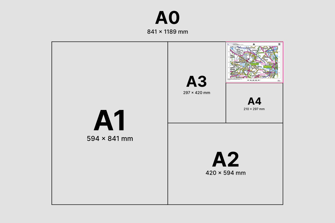
Atlas-style road mapping - motorways, A-roads, B-roads, railways and towns across a whole region Available in portrait or landscape orientation - two extracts showing regional road networks Available from A4 to A0 - choose the sheet size that covers your region or route corridor Journey planning at a glance - motorways, A-roads and towns colour-coded on a single sheet Coverage from northern England to the Scottish islands - ferry routes and coastal roads included Pink motorways, green A-roads, blue railways and named towns - clear atlas-style road detail Scotland's central belt, west coast and islands - ideal for tourism, logistics and regional planning Open Government Licence - unlimited printing, copying and commercial use at no extra cost
Contains OS data © Crown copyright and database rights 2026
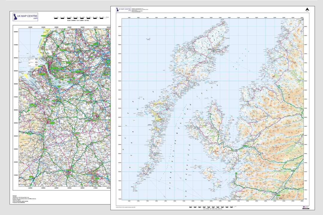
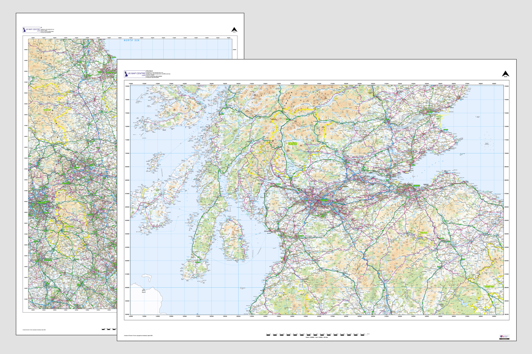
OS 1:250 000 Road Map Extract
- Colour only
- PDF, TIFF, JPG, PNG
- A4 to A0 size
- Open Government Licence
- Unlimited printing
- North Arrow
- Scale Bar
- 1 cm = 2.5 km
Ordnance Survey 1:250 000 Road Map Extracts - Atlas-Style Mapping Centred on Your Area
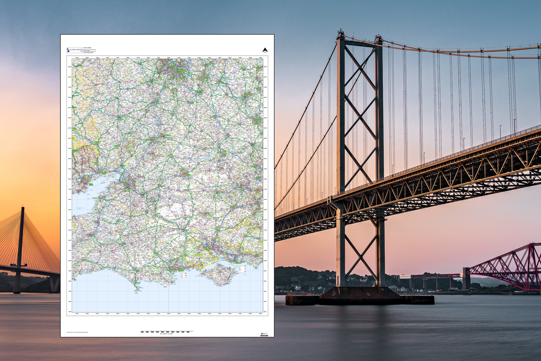
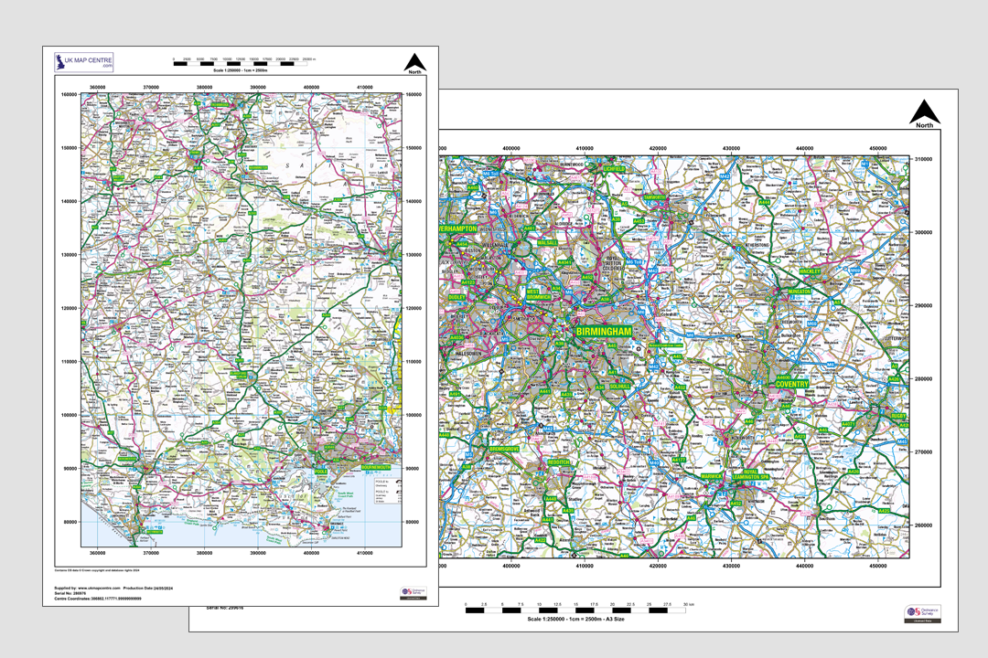
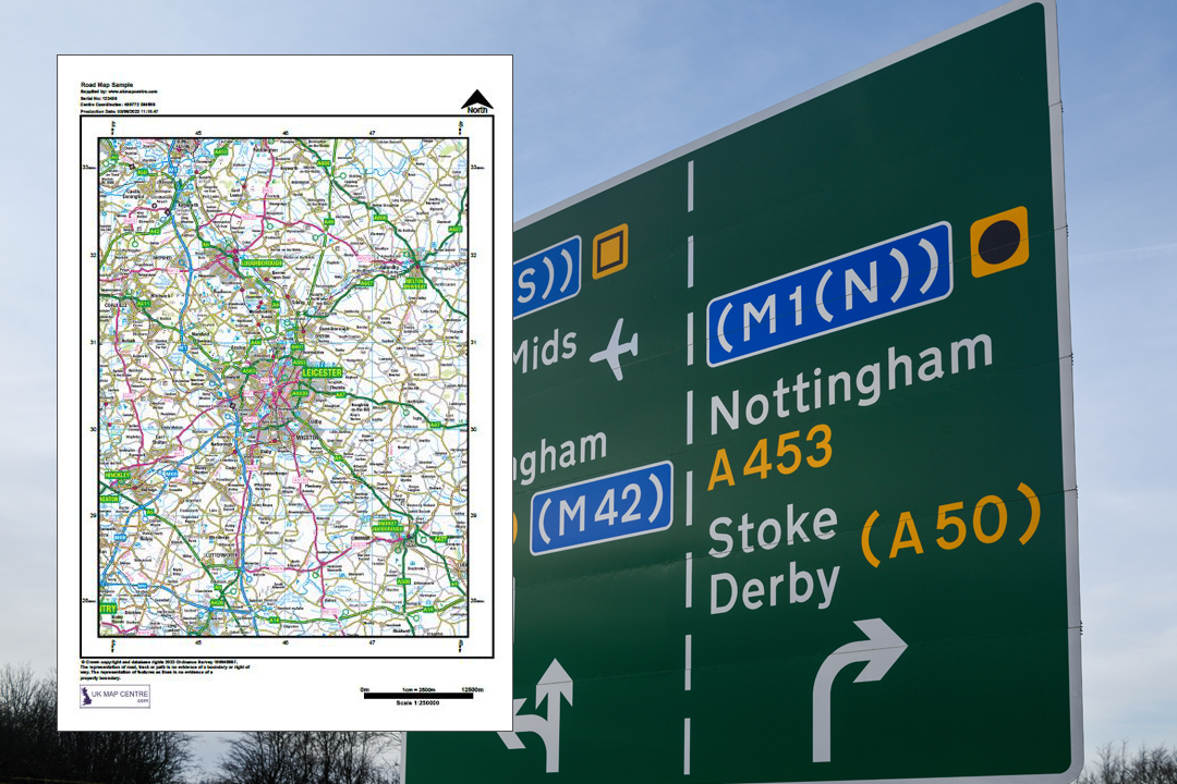
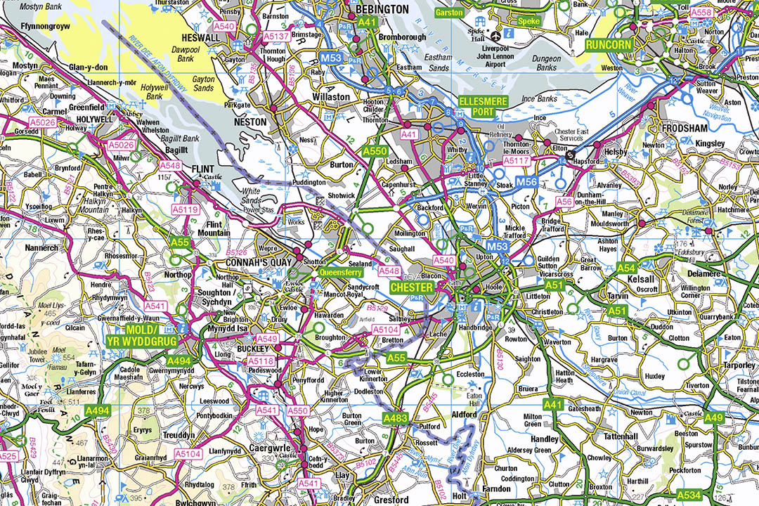
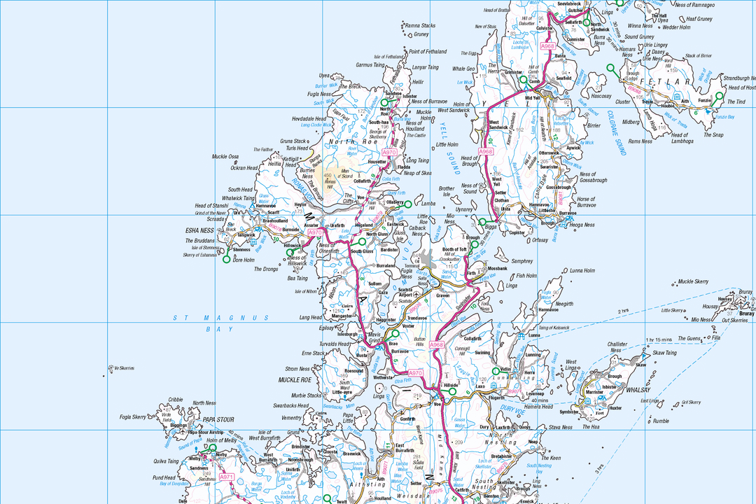
The OS 1:250 000 Road Map extract is a digital atlas-style product that gives you a regional overview of the UK road network - similar in content and appearance to a traditional printed road atlas but centred on the exact location you choose. Motorways, A-roads, B-roads, railways, cities, towns, villages, rivers, woodlands and tourist attractions all appear at a scale that makes sense for journey planning, regional reports and wall displays.
At 1:250 000, 1 centimetre on the paper equals 2.5 kilometres on the ground. A single A4 sheet takes in roughly 42 km by 57 km - enough to show an entire county or metropolitan area at a glance. The data is the OS 1:250 000 Scale Colour Raster, updated annually in June.
Pick your centre point, choose a paper size and file format, pay online and the extract is emailed to you in around 30 minutes, seven days a week. This product is supplied under the Open Government Licence, so you can print unlimited copies, distribute the map freely and use it commercially without additional fees.
What Is an OS 1:250 000 Road Map Extract?
It is a raster image extract from the Ordnance Survey 1:250 000 Scale Colour Raster dataset - the same data that underpins traditional printed road atlases of Great Britain. Our digital extract is centred on the location you search for and cut to the sheet size you need, giving you a clean atlas-style map page without the fixed boundaries of a printed atlas.
Atlas-Style Road Mapping
Motorways and main roads stand out clearly, but you can also see B-roads, country lanes, railways, rivers and named settlements. The styling matches what you would expect from a high-quality printed road atlas - clean, readable and colour-coded by road classification.
Open Government Licence
Unlike our other OS products, the 1:250 000 Road Map is supplied under the Open Government Licence (OGL). That means unlimited printing, free copying, commercial use and the right to adapt or combine the data with your own datasets - no complex licensing terms.
Tourist Attractions & Places of Interest
Camping sites, caravan parks, tourist attractions and places of interest are all clearly marked. That makes the 1:250 000 extract a ready-made backdrop for visitor guides, tourism websites, leaflets and brochures promoting your local area.
Annotate in Photoshop, InDesign or Any Art Package
Order as a TIFF or PNG and open the extract in Photoshop, InDesign, Illustrator, Affinity Designer or any image editor. Highlight sales areas, mark branch locations, draw delivery zones, add company branding or annotate a route corridor - then export a client-ready map for a report, pitch deck or printed brochure.
The 1:250 000 Road Map sits above the detail of our 1:50 000 Landranger extract (the digital equivalent of the pink fold-out maps), giving you the broadest regional view available from Ordnance Survey. Where the Landranger shows individual footpaths and field boundaries, the 1:250 000 strips those away and focuses on the road network, settlements and regional geography that matter for journey planning and area-level context.
When Do I Need a 1:250 000 Road Map Extract?
The 1:250 000 Road Map is for anyone who needs a broad regional overview - whether for a corporate report, a tourism leaflet, a logistics plan or a wall display. Common users and uses include:
Corporate & Government Reports
Regional context maps for board papers, strategy documents, annual reports and policy briefings. The atlas-style clarity makes it easy for readers to locate sites, offices and project areas without being overwhelmed by street-level detail.
Transport, Logistics & Fleet Planning
Haulage firms, courier companies, bus operators and fleet managers use the 1:250 000 view for depot catchment maps, route corridor planning, delivery zone illustrations and driver briefing sheets. The road classification colouring makes major routes instantly recognisable.
Tourism, Visitor Guides & Brochures
Tourist boards, holiday parks, campsites, hotels and visitor attractions. The map shows camping and caravan sites, places of interest and the surrounding road network - ready to drop into a leaflet, website or printed brochure to help visitors plan their journey.
Sales Territory & Branch Network Maps
Estate agents, franchise networks, utility companies and retail chains use the 1:250 000 backdrop to map branch locations, sales territories, coverage zones and catchment areas. Open the TIFF in Photoshop, Illustrator or Affinity Designer, draw your zones, drop in pins and branding, and the annotated map is ready for a pitch deck or client report.
Education & Geography Projects
Schools, colleges and universities use the 1:250 000 extract for geography coursework, settlement studies, transport analysis and regional comparison exercises. The Open Government Licence means teachers and students can print, copy and annotate freely without worrying about reproduction fees.
Journey Planning & Road Trips
A printed atlas-style page centred on your journey corridor. Motorists, coach operators, cycling tour organisers and classic car rally planners use the 1:250 000 as a clean route overview that shows the whole picture without the interruptions of sat-nav rerouting.
Wall Displays & Reception Maps
Offices, showrooms, hotels, holiday lets and visitor centres. A framed A1 or A0 road map extract centred on your location makes a practical, professional wall display - showing guests and clients where you sit in relation to motorways, towns and regional landmarks.
Leaflets, Brochures & Marketing Material
The Open Government Licence lets you cut, crop and adapt the map for print and digital marketing. Open in Photoshop or InDesign, crop to the area you need, add text and branding, then export for an event flyer, property brochure, newsletter or website landing page - no additional OS fees and no attribution headaches.
If you need more detail for individual streets, footpaths or property boundaries, our 1:50 000 Landranger, 1:25 000 Explorer or 1:10 000 regional plan zoom in further. The 1:250 000 Road Map is the right product when you want the road network and regional geography on a single sheet without building-level clutter.
Open Government Licence - Use It Freely
The OS 1:250 000 Scale Colour Raster is published under the Open Government Licence (OGL). That means you can copy, distribute, transmit and adapt the data for commercial, educational and personal purposes without complex licensing terms. Print as many copies as you need, embed the map in client reports, add it to your website or combine it with your own data - the licence permits all of this at no additional cost. The only requirement is to include the attribution: "Contains OS data © Crown copyright and database rights 2026".
Further Reading
Not sure which OS map scale you need? These guides answer the questions we hear most often:
- How to Print Your OS Map to Scale - Step by Step
- Map Scales Explained: Understanding Ordnance Survey Scale Ratios
- OS Raster Maps: What They Are and When to Use Them
About UK Map Centre LLP

