


Ordnance Survey Aerial Imagery 1:1250 Scale Extracts - OrthoRectified (no building lean)
Available Formats via Email: PDF • TIFF • JPG • PNG
OS Premium Partner • Ordnance Survey Licensed Product • OS MasterMap Imagery Layer • Digital colour-balanced
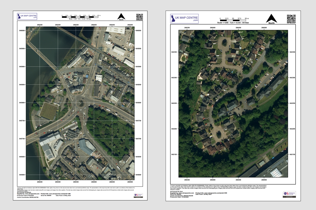
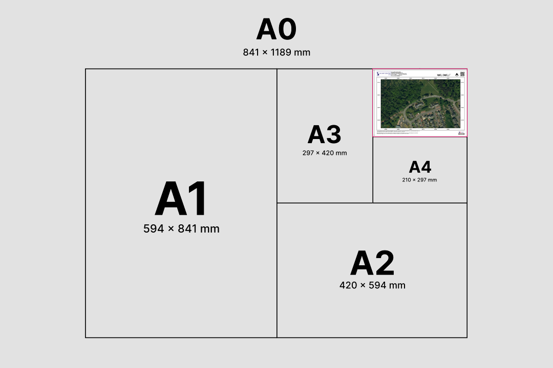
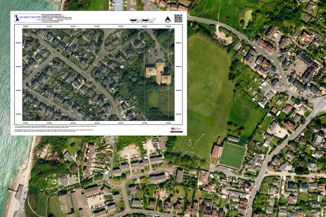
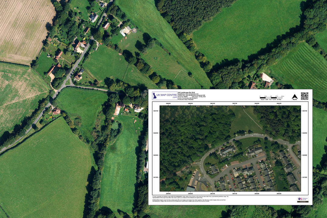
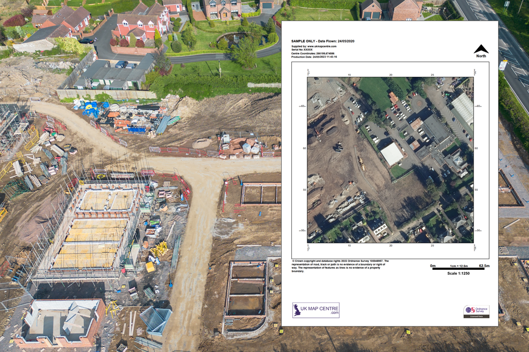
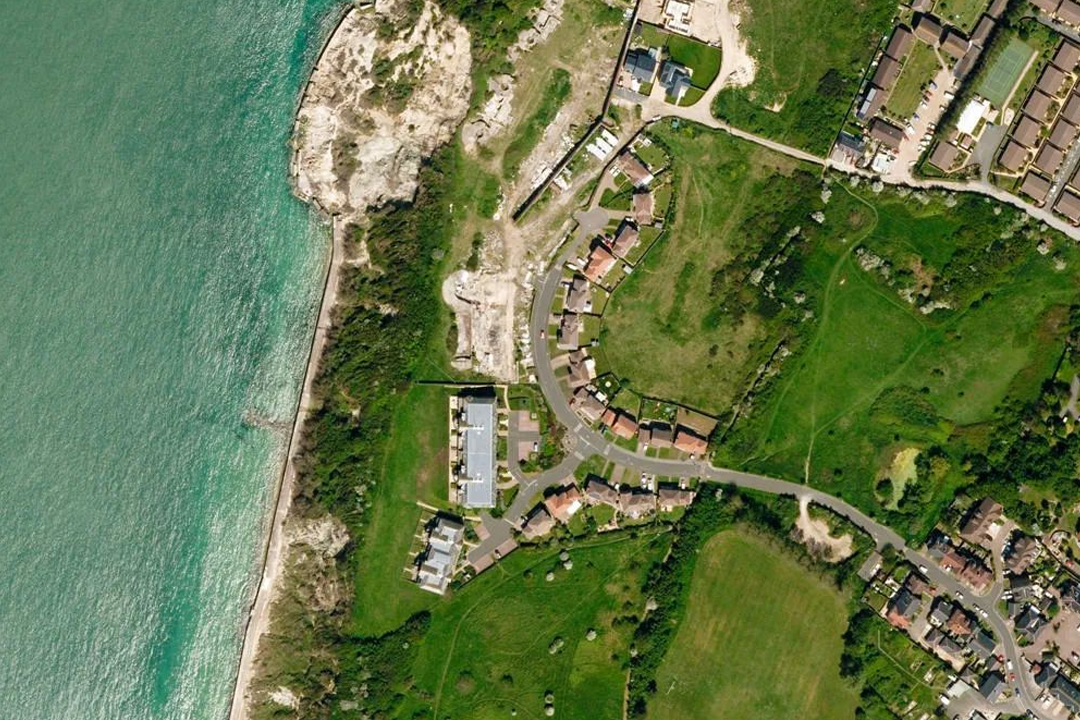
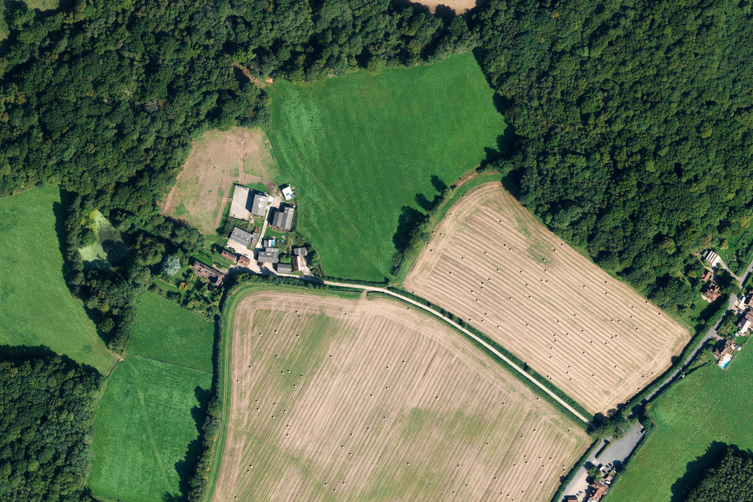
Orthorectified aerial imagery - car parks, buildings, landscaping and woodland in true top-down view Available in portrait or landscape - town centre detail and residential areas at 25 cm resolution Available from A4 to A0 - choose the sheet size that covers your site or project area Coastal residential area - houses, gardens, green space and shoreline clearly visible from above Rural hamlet surrounded by fields and hedgerows - ideal for agricultural and land-use assessment Construction activity visible at 25 cm resolution - foundations, scaffolding and ground disturbance Coastal settlement - beach, rocky shoreline, golf course and houses in true orthorectified view Isolated rural farm - farmhouse, outbuildings, fields, woodland and tracks with no building lean
© Crown copyright and database rights 2026 OS AC0000848283
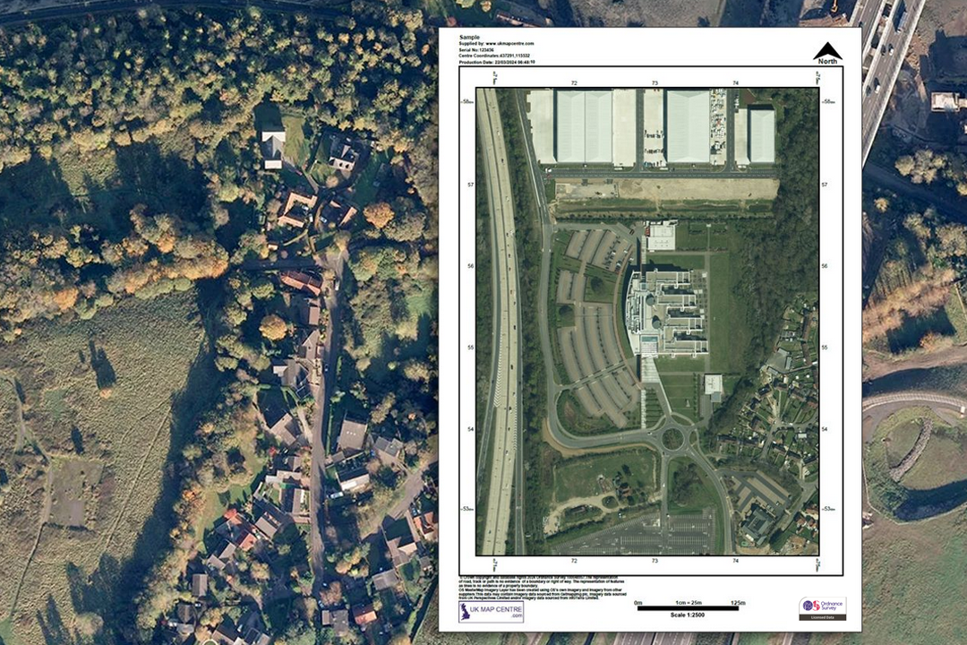
OS Aerial Imagery 1:1250 Extract
- 25 cm resolution
- PDF, TIFF, JPG
- A4 to A0 size
- Orthorectified (no building lean)
- Colour balanced
- North Arrow
- Scale Bar
- 1 cm = 12.5 m
Ordnance Survey Aerial Imagery at 1:1250 - Orthorectified Photography with No Building Lean
The OS 1:1250 aerial imagery extract is a high-resolution, colour-balanced aerial photograph derived from the OS MasterMap Imagery Layer. Every image is orthorectified - geometrically corrected to remove building lean and distortion - giving you a true top-down view of the ground as if every feature were photographed directly from above. At 25 cm resolution you can identify individual properties, driveways, fences, garden boundaries, road markings, tree canopy and building features such as solar panels and conservatories.
At 1:1250 scale, 1 centimetre on the print equals 12.5 metres on the ground. The imagery is aligned to the OS MasterMap Topography Layer, so it sits precisely alongside OS vector mapping when the two are used together. The data is updated quarterly in February, May, August and November, with more than 99% of the imagery less than five years old.
Pick your centre point, choose a paper size and file format, pay online and the aerial extract is emailed to you in around 30 minutes, seven days a week.
What Is an OS 1:1250 Aerial Imagery Extract?
It is a licensed aerial photograph sourced from the OS MasterMap Imagery Layer - the same imagery dataset that underpins Ordnance Survey's large-scale data updates across Great Britain. Our extract is centred on the location you search for and printed at 1:1250 scale on the sheet size you choose, with a north arrow, scale bar and OS licence number stamped on every sheet.
True Orthorectified Imagery
All imagery since 2015 is true orthorectified - building lean has been removed so that every structure appears directly from above in its correct geographic position. This makes the photograph geometrically reliable for measurement, annotation and overlay work.
25 cm Resolution
At 25 cm ground sample distance you can spot individual solar panels, conservatories, garden sheds, road markings, parking bays and tree canopy edges. This level of detail is what makes the imagery valuable for site assessment without needing a physical visit.
Aligned to OS MasterMap
The aerial imagery is precisely aligned to the OS MasterMap Topography Layer. That means you can overlay vector mapping data directly onto the photograph for combined analysis - boundaries, buildings and features line up accurately.
Reduce the Need for Site Visits
Check road markings, tree canopy extents, site entrances, boundary fences, roof conditions and access routes from your desk. Using aerial imagery to verify ground conditions before visiting a site saves time and travel costs on every project.
If you need the same aerial imagery at a wider scale, our 1:2500 aerial extract covers more ground per sheet. For vector mapping at this scale, see our 1:1250 OS MasterMap location plan. If you work in GIS and need georeferenced aerial tiles or full GIS-ready imagery data, see our dedicated products below.
GIS: Aerial GeoTIFF Tiles GIS: Aerial Imagery DataWhen Do I Need a 1:1250 Aerial Extract?
The 1:1250 aerial extract is for anyone who needs a real-world photographic view of a site at close range - whether for professional assessment, insurance work, property management or visual verification. Common users and uses include:
Surveyors & Engineers
Visual verification of site boundaries, access points, road markings, drainage runs and ground conditions. The orthorectified image provides a geometrically reliable base for overlay measurement and pre-survey desk study before mobilising to site.
Architects & Planning Consultants
A photographic site context to accompany planning submissions, design and access statements and pre-application assessments. The aerial view shows the relationship between a development site and its surroundings in a way that a line drawing cannot.
Property Insurance & Risk Analysis
Insurers, loss adjusters and risk assessors use the aerial image to verify property features, roof materials, proximity to watercourses, flood-prone land and neighbouring structures - all without scheduling a site visit.
Asset Management & Utilities
Utility companies, telecoms providers and infrastructure managers use aerial imagery to check access routes, monitor installations, identify vegetation encroachment near overhead lines and plan maintenance schedules across their asset base.
Environmental & Vegetation Studies
Ecologists, arboriculturists and environmental consultants use the 25 cm resolution to assess tree canopy cover, hedgerow condition, habitat boundaries and land-use change over time when compared against earlier imagery.
Property Management & Valuation
Estate agents, property managers and valuers use the aerial photograph to verify extensions, conservatories, outbuildings, parking provision and garden size without visiting every property in a portfolio.
Agricultural & Land-Use Analysis
Farmers, land agents and rural surveyors use aerial imagery for crop assessment, field boundary verification, drainage pattern identification and agricultural land classification work.
Route Planning & Accessibility
Transport planners, highways consultants and access auditors use the photograph to check road widths, junction layouts, pedestrian crossings, cycle infrastructure and loading-bay arrangements ahead of a detailed site survey.
If you need vector line mapping rather than photography, our 1:1250 OS MasterMap location plan provides the standard topography layer. For wider area aerial coverage, see our 1:2500 aerial extract.
Sourced Direct from Ordnance Survey
UKMapCentre.com operates as a Premium Licensed Partner of Ordnance Survey, which means every aerial imagery extract we supply is sourced directly from the OS MasterMap Imagery Layer and carries a current, correctly attributed OS licence. The imagery is expertly colour-balanced, geometrically corrected and orthorectified to the same standard used by Ordnance Survey for their own large-scale mapping updates across England, Scotland and Wales.
Further Reading
New to OS aerial imagery or not sure which product you need? These guides answer the questions we hear most often:
- How to Print Your OS Map to Scale - Step by Step
- Map Scales Explained: Understanding Ordnance Survey Scale Ratios
- What Is Aerial Imagery? An OS MasterMap Guide
About UK Map Centre LLP

