


Ordnance Survey 1:25,000 Colour Explorer Scale Digital Map Extracts
Available Formats via Email: PDF • TIFF • JPG • BMP • PNG • DOCX • WORD
OS Premium Partner • Ordnance Survey Licensed Product • Ideal for Leisure Activities
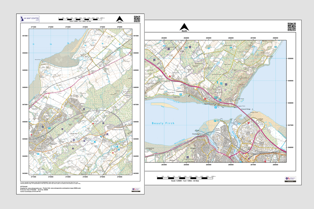
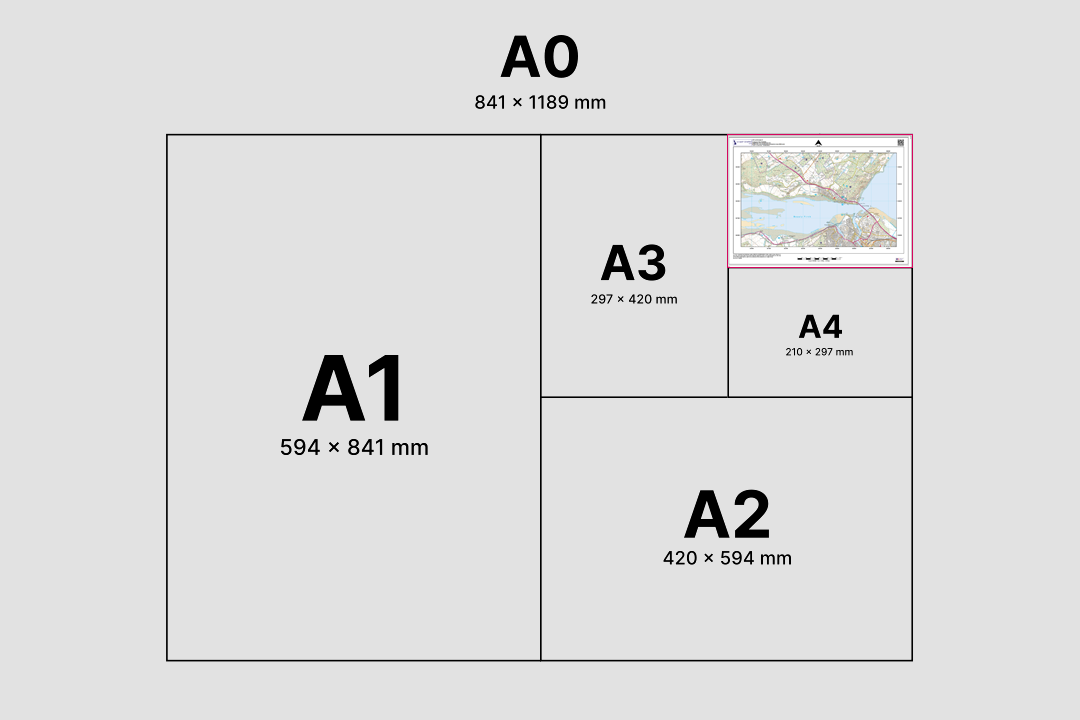
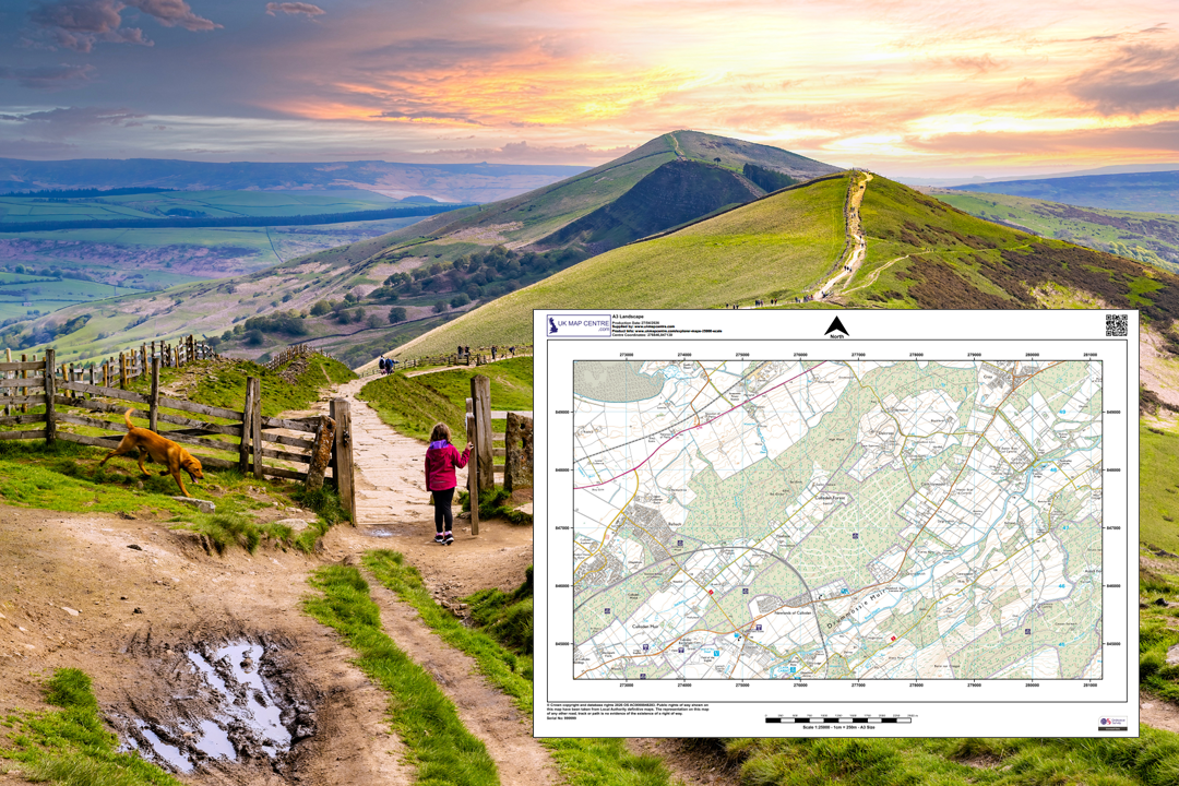
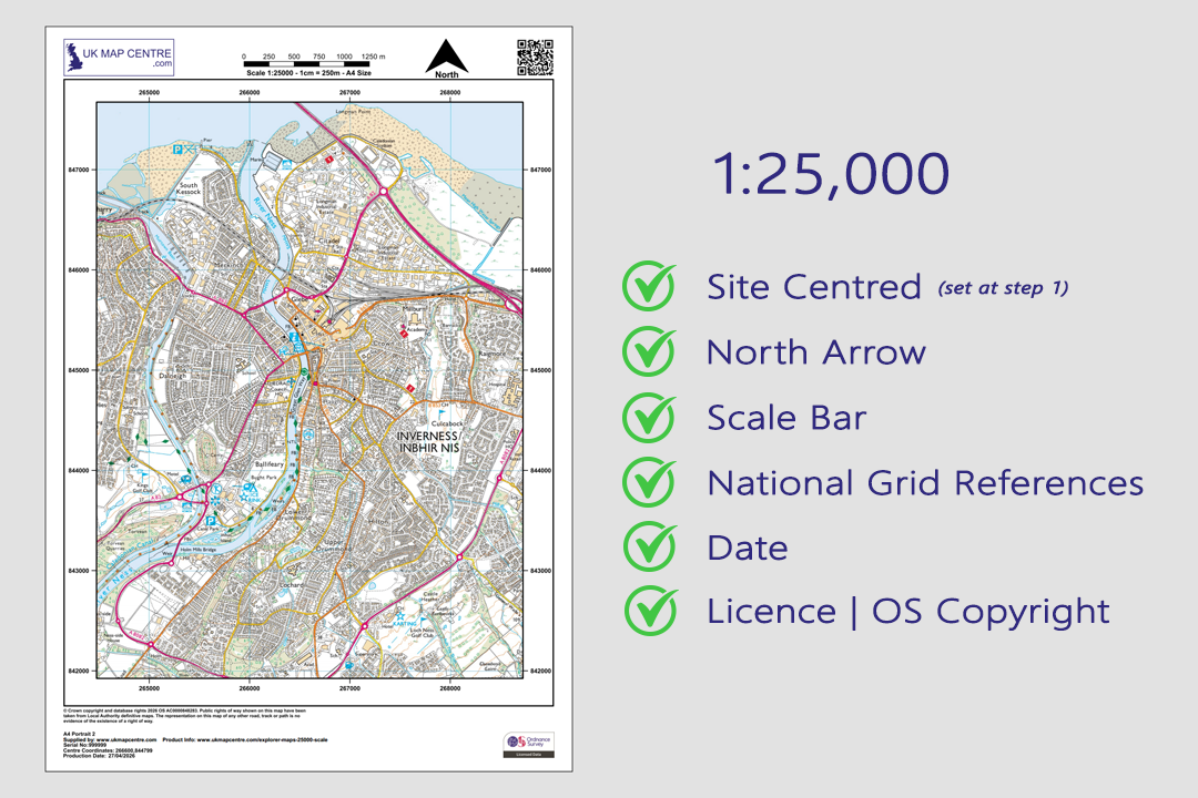
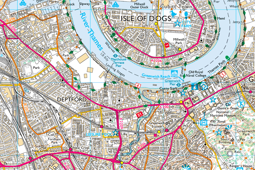
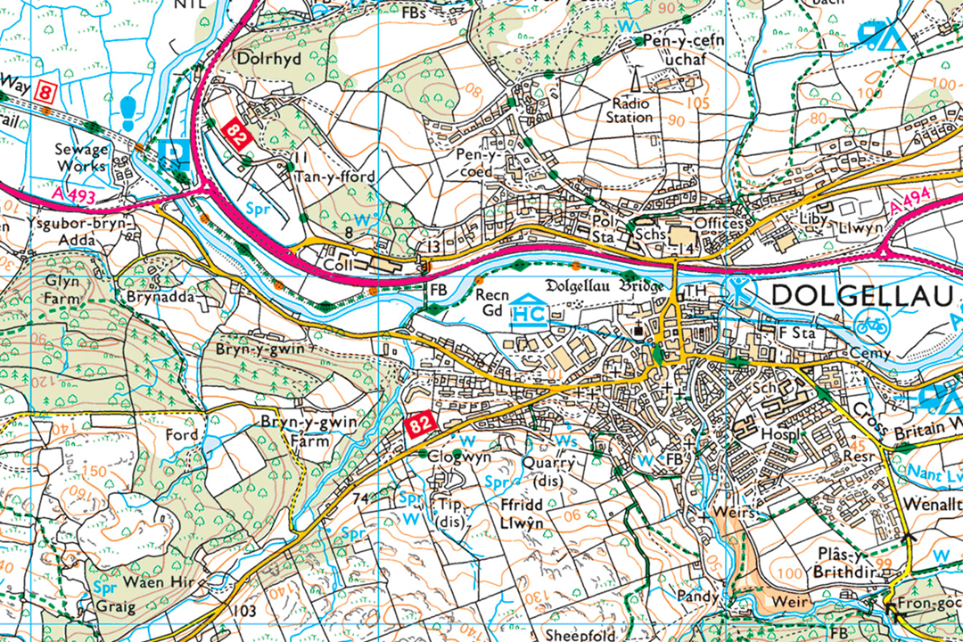
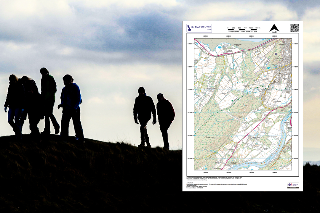
The same detail as the orange fold-out OS Explorer maps - site-centred and delivered digitally Available in portrait or landscape orientation - two extracts showing coastal areas at 1:25 000 Available from A4 to A0 - choose the sheet size that covers your walking route or project area OS 1:25 000 Explorer extract - footpaths, contour lines and rights of way across open hillside Every extract includes a north arrow, scale bar, grid references, date and OS licence number Explorer map detail in an urban area - Isle of Dogs and Deptford showing streets, docks and the Thames Explorer map detail in rural Wales - Dolgellau with contour lines, rivers, woodland and field boundaries The 1:25 000 Explorer is the standard map for walkers, hikers, DofE expeditions and outdoor instruction
© Crown copyright and database rights 2026 OS AC0000848283
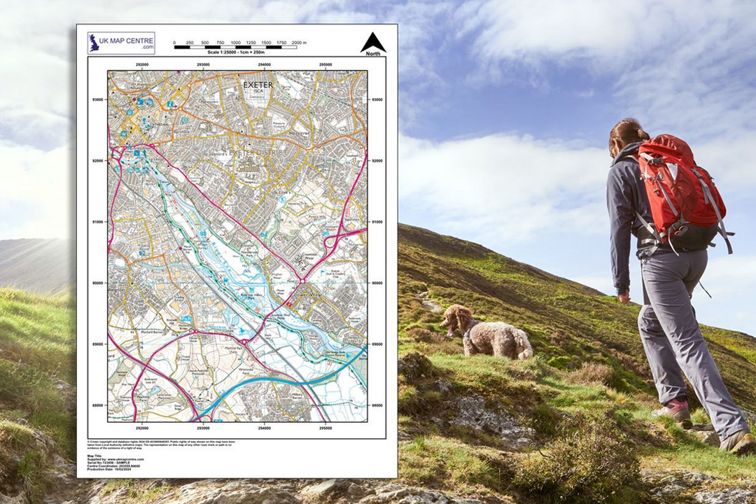
OS 1:25 000 Explorer Extract
- Colour only
- PDF, TIFF, JPG, BMP, PNG
- A4 to A0 size
- Rights of way shown
- Contour lines included
- North Arrow
- Scale Bar
- 4 cm = 1 km
Ordnance Survey 1:25 000 Explorer Map Extracts - The Same Detail as the Orange Fold-Out Maps
The OS 1:25 000 Explorer extract gives you exactly the same mapping you will find in the familiar orange-covered Ordnance Survey Explorer paper maps sold in outdoor shops and bookshops across the UK - but centred on the location you choose, cut to the sheet size you need and delivered digitally by email. No more unfolding a full Explorer sheet on a wet hillside to find the one grid square you actually need.
At 1:25 000, 4 centimetres on the paper equals 1 kilometre on the ground. That makes it the most detailed leisure map Ordnance Survey publishes, showing footpaths, bridleways, National Trails, access land, contour lines, field boundaries, vegetation, scree slopes, shoreline detail, tourist attractions and places of interest. The data is the OS 1:25 000 Scale Colour Raster, updated quarterly in March, June, September and December.
Pick your centre point, choose a paper size and file format, pay online and the extract is emailed to you in around 30 minutes, seven days a week. Larger sheets above A3 can be taken to your local print shop and printed professionally - the OS licence covers the reproduction.
What Is an OS 1:25 000 Explorer Extract?
It is a digital extract from the same Ordnance Survey dataset that produces the printed Explorer map series. Where the paper Explorer covers a fixed area defined by Ordnance Survey, our digital extract is centred on the exact spot you search for - your walking start point, your project site, your farm or your event venue - and emailed at the sheet size that covers the ground you need.
Same Detail as the Orange Explorer Maps
Every footpath, contour line, right of way, access land boundary, tourist symbol and field boundary you see on the paper Explorer is on this digital extract. The difference is you choose where the centre of the sheet falls and how large the sheet is.
Site-Centred to Your Specification
No more guessing which Explorer sheet number covers your area. Enter a postcode, placename or grid reference, frame the extent you need and the extract is built around your chosen centre point - not around a fixed OS tile boundary.
The Must-Have Navigation Map
The 1:25 000 Explorer is the standard map for walkers, hikers, cyclists, horse riders, trail runners, Duke of Edinburgh expeditions, mountain rescue teams and outdoor instructors. At 4 cm per kilometre it shows enough detail to navigate safely off-road.
Print Professionally at Any Size
Every extract is fully licensed under Ordnance Survey licence AC0000848283. Larger files above A3 can be taken to your local print shop and printed professionally - the licence covers the printed reproduction, so the print shop does not need its own OS agreement.
The 1:25 000 Explorer extract sits between the close-up detail of our 1:10 000 regional plan and the broader overview of our 1:50 000 Landranger extract (the digital equivalent of the pink fold-out Landranger maps), giving you the richest level of terrain and rights-of-way detail available from Ordnance Survey on a single page.
When Do I Need a 1:25 000 Explorer Extract?
The Explorer extract is for anyone who needs detailed OS mapping of a specific area - whether for outdoor recreation, professional fieldwork, emergency response or a printed report. Common users and uses include:
Walking, Hiking & Trail Running
Route planning and on-the-ground navigation for day walks, long-distance trails, fell running and mountain expeditions. Footpaths, bridleways, National Trails, access land and contour lines are all shown at the detail walkers depend on.
Cycling & Horse Riding
Bridleways, byways open to all traffic, restricted byways and quiet lanes are all marked on the 1:25 000 sheet. Cyclists and riders use it for off-road route planning, event mapping and club ride printouts.
Emergency Response & Search Teams
Mountain rescue, coastguard, fire and police teams use the 1:25 000 scale to coordinate responses in remote areas. Field boundaries, contours, vegetation, scree slopes and shoreline detail help responders reach incidents quickly and safely.
Environmental & Consultation Reports
Environmental impact assessments, ecological surveys, flood risk appraisals and heritage statements. TIFF files open directly in Photoshop and InDesign for annotation, making the Explorer extract a clean backdrop for consultation documents and published reports.
Farm, Estate & Property Management
Farmers, land agents and estate managers use the 1:25 000 sheet as a working overview of a holding, showing field boundaries, tracks, woodland, watercourses and neighbouring land in a single glance.
Education & Outdoor Instruction
Duke of Edinburgh expeditions, orienteering events, Scouts, Cadets and outdoor education centres. A site-centred extract at the right sheet size is cheaper and more practical than buying a full Explorer sheet for every group.
Construction & Engineering Context
A wider geographic context drawing for construction site reports, engineering feasibility studies and planning licence applications where the surrounding terrain, access routes and local features need to be shown at a readable scale.
Leisure, Tourism & Events
Tourist attractions, heritage sites, campsites, parking areas and places of interest are all marked on the Explorer sheet. Event organisers use printed extracts for race routes, festival site plans, orienteering courses and guided walk handouts.
If you need tighter detail for a specific plot or building, our 1:10 000 regional plan, 1:5000 plan or 1:2500 rural plan zoom in further. The 1:25 000 Explorer is the right product when you want the full terrain picture across a wide area.
Sourced Direct from Ordnance Survey
UKMapCentre.com operates as a Premium Licensed Partner of Ordnance Survey, which means every 1:25 000 Explorer extract we supply carries a current, correctly attributed OS licence. That status makes our extracts ready to use for navigation, outdoor instruction, emergency response planning, environmental reports, consultation documents, event mapping, farm management and any professional or recreational use where OS-licensed mapping is expected.
Further Reading
New to OS Explorer maps or not sure which scale you need? These guides answer the questions we hear most often:
- How to Print Your OS Map to Scale - Step by Step
- Map Scales Explained: Understanding Ordnance Survey Scale Ratios
- OS Raster Maps: What They Are and When to Use Them
About UK Map Centre LLP

