


Ordnance Survey (OS) Landranger Maps — 1:50,000 Colour Landranger Scale Digital Map Extracts
Available Formats via Email: PDF • TIFF • JPG • BMP • PNG • DOCX • WORD
OS Premium Partner • OS Licensed Product • Great for Outdoor enthusiasts • Popular Leisure Product
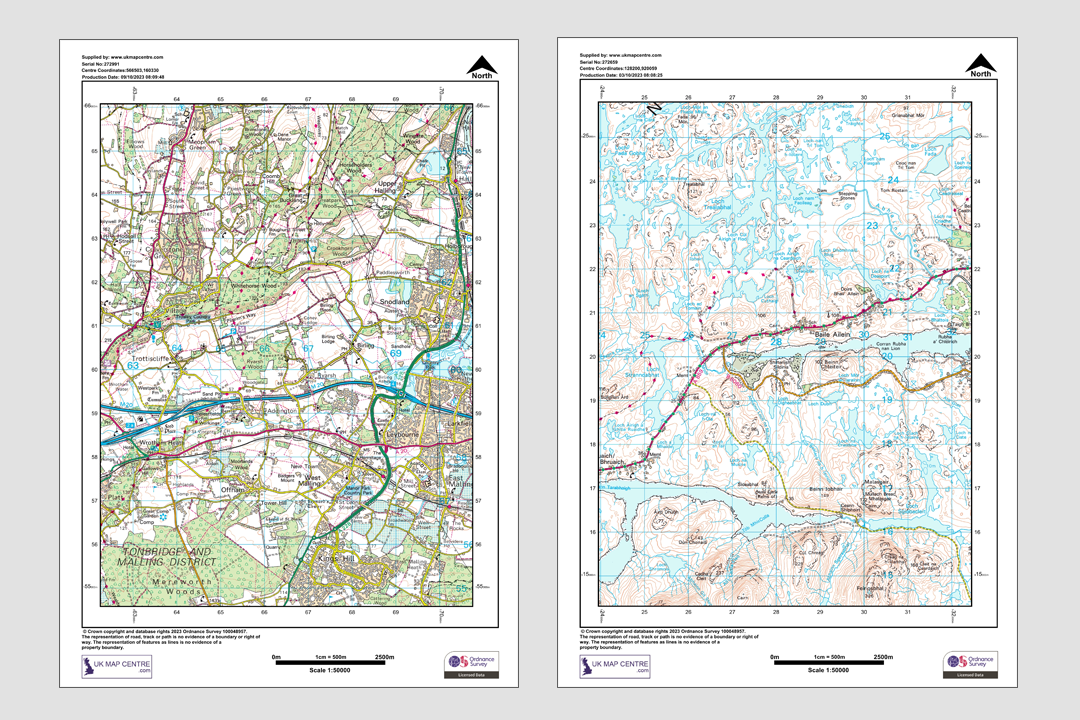
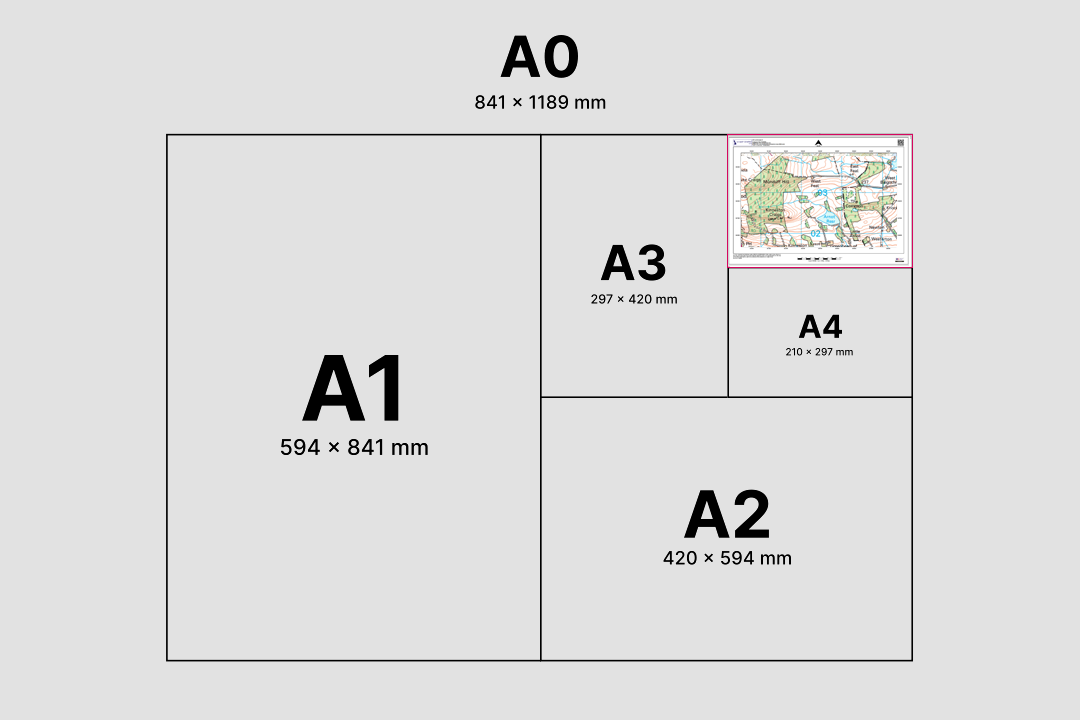
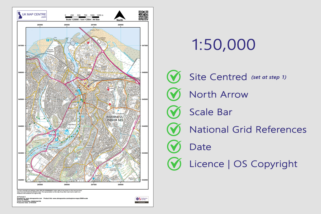
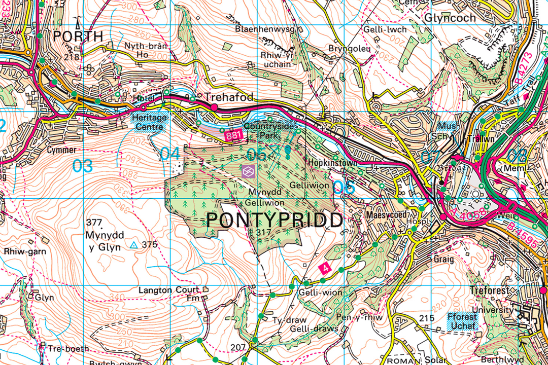
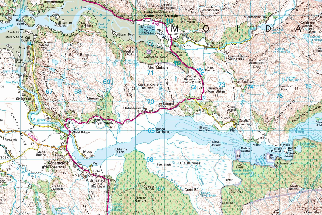
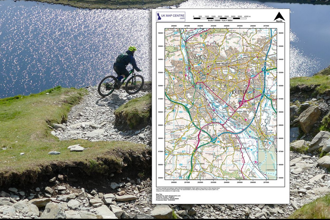
The same detail as the pink fold-out OS Landranger maps - site-centred and delivered digitally Available in portrait or landscape orientation - two extracts showing rivers, roads and settlements Available from A4 to A0 - choose the sheet size that covers your route or region OS 1:50 000 Landranger extract - roads, rivers and contour lines across a wide touring area Every extract includes a north arrow, scale bar, grid references, date and OS licence number Landranger detail in the South Wales valleys - Pontypridd with roads, contours and settlements Landranger detail in the Scottish Highlands - lochs, mountains, pink roads and contour shading The 1:50 000 Landranger puts an entire region on a single sheet for cycling, touring and planning
© Crown copyright and database rights 2026 OS AC0000848283
OS 1:50 000 Landranger Extract
- Colour only
- PDF, TIFF, JPG, PNG, WORD
- A4 to A0 size
- Contour lines included
- Tourist information shown
- North Arrow
- Scale Bar
- 2 cm = 1 km
Ordnance Survey 1:50 000 Landranger Map Extracts - The Same Detail as the Pink Fold-Out Maps
The OS 1:50 000 Landranger extract gives you exactly the same mapping you will find in the familiar pink-covered Ordnance Survey Landranger paper maps - but centred on the location you choose, cut to the sheet size you need and delivered digitally by email. Whether you are planning a long cycle tour, briefing an emergency response or simply want an overview of the landscape around you, the Landranger extract puts an entire region on a single sheet.
At 1:50 000, 2 centimetres on the paper equals 1 kilometre on the ground. That makes it the broadest OS map to still show individual roads, contour lines, woodland, watercourses, railway lines, settlements and tourist information. The data is the OS 1:50 000 Scale Colour Raster, updated quarterly in March, June, September and December.
Pick your centre point, choose a paper size and file format, pay online and the extract is emailed to you in around 30 minutes, seven days a week. Larger sheets above A3 can be taken to your local print shop and printed professionally - the OS licence covers the reproduction.
What Is an OS 1:50 000 Landranger Extract?
It is a digital extract from the same Ordnance Survey dataset that produces the printed Landranger map series. Where the paper Landranger covers a fixed area defined by Ordnance Survey, our digital extract is centred on the exact spot you search for - your ride start point, your operational area, your event venue or the region you want to explore - and emailed at the sheet size that covers the ground you need.
Same Detail as the Pink Landranger Maps
Every road, contour line, settlement, railway, woodland block and tourist symbol you see on the paper Landranger is on this digital extract. The difference is you choose where the centre of the sheet falls and how large the sheet is.
Site-Centred to Your Specification
No more guessing which Landranger sheet number covers your area. Enter a postcode, placename or grid reference, frame the extent you need and the extract is built around your chosen centre point - not around a fixed OS tile boundary.
The Wider Picture at a Readable Scale
The 1:50 000 Landranger shows the broader landscape that the 1:25 000 Explorer cannot fit on a single page. At 2 cm per kilometre, an A4 sheet covers roughly 10 km by 15 km - enough for a full day's cycling or an operational briefing area.
Print Professionally at Any Size
Every extract is fully licensed under Ordnance Survey licence AC0000848283. Larger files above A3 can be taken to your local print shop and printed professionally - the licence covers the printed reproduction, so the print shop does not need its own OS agreement.
The 1:50 000 Landranger extract sits above the close-up detail of our 1:25 000 Explorer extract (the digital equivalent of the orange fold-out maps), giving you the broadest terrain overview available from Ordnance Survey while still showing individual roads, contours and named features.
When Do I Need a 1:50 000 Landranger Extract?
The Landranger extract is for anyone who needs a wide-area overview of OS mapping - whether for route planning, operational coordination, general reference or a printed report. Common users and uses include:
Cycling & Long-Distance Touring
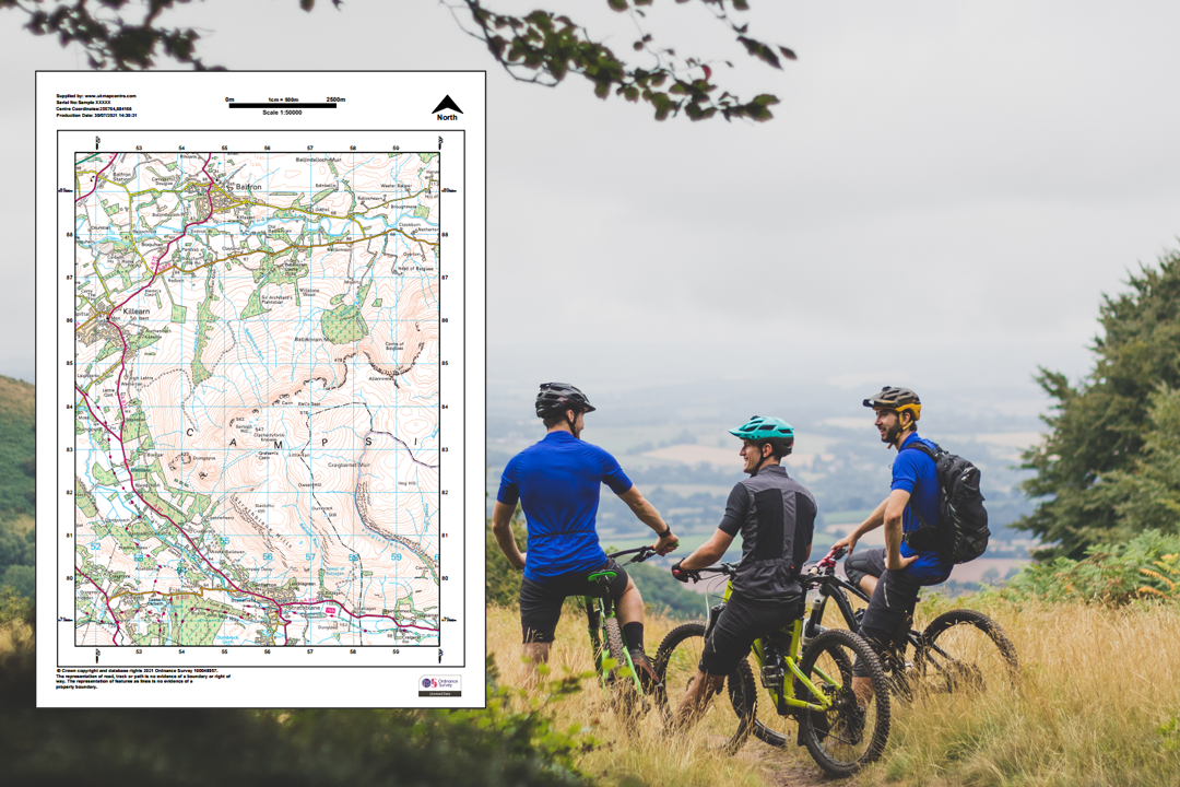
Road cyclists, touring cyclists and bikepacking riders use the 1:50 000 scale for route planning across counties. The Landranger shows every classified road, lane, gradient and settlement, letting you map a full day's ride on one sheet.
Walking & Trail Overview
Where the Explorer shows every stile on a single day walk, the Landranger shows how that walk fits into the wider landscape. Ideal for multi-day trail planning, route context sheets and overview maps for walking guidebooks and club newsletters.
Emergency Services & Operational Planning
Police, fire, ambulance, mountain rescue, coastguard and military teams use Landranger mapping for area-wide briefings. Access roads, terrain, settlements and key infrastructure sit on a single sheet at a scale that works on a briefing-room wall.
Local Authority & Council Reference
Local planners, highways officers, drainage engineers and council teams use the 1:50 000 as a general reference map for area context. It provides the wider setting around a development site, parish boundary or infrastructure corridor without the clutter of building-level detail.
Tourism, Events & Visitor Guides
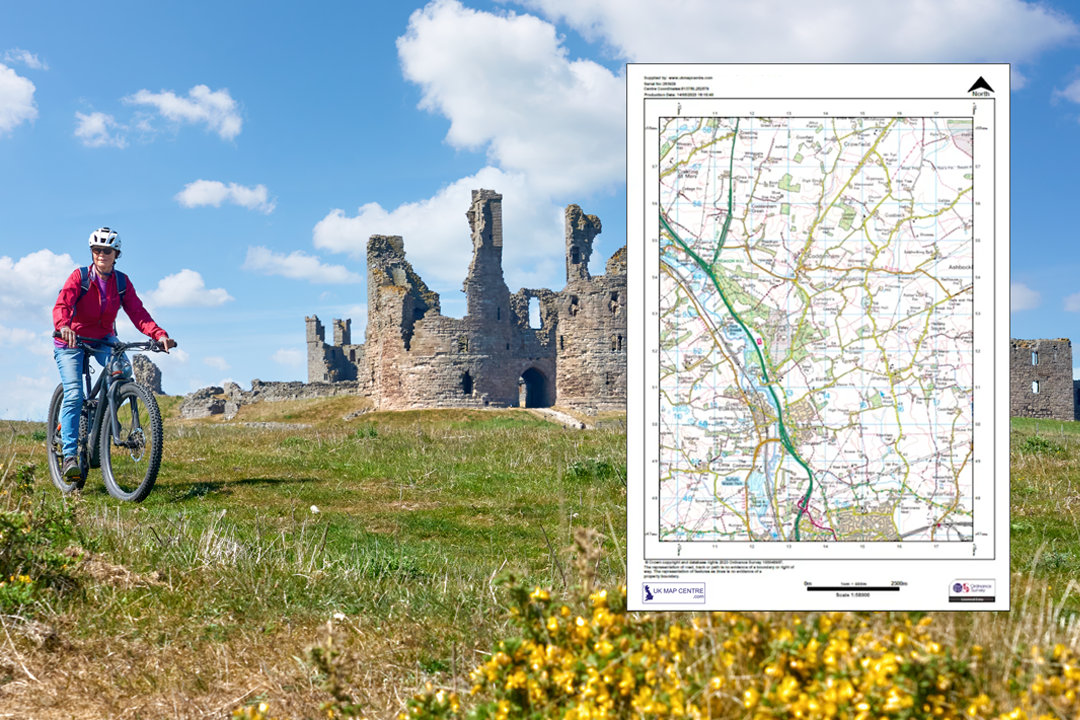
Tourist boards, visitor centres, campsites and event organisers use the Landranger to show how an area fits together - attractions, villages, road connections and terrain at a glance. Printed A1 and A0 sheets make excellent wall displays for reception areas and information boards.
Motoring, Road Trips & Caravanning
The Landranger is the classic road-trip map. Motorists, caravanners, motorhome owners and driving enthusiasts use it for scenic route planning, rally reconnaissance and navigating the lanes and byways that sat-nav sometimes ignores.
Education & Geography Teaching
Schools, colleges and field-study centres use 1:50 000 extracts for geography coursework, river studies, settlement analysis and landscape interpretation exercises. A site-centred extract at the right sheet size is more practical than a full Landranger sheet for a classroom handout.
General Reference & Wall Display
Offices, clubhouses, farms, holiday lets and home studies. A framed Landranger extract centred on your property or business makes a practical wall map and a conversation piece - showing the surrounding countryside, coast, roads and towns at an accessible scale.
If you need tighter detail for footpaths, rights of way and off-road navigation, our 1:25 000 Explorer extract zooms in to show every stile and field boundary. For plot-level detail, see our 1:10 000 regional plan or 1:2500 rural plan. The 1:50 000 Landranger is the right product when you want an entire region on a single sheet.
Sourced Direct from Ordnance Survey
UKMapCentre.com operates as a Premium Licensed Partner of Ordnance Survey, which means every 1:50 000 Landranger extract we supply carries a current, correctly attributed OS licence. That status makes our extracts ready to use for route planning, operational briefings, emergency response coordination, tourism and visitor guides, council and local authority reference, educational fieldwork, event mapping, wall displays and any professional or recreational use where OS-licensed mapping is expected.
Further Reading
New to OS Landranger maps or not sure which scale you need? These guides answer the questions we hear most often:
- How to Print Your OS Map to Scale - Step by Step
- Map Scales Explained: Understanding Ordnance Survey Scale Ratios
- OS Raster Maps: What They Are and When to Use Them
About UK Map Centre LLP

