


Ordnance Survey Aerial Imagery 1:2500 Scale Extracts - OrthoRectified (no building lean)
Available Formats via Email: PDF • TIFF • JPG • PNG
Ordnance Survey Premium Partner • OS Licensed Product • OS MasterMap Imagery Layer • Digital colour-balanced • Corrected for geometric distortions (orthorectified) • Aerial Photography 2500 scale • Emailed Fast
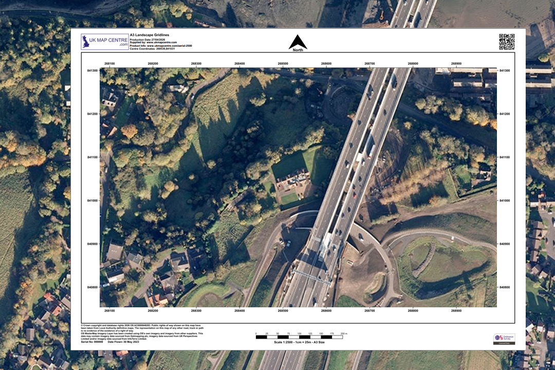
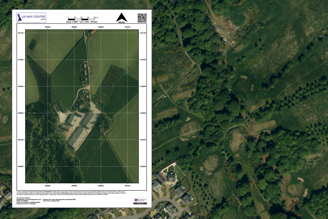
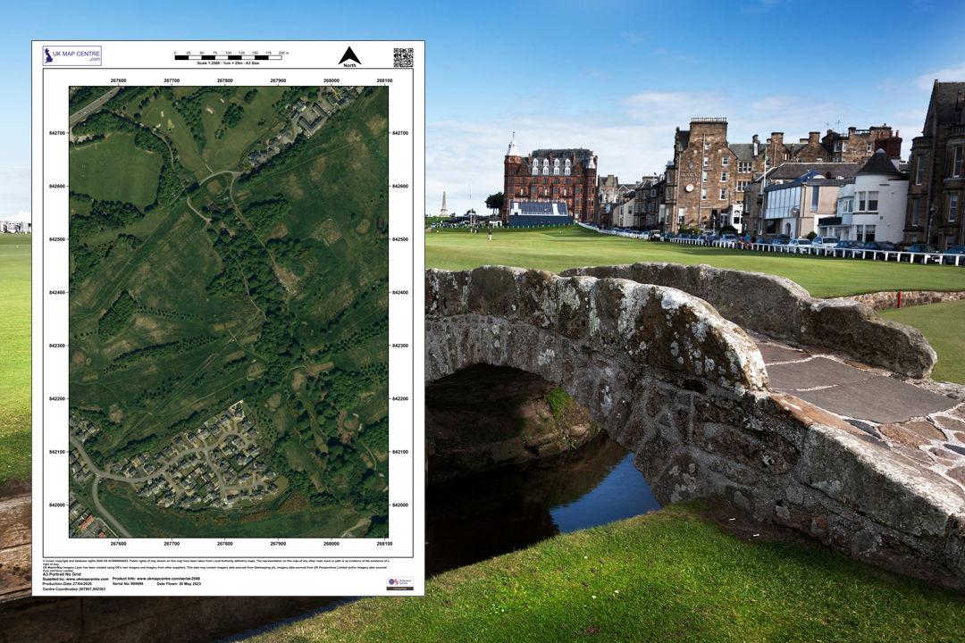
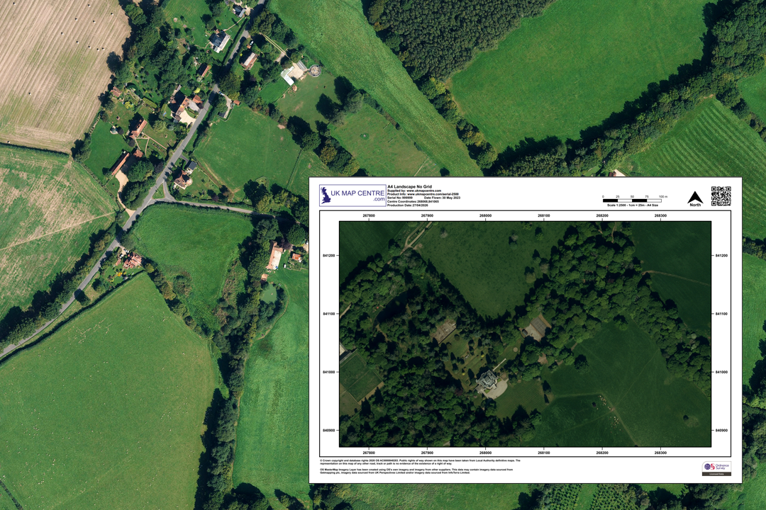
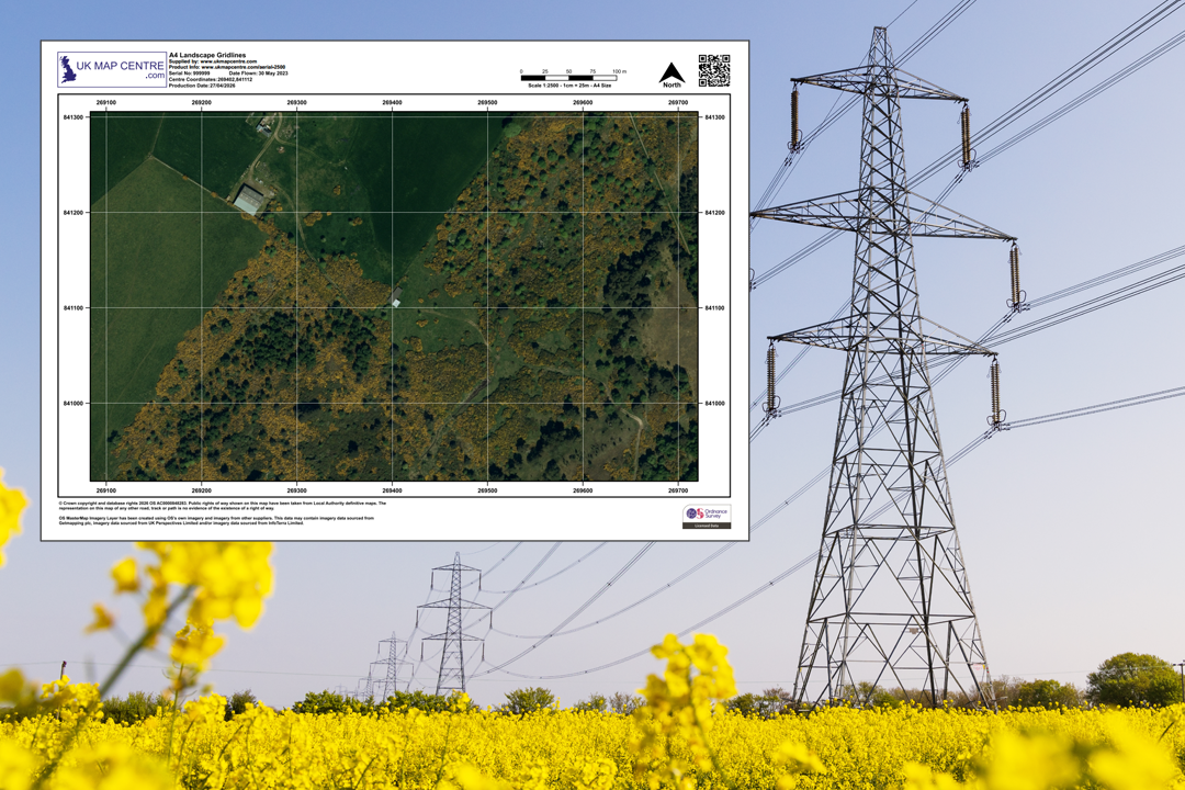
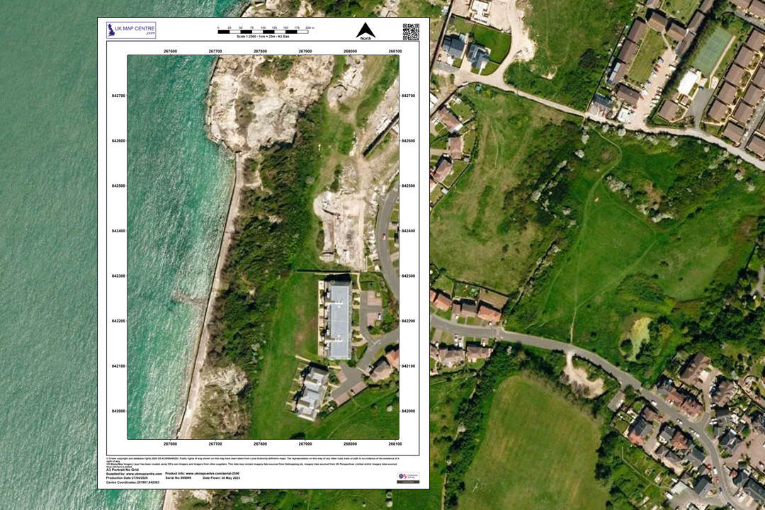
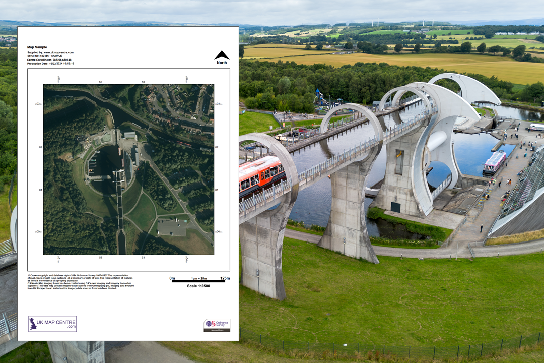
Orthorectified aerial imagery - railway, roads, woodland and buildings in true top-down view Farm buildings, fields, tracks and hedgerows at 25 cm resolution - wider coverage than 1:1250 Available from A4 to A0 - choose the sheet size that covers your holding or project area Rural landscape and golf course terrain - the wider view that puts a site in its surroundings Woodland, fields and rural property - ideal for estate and land management assessment Overhead line corridors and vegetation encroachment - utility and infrastructure planning from your desk Coastal area with beach, cliffs and buildings - 25 cm resolution reveals ground detail from above Infrastructure and engineering context - canal, structures and landscape on a single sheet
© Crown copyright and database rights 2026 OS AC0000848283
OS Aerial Imagery 1:2500 Extract
- 25 cm resolution
- PDF, TIFF, JPG
- A4 to A0 size
- Orthorectified (no building lean)
- Colour balanced
- North Arrow
- Scale Bar
- 1 cm = 25 m
Ordnance Survey Aerial Imagery at 1:2500 - Wider Coverage for Rural and Estate-Level Assessment
The OS 1:2500 aerial imagery extract is a high-resolution, colour-balanced aerial photograph derived from the OS MasterMap Imagery Layer. Every image is orthorectified - geometrically corrected to remove building lean and distortion - giving you a true top-down view of the landscape. At 25 cm resolution you can identify individual buildings, field boundaries, hedgerows, tree canopy, watercourses, tracks and land-use patterns across a wider area than the 1:1250 extract allows on the same sheet size.
At 1:2500, 1 centimetre on the print equals 25 metres on the ground. An A4 sheet covers roughly 425 m by 575 m - enough for a farmhouse with surrounding fields, a smallholding or a suburban neighbourhood. The imagery is aligned to the OS MasterMap Topography Layer and is updated quarterly in February, May, August and November, with more than 99% of the photography less than five years old.
Pick your centre point, choose a paper size and file format, pay online and the aerial extract is emailed to you in around 30 minutes, seven days a week.
What Is an OS 1:2500 Aerial Imagery Extract?
It is a licensed aerial photograph sourced from the OS MasterMap Imagery Layer - the same imagery dataset that underpins Ordnance Survey's large-scale mapping updates across Great Britain. The 1:2500 scale shows twice as much ground per centimetre as the 1:1250 extract, making it the natural choice when you need to see a holding, an estate or a wider site area in a single photograph.
True Orthorectified Imagery
All imagery since 2015 is true orthorectified - building lean has been removed so that every structure appears directly from above in its correct geographic position. Field boundaries, hedgerows and fence lines sit where they should, making the photograph reliable for visual measurement and boundary assessment.
Wider Coverage per Sheet
At 1:2500 an A4 extract covers roughly 425 m by 575 m - four times the ground area of a 1:1250 sheet at the same paper size. That extra reach makes it practical for farms, estates, multi-field holdings and sites where the surrounding land use matters as much as the site itself.
Aligned to OS MasterMap
The aerial imagery is precisely aligned to the OS MasterMap Topography Layer. Overlay vector mapping data directly onto the photograph and property boundaries, roads and buildings line up accurately - useful when you need both the photograph and the line drawing on the same base.
Reduce the Need for Site Visits
Assess field conditions, hedgerow extents, tree canopy coverage, drainage patterns, access tracks and neighbouring land use from your desk. A quick aerial check before a site visit saves time and highlights features that might not be obvious from ground level.
If you need closer detail on a single property or building, our 1:1250 aerial extract zooms in further. For vector mapping at this scale, see our 1:2500 OS MasterMap rural plan. If you work in GIS and need georeferenced aerial tiles or full GIS-ready imagery data, see our dedicated products below.
GIS: Aerial GeoTIFF Tiles GIS: Aerial Imagery DataWhen Do I Need a 1:2500 Aerial Extract?
The 1:2500 aerial extract is for anyone who needs a photographic view of a site and its surroundings at a scale that captures the wider landscape context. Common users and uses include:
Estate & Land Management
Estate managers, land agents and rural surveyors use the 1:2500 aerial to review field conditions, woodland blocks, track networks, watercourses and boundary features across a holding. The wider coverage puts the whole property in context on a single sheet.
Agricultural Assessment & Crop Review
Farmers, agronomists and agricultural consultants use aerial imagery for crop assessment, field boundary verification, drainage pattern identification and Basic Payment Scheme cross-checks. At 25 cm resolution, individual crop rows, bare patches and waterlogged areas are visible.
Environmental & Ecological Surveys
Ecologists, arboriculturists and environmental consultants use the 1:2500 aerial to map habitat boundaries, assess hedgerow connectivity, evaluate tree canopy cover and document land-use change over time. The photograph provides an evidence base that supplements fieldwork records.
Property & Insurance Verification
Insurers, loss adjusters and valuers use the wider-scale aerial image to verify property extents, outbuildings, access arrangements, flood risk context and neighbouring land use across a larger area than the 1:1250 can show on a single sheet.
Utility & Infrastructure Planning
Utility companies, telecoms providers and pipeline operators use the 1:2500 aerial to assess corridor routes, identify vegetation encroachment, check access points and plan maintenance schedules across linear assets that span multiple fields.
Architects & Planning Consultants
A photographic site context at 1:2500 shows how a development site sits within the wider landscape. Architects and planning consultants use it to support design and access statements, heritage impact assessments and pre-application discussions where surrounding land use matters.
Forestry & Woodland Assessment
Forestry managers, woodland trusts and timber buyers use the 1:2500 aerial to assess canopy cover, identify windthrow, review planting boundaries and compare current woodland extent against earlier photography and OS vector data.
Flood Risk & Drainage Studies
Flood risk consultants, drainage engineers and water management teams use the aerial photograph to trace watercourse alignments, spot standing water, identify culvert headwalls and understand surface water flow paths across a catchment before visiting the site.
If you need tighter detail on a single property, our 1:1250 aerial extract zooms in to individual buildings and driveways. For vector line mapping at 1:2500, see our 1:2500 OS MasterMap rural plan.
Sourced Direct from Ordnance Survey
UKMapCentre.com operates as a Premium Licensed Partner of Ordnance Survey, which means every aerial imagery extract we supply is sourced directly from the OS MasterMap Imagery Layer and carries a current, correctly attributed OS licence. The imagery is expertly colour-balanced, geometrically corrected and orthorectified to the same standard used by Ordnance Survey for their own large-scale mapping updates across England, Scotland and Wales.
Further Reading
New to OS aerial imagery or not sure which scale you need? These guides answer the questions we hear most often:
- How to Print Your OS Map to Scale - Step by Step
- Map Scales Explained: Understanding Ordnance Survey Scale Ratios
- What Is Aerial Imagery? An OS MasterMap Guide
About UK Map Centre LLP

