


Ordnance Survey 1:10,000 Map Extract for Forestry and Land Registry
Available Formats via Email: PDF • TIFF • JPG • BMP • PNG • DOCX • WORD
Ordnance Survey Premium Partner • OS Licensed Data • Council Compliant • Ideal for De-crofting and Forestry
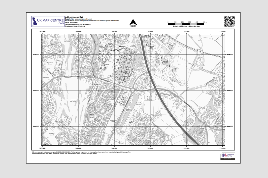
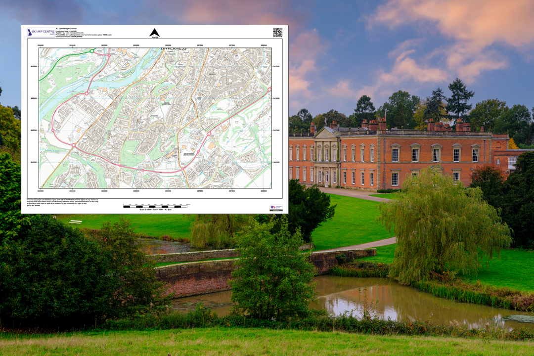
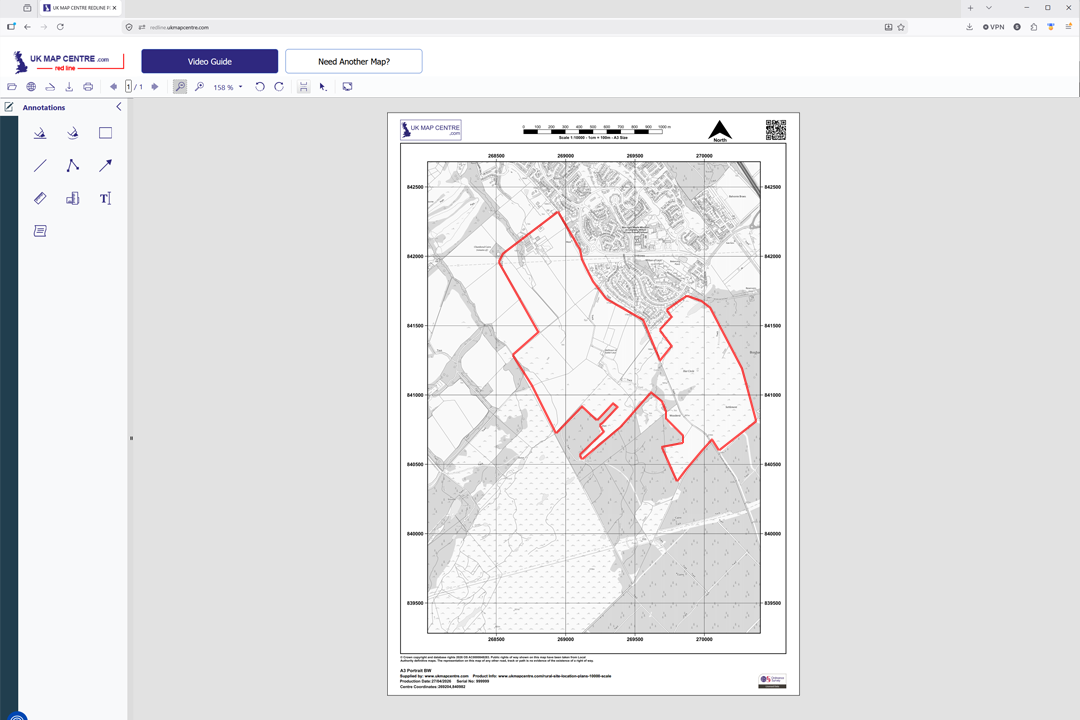
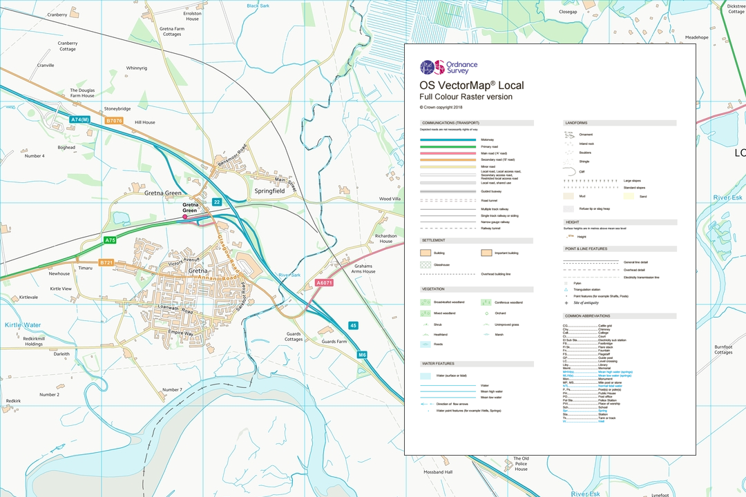
OS 1:10 000 B&W plan - the widest-coverage OS location plan, ideal for Highland estates and large rural holdings OS 1:10 000 Black & White landscape plan - clean line work for registration and boundary mark-up Available from A4 to A0 - choose the sheet size that covers your estate or forestry block OS 1:10 000 Colour plan - full OS palette showing roads, buildings, woodland and water features in context Every plan includes a north arrow, scale bar, grid references, date and OS licence number Mark up your plan online - draw red site boundaries and add notes with our redlining tool Forestry and woodland - typical projects supported by a 1:10 000 OS regional plan OS VectorMap Local data at 1:10 000 - the source dataset behind every plan we produce at this scale
© Crown copyright and database rights 2026 OS AC0000848283
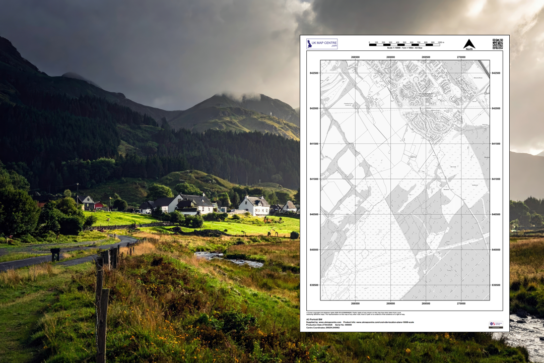
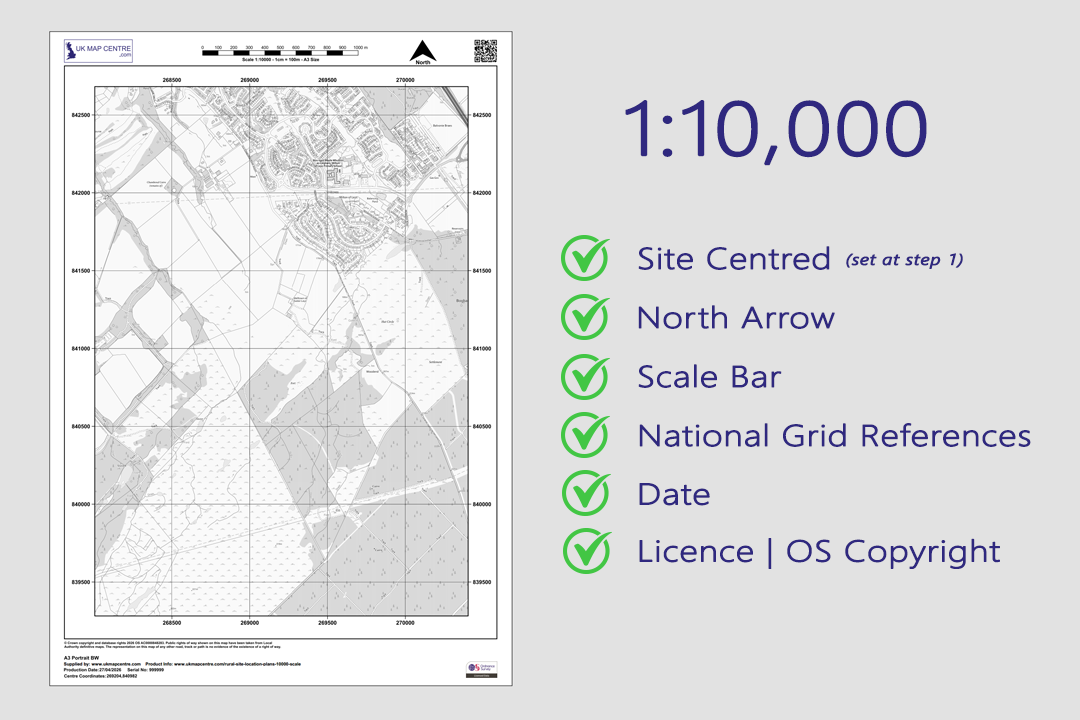
OS 1:10 000 Extract
- Black & White or Colour
- PDF, TIFF, JPG, BMP, PNG, WORD
- A4 to A0 size
- Optional 5 m contours
- Council Compliant
- North Arrow
- Scale Bar
- 1 cm = 100 m
Ordnance Survey 1:10 000 Regional Plan for Forestry, Land Registry and Estate Management
The OS 1:10 000 plan is the widest-coverage raster location plan we supply. Derived from OS VectorMap® Local, it takes in whole estates, forestry plantations, catchment areas and large rural holdings on a single sheet. At this scale 1 centimetre on the paper represents 100 metres on the ground - sixteen times the area of a 1:2500 plan and four times a 1:5000 plan on the same paper size.
The 1:10 000 sheet is one of the standard scales accepted by HM Land Registry, Registers of Scotland and the Crofting Commission for rural registrations and decrofting applications. It is also the scale most commonly used for forestry felling licences, woodland creation grant applications and estate-wide management plans. OS VectorMap Local data is updated quarterly in January, April, July and October.
Frame your site, choose a sheet size and file format, pay online and the plan is emailed to you in around 20 minutes, seven days a week. Ready to upload to the Land Registry, Registers of Scotland, the Crofting Commission, Scottish Forestry, Forestry England or your local planning authority.
What Is an Ordnance Survey 1:10 000 Plan?
A 1:10 000 scale map is a raster extract from OS VectorMap Local where 1 centimetre on the sheet represents 100 metres on the ground. It replaces the discontinued OS Landplan product and provides a consistent, licensed OS base across Great Britain for any professional or regulatory use that needs a wide-area overview with enough detail to identify individual buildings, field boundaries, roads and woodland blocks.
Accepted by Land Registry
1:10 000 is one of the three standard OS scales named in HM Land Registry Practice Guide 40 (alongside 1:1250 and 1:2500). It is the correct scale for rural first registrations, transfers of part and boundary agreements across large agricultural holdings and estates.
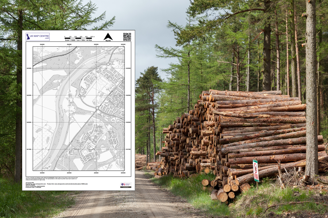
The Forestry Standard
Scottish Forestry and Forestry England routinely work at 1:10 000 for felling licence applications, woodland creation grants, restocking proposals and compartment-level management plans. A full plantation block with its access roads fits on a single sheet.
Optional 5 m Contours
Add 5-metre contour lines at checkout for terrain context. Contours are valuable for forestry planting design, slope analysis, drainage planning and flood-risk assessments where elevation across a wide area needs to be visible on the same drawing.
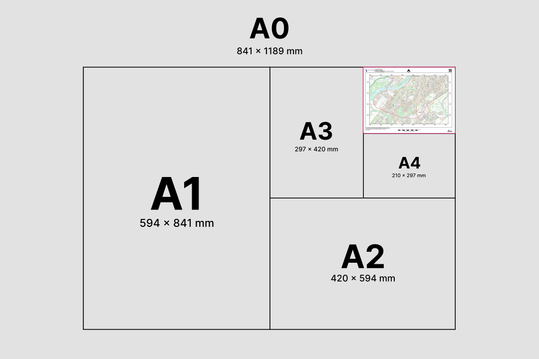
Sixteen Times the Reach of 1:2500
A single A4 sheet at 1:10 000 covers roughly the same ground as sixteen A4 sheets at 1:2500. That wide window is why it is the default scale for estate plans, catchment overviews and any rural submission where the full extent of the land needs to be shown in one view.
The 1:10 000 sheet sits alongside our 1:5000 plan and 1:2500 rural plan so you can pick the scale that matches the size of your holding. If you need tighter detail for a specific part of the estate, order a 1:2500 or 1:5000 sheet for that area alongside the wider 1:10 000 context drawing.
When Do I Need a 1:10 000 Regional Plan?
The 1:10 000 plan is the right choice whenever you need to show a large rural area on a single sheet with enough detail to satisfy a registration body, forestry authority or planning officer. Common users and uses include:
Forestry & Woodland Management
Felling licence applications, woodland creation grant submissions, restocking schemes, long-term forest plans and compartment maps. Scottish Forestry and Forestry England both work at 1:10 000 as standard, and the contour option supports planting design on sloped ground.
HM Land Registry
One of the three accepted OS scales for rural registrations. Used for first registrations of large agricultural holdings, transfers of part across estates and boundary agreements where the parcel is too extensive for a 1:2500 sheet.
Registers of Scotland
Accepted for voluntary and first registration of large rural titles and plans lodged with the Scottish Land Register. The 1:10 000 sheet shows entire holdings, sporting estates and hill land in a single drawing.
Crofting Commission
Accepted for decrofting applications, croft registration, resumption applications and other Crofting Commission paperwork where the croft or township boundary extends across a wide area of the Highlands and Islands.
Estate & Catchment Management
Whole-estate plans, sporting rights boundaries, deer management group areas, river catchment overviews and habitat management plans. Land agents, factors and estate managers use 1:10 000 when the holding runs to several thousand acres.
Ecology & Environmental Assessment
Phase 1 habitat surveys, ecological impact appraisals, environmental impact assessments, flood risk appraisals and SEPA/NRW/EA consultations. The wide coverage lets ecologists map habitats and constraints across a full development zone on one base.
Archaeology & Heritage
Desk-based archaeological assessments, scheduled monument mapping, historic landscape characterisation and heritage impact statements. The 1:10 000 scale shows how a proposed development relates to recorded heritage features across the surrounding landscape.
Energy & Infrastructure
Windfarm layouts, solar farm proposals, overhead line routes, pipeline corridors and hydro catchment schemes. At 1:10 000 the full project footprint, its access infrastructure and the surrounding land context all fit on one sheet.
If your site is compact enough to fit on a 1:5000 plan or a 1:2500 rural plan, use the tighter scale for sharper detail. The 1:10 000 is designed for sites where coverage matters more than close-up resolution.
Sourced Direct from Ordnance Survey
UKMapCentre.com operates as a Premium Licensed Partner of Ordnance Survey, which means every 1:10 000 plan we supply carries a current, correctly attributed OS licence. That status makes our plans ready to submit for HM Land Registry registrations, Registers of Scotland applications, Crofting Commission decrofting, Scottish Forestry felling licences, Forestry England woodland creation grants, rural planning applications, building warrants and any professional use where OS-licensed mapping is expected.
Further Reading
Working with wider-area OS maps raises its own set of questions around scale, printing and file formats. These guides cover the topics our customers ask about most before ordering a 1:10 000 plan:
- How to Print Your OS Map to Scale - Step by Step
- Map Scales Explained: Understanding Ordnance Survey Scale Ratios
- OS Raster Maps: What They Are and When to Use Them
- Correct Land Registry Map Scales: A Guide
About UK Map Centre LLP

